
 |
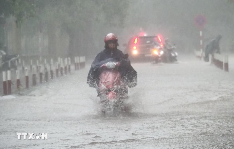
| Illustrative photo. (Photo: VNA) |
According to the National Center for Hydro-Meteorological Forecasting, while at sea there are strong winds and rough seas, on land there is very heavy rain spreading across regions across the country.
Low pressure area causes strong winds and big waves at sea
According to information from the National Center for Hydro-Meteorological Forecasting, the low pressure area in the central East Sea at 1 a.m. is located at about 13.5-14.5 degrees North latitude; 112.5-113.5 degrees East longitude.
In Ly Son special zone, there are gusts of level 7, Huyen Tran station has strong southwest winds of level 6, gusts of level 8-9.
It is forecasted that in the next 24 hours, the low pressure area in the central East Sea will move slowly in a North-Northwest direction and is likely to strengthen into a tropical depression.
Day and night of August 16, the sea area from Khanh Hoa to Ho Chi Minh City, the South East Sea area (including Truong Sa special zone) has strong winds of level 6, gusts of level 7-8, waves 2-3.5m high.
In the North of the North East Sea, the wind is level 5, sometimes level 6, gusting to level 7-8, rough sea, waves 2-3.5m high.
In the central East Sea, wind level 6, gust level 7-8, waves 2-3.5m high.
In addition, on the day and night of August 16, the Gulf of Tonkin, the sea area from South Quang Tri to Ca Mau, Ca Mau to An Giang , the Gulf of Thailand, the North, Central and South East Sea (including Hoang Sa and Truong Sa special zones) will have scattered showers and thunderstorms, with the possibility of tornadoes, strong gusts of wind and waves over 3.5m high during thunderstorms.
The National Center for Hydro-Meteorological Forecasting warns that during the day and night of August 17, the sea area from Lam Dong to Ho Chi Minh City and the South East Sea area (including Truong Sa special zone) will have strong southwest winds of level 6, gusting to level 7-8; at night the wind will gradually decrease; waves will be 1.5-3.5m high; rough seas.
The northern sea area of the North East Sea has strong East to Southeast winds at level 6, gusting to level 7-8; waves from 2-3.5m high, rough seas.
The central East Sea area has strong winds of level 6, gusting to level 7-8; waves 2-3.5m high, rough seas.
Risk level of natural disasters due to strong winds at sea: Sea area from Khanh Hoa to Ho Chi Minh City level 2. All vessels operating in the above areas are at high risk of being affected by tornadoes, strong winds and big waves.
Heavy rain in many areas
The National Center for Hydro-Meteorological Forecasting said that from August 16 to the night of August 17, the Northeast region, Thanh Hoa and Nghe An will have moderate rain, heavy rain and thunderstorms with common rainfall of 50-120mm, locally very heavy rain over 250mm.
During the day and night of August 16, the Central Highlands and the South will have moderate rain, heavy rain and thunderstorms with common rainfall of 30-60mm, locally very heavy rain over 120mm.
During the day and night of August 17, Ha Tinh and Quang Tri areas will have moderate to heavy rain with common rainfall of 30-60mm, locally very heavy rain over 100mm.
In addition, in the afternoon and night of August 16, the Northwest, the area from Ha Tinh to Hue and the South Central Coast will have scattered showers and thunderstorms, with some places experiencing heavy to very heavy rain with rainfall of 15-35mm, locally over 80mm.
Warning of risk of heavy rain over 100mm in 3 hours, thunderstorms with possibility of tornadoes, lightning, hail and strong gusts of wind.
On the day and night of August 18, the Northeast and Thanh Hoa to Ha Tinh will have moderate rain, heavy rain and thunderstorms, some places will have very heavy rain with common rainfall of 30-60mm, locally over 150mm.
Level 1 natural disaster risk due to heavy rain, tornado, lightning, hail.
Heavy rain can cause flooding in low-lying areas, urban and industrial areas; flash floods on small rivers and streams, landslides on steep slopes; thunderstorms can cause tornadoes, lightning, hail and strong gusts of wind.
During the night of August 15 and early morning of August 16, the Northern, Central, Central Highlands and Southern regions will have scattered showers and thunderstorms, with some places experiencing heavy to very heavy rain. The rainfall from 7:00 p.m. on August 15 to 3:00 a.m. on August 16 was over 60mm in some places, such as: Kien Lao station (Lao Cai) 68.4mm, Dam Ha station (Quang Ninh) 67.4mm, Tan Dan 2 station (Phu Tho) 66.2mm, Hoang Mai station (Nghe An) 150.4mm, Di Linh station (Lam Dong) 79mm...
Weather in regions day and night 16/8
The Northwest region has scattered showers and thunderstorms, locally heavy to very heavy rain, with the possibility of tornadoes, lightning, hail and strong gusts of wind. The lowest temperature is 23-25 degrees Celsius. The highest temperature is 27-30 degrees Celsius, some places above 30 degrees Celsius.
The Northeast region has moderate to heavy rain and scattered thunderstorms, locally very heavy rain, with the possibility of tornadoes, lightning, hail and strong gusts of wind. The lowest temperature is 22-25 degrees Celsius. The highest temperature is 28-31 degrees Celsius, some places above 31 degrees Celsius.
Hanoi city has moderate rain, heavy rain and scattered thunderstorms, locally very heavy rain in some places, in thunderstorms there is a possibility of tornadoes, lightning and strong gusts of wind. Lowest temperature 24-26 degrees Celsius. Highest temperature 30-32 degrees Celsius.
Provinces and cities from Thanh Hoa to Hue, the North (Thanh Hoa, Nghe An) have moderate rain, heavy rain and thunderstorms, locally very heavy rain; the South has scattered showers and thunderstorms, locally heavy to very heavy rain, in thunderstorms there is a possibility of tornadoes, lightning, hail and strong gusts of wind. The lowest temperature is 24-27 degrees Celsius. The highest temperature is 30-33 degrees Celsius.
The South Central Coast has scattered showers and thunderstorms, locally heavy to very heavy rain (rain concentrated in the afternoon and night), with the possibility of tornadoes, lightning, hail and strong gusts of wind during thunderstorms. Southwest wind level 2-3. Lowest temperature 24-27 degrees Celsius. Highest temperature 31-34 degrees Celsius.
The Central Highlands has moderate to heavy rain and scattered thunderstorms, locally very heavy rain (rain concentrated in the afternoon and night), with the possibility of tornadoes, lightning, hail and strong gusts of wind in thunderstorms. Southwest wind level 2-3. Lowest temperature 19-22 degrees Celsius. Highest temperature 27-30 degrees Celsius, some places over 30 degrees Celsius.
The Southern region has moderate rain, heavy rain and scattered thunderstorms, locally very heavy rain (rain concentrated in the afternoon and night), thunderstorms are likely to have tornadoes, lightning, hail and strong gusts of wind. Southwest wind level 2-3. Lowest temperature 23-26 degrees Celsius. Highest temperature 29-32 degrees Celsius, some places above 32 degrees Celsius.
Ho Chi Minh City has moderate rain, heavy rain and scattered thunderstorms, locally very heavy rain (rain concentrated in the afternoon and night), thunderstorms are likely to have tornadoes, lightning, hail and strong gusts of wind. Southwest wind level 2-3. Lowest temperature 24-26 degrees Celsius. Highest temperature 30-32 degrees Celsius./.
Source: https://huengaynay.vn/chinh-tri-xa-hoi/thoi-weather-ngay-16-8-vung-ap-thap-co-kha-nang-manh-len-co-noi-mua-tren-250mm-156766.html


![[Photo] National Assembly Chairman Tran Thanh Man attends the program "Returning to the source - Towards the future"](https://vphoto.vietnam.vn/thumb/1200x675/vietnam/resource/IMAGE/2025/8/16/d081d9c162ee4ed9919e723aa322a53a)

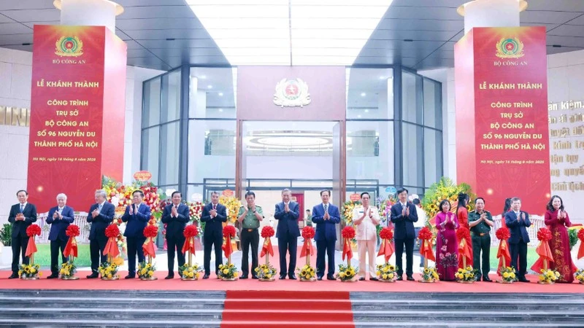
![[Photo] General Secretary attends the inauguration ceremony of the Ministry of Public Security Headquarters](https://vphoto.vietnam.vn/thumb/1200x675/vietnam/resource/IMAGE/2025/8/16/3ceec3a24ef945c18ae2b523563b749d)

![[Photo] “Moving forward with Vietnam” on the most romantic road in Vietnam](https://vphoto.vietnam.vn/thumb/1200x675/vietnam/resource/IMAGE/2025/8/16/0ee500bc59fd4468863261ee26f47fe7)


Comment (0)