

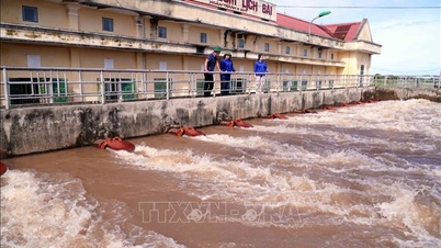
Heavy rains in the North and Central regions. (Photo: Tuan Anh/VNA)
According to the National Center for Hydro-Meteorological Forecasting, from July 26 to the night of July 27, the area from Ha Tinh to Da Nang will have moderate rain, heavy rain and thunderstorms, locally very heavy rain with common rainfall of 50-100mm, locally over 180mm. Warning of the risk of heavy rain, over 100mm/3 hours.
In addition, on the day and night of July 26, the North, Thanh Hoa and Nghe An will have scattered showers and thunderstorms, locally heavy rain with rainfall of 15-30mm, locally over 80mm.
The Central Highlands region has scattered showers and thunderstorms, locally heavy rain with rainfall of 10-30mm, locally over 70mm (rain concentrated in the afternoon and evening).
Thunderstorms may produce tornadoes, lightning, hail, and strong gusts of wind. Warning level of natural disaster risk due to heavy rain, tornadoes, lightning, and hail: level 1.
Heavy rains can cause flooding in low-lying areas, urban and industrial areas; flash floods in small rivers and streams; landslides on steep slopes. Thunderstorms can cause tornadoes, lightning, hail and strong gusts of wind.
Last night and early this morning (July 26), in the Northern region, there were scattered showers and thunderstorms, with some places having heavy to very heavy rain. The rainfall from 7:00 p.m. on July 25 to 3:00 a.m. on July 26 was over 60mm in some places, such as: Muong Pon station ( Dien Bien ) 104mm, Tan Tien station (Lao Cai) 101.4mm, Tan Trinh station (Tuyen Quang) 61mm...
Big waves, thunderstorms at sea
In the North and Central East Sea, there are showers and thunderstorms; Ly Son special zone has gusts of level 8; Phu Quy special zone has strong winds of level 6, gusts of level 7; Huyen Tran station has strong southwest winds of level 5, sometimes level 6.
Forecast for the day and night of July 26, the eastern sea area of the North East Sea will have strong southwest winds of level 6, gusting to level 7-8. Rough seas. From noon to afternoon, the wind intensity will gradually decrease. Waves will be 2-4m high.
The Central East Sea area and the sea area from Gia Lai to Ho Chi Minh City has southwest wind level 6, gusting to level 7-8. Rough sea. Waves 2-4m high.
The sea area from Dong Thap to Ca Mau and the South East Sea area (including Truong Sa special zone) has southwest wind level 5, sometimes level 6, gusting to level 7-8. Rough sea. Waves 2-3.5m high.
In addition, on the day and night of July 26, in the Gulf of Tonkin, the North and Central East Sea (including Hoang Sa special zone), the sea area from South Quang Tri to Quang Ngai will have showers and thunderstorms. During the thunderstorms, there is a possibility of tornadoes and strong gusts of wind of level 7-8.

Illustrative photo. (Source: VNA)
On the day and night of July 27, the sea area south of the North East Sea (including Hoang Sa special zone), the area in the middle of the East Sea and the sea area from Gia Lai to Ho Chi Minh City will have strong southwest winds of level 6, gusting to level 7-8; waves 2-4m high, rough seas. Disaster risk level due to strong winds at sea: level 2.
All vessels operating in the above areas are at high risk of being affected by cyclones, strong winds and large waves.
Specific weather in each region
The Northwest region is cloudy with scattered showers and thunderstorms, with some places experiencing heavy rain. During thunderstorms, there is a possibility of tornadoes, lightning, hail and strong gusts of wind. The lowest temperature is from 23-26 degrees Celsius, in some places below 22 degrees Celsius; the highest is from 30-33 degrees Celsius, in some places above 33 degrees Celsius, in the Northwest region from 27-30 degrees Celsius.
In the Northeast, there will be scattered showers and thunderstorms during the day and showers and thunderstorms in some places at night. During thunderstorms, there is a possibility of tornadoes, lightning, hail and strong gusts of wind. The lowest temperature will be from 24-27 degrees Celsius, the highest from 30-33 degrees Celsius, with some places above 33 degrees Celsius.
From Thanh Hoa to Hue, the sky is cloudy. In the North, there will be scattered showers and thunderstorms, with some places experiencing heavy rain; in the South, there will be moderate rain, heavy rain and thunderstorms, with some places experiencing very heavy rain. During thunderstorms, there is a possibility of tornadoes, lightning and strong gusts of wind. The lowest temperature will be from 23-26 degrees Celsius, the highest from 29-32 degrees Celsius.
The South Central Coast is cloudy with scattered showers and thunderstorms, with some heavy rain in some places; the Da Nang area has moderate rain and thunderstorms, with some heavy rain. The South has scattered showers and thunderstorms. Southwest wind level 2-3.
During thunderstorms, there is a possibility of tornadoes, lightning, hail and strong gusts of wind. The lowest temperature is from 25-28 degrees Celsius, the highest in the North is from 30-32 degrees Celsius, in the South is from 32-34 degrees Celsius, some places are over 34 degrees Celsius.

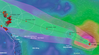
(Photo: Thanh Phuong/VNA)
The Central Highlands region has scattered showers and thunderstorms; in the afternoon and evening there will be scattered showers and thunderstorms, with some places having heavy rain. Southwest wind level 2-3. During thunderstorms there is a possibility of tornadoes, lightning and strong gusts of wind. The lowest temperature is from 20-23 degrees Celsius, the highest is from 26-29 degrees Celsius, some places over 30 degrees Celsius.
The South has scattered showers and thunderstorms in some places. The Southeast region has scattered showers and thunderstorms in the afternoon and evening, with some places having heavy rain. Southwest wind level 2-3. During thunderstorms, there is a possibility of tornadoes, lightning and strong gusts of wind. The lowest temperature is from 25-28 degrees Celsius, the highest is from 31-34 degrees Celsius, some places are over 34 degrees Celsius.
Hanoi today is cloudy with occasional showers and thunderstorms, intermittent sunshine during the day. Light wind. During thunderstorms, there is a possibility of tornadoes, lightning and strong gusts of wind. Lowest temperature from 25-27 degrees Celsius, highest from 31-33 degrees Celsius.
Ho Chi Minh City is cloudy with scattered showers and thunderstorms; in the afternoon and evening, there may be showers and thunderstorms. Southwest wind level 2-3. During thunderstorms, there is a possibility of tornadoes, lightning and strong gusts of wind. The lowest temperature is from 25-27 degrees Celsius, the highest is from 32-34 degrees Celsius./.
According to Vietnamplus
Source: https://www.vietnamplus.vn/thoi-tiet-ngay-267-mua-lon-dien-rong-tai-bac-bo-va-trung-bo-bien-dong-manh-post1051904.vnp
Source: https://baolongan.vn/thoi-tiet-ngay-26-7-mua-lon-dien-rong-tai-bac-bo-va-trung-bo-bien-dong-manh-a199517.html

![[Photo] Binh Trieu 1 Bridge has been completed, raised by 1.1m, and will open to traffic at the end of November.](https://vphoto.vietnam.vn/thumb/1200x675/vietnam/resource/IMAGE/2025/10/2/a6549e2a3b5848a1ba76a1ded6141fae)


Comment (0)