

In particular, the Son Duong town bypass route from Km0+419.68 (from the roundabout to Son Duong 2 bridge) to Km3+380.23 (the beginning of branch 1 - intersection 3 with National Highway 37) has experienced serious landslides. Soil and rocks tend to continue to slide down, causing the risk of burying the entire road surface, not ensuring safety for vehicles and traffic participants traveling through this area.
At the same time, based on the request of the Provincial Traffic Construction Investment Project Management Board in Document No. 1270/BQLDA-DANN dated September 30, 2025, to ensure the safety of people's lives and property and vehicles participating in traffic, the Department of Construction announced that people and vehicles participating in traffic temporarily stopped circulating on the road avoiding Son Duong town.
Therefore, the direction from Minh Xuan ward to Son Duong commune and vice versa is as follows: vehicles participating in traffic follow National Highway 37 to Son Duong commune and vice versa. Traffic suspension time is from October 7 until further notice.
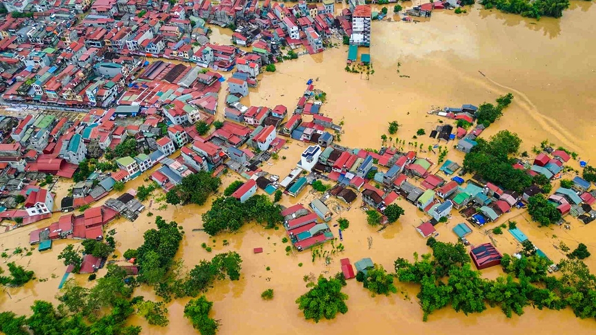
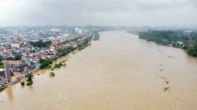
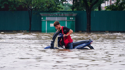
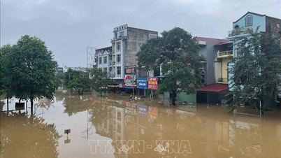
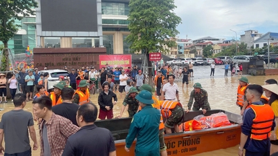
Due to the impact of the circulation of storm No. 11, on the morning of October 7, many places in the province were flooded. Rainfall in many localities was generally from 10 - 50 mm, in some places over 60 mm such as: Tuyen Quang Meteorological Station (Minh Xuan) 75 mm; Hoang Khai (An Tuong) 74 mm, Tan Trao 67 mm... In particular, landslides occurred from the top of Tho Son mountain in the area of Nong Tien bridgehead, Minh Xuan ward (Tuyen Quang) and the functional forces blocked off the area of Nong Tien bridgehead to handle the landslide.
According to the Hydrometeorological Station of Tuyen Quang province, warnings are issued for areas in the wards of Minh Xuan, My Lam, An Tuong, Nong Tien, Binh Thuan ; the communes of Hoang Khai, Yen Son, Kim Phu, Tan Trao, Son Thuy, Xuan Van, Luc Hanh, Tan Long, Dong Tho, Truong Son, Truong Sinh, Phu Luong, Son Duong ... and the communes along the Lo and Gam rivers, flooding will occur with a common depth of 0.5 - 1 m, the maximum depth of flooding can be up to 2 m and the flooding time can last from 6 - 12 hours, in some places longer.
Source: https://baotintuc.vn/xa-hoi/tuyen-quang-tam-dung-luu-thong-qua-tuyen-duong-tranh-thi-tran-son-duong-20251007135726980.htm


![[Photo] Prime Minister Pham Minh Chinh chairs the 16th meeting of the National Steering Committee on combating illegal fishing.](https://vphoto.vietnam.vn/thumb/1200x675/vietnam/resource/IMAGE/2025/10/07/1759848378556_dsc-9253-jpg.webp)


Comment (0)