
On the afternoon of October 30, the Department of Construction of Lam Dong province issued a warning of danger, absolutely prohibiting people and vehicles from moving through the above landslide point.
Over the past two days, authorities have mobilized people and vehicles to move and transport hundreds of cubic meters of soil, rocks, and trees away from the landslide site. However, when inspecting the slope on top of the pine hill, authorities discovered a new slide with many cracks, subsidence of soil and trees, showing signs of being pushed down onto Highway 20.
In addition, a crack about 30m long has appeared on Highway 20 passing through this area, facing the negative slope, posing a safety risk.

To prevent incidents caused by natural disasters, from 4:00 p.m. on October 30, Lam Dong Province Department of Construction has absolutely banned people and vehicles from moving through the above location.
During this time, people and vehicles traveling from Khanh Hoa province (old Ninh Thuan ) to Da Lat must travel along Highway 27, to Phi Nom intersection, turn right onto Highway 20 and then go to Da Lat. People and vehicles traveling from Da Lat to D'ran commune and Khanh Hoa province travel in the opposite direction.

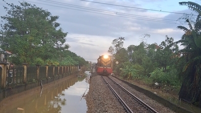
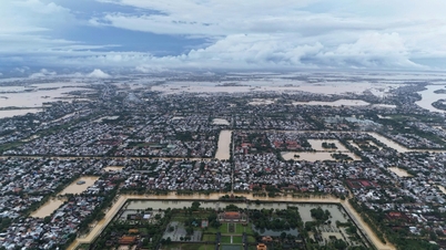
In recent days, Lam Dong province has had prolonged heavy rains, many river and stream areas, low-lying areas, especially communes and wards such as Ham Thuan Bac, Ham Thuan, Ham Liem, Ham Thang, Hong Son, Phu Thuy... have been flooded on a large scale. The police force has coordinated with local organizations and unions to help evacuate people and property to safety.
On the afternoon of October 30, many hydroelectric and irrigation reservoirs in Lam Dong province continued to announce flood discharge regulation, of which Song Quao and Suoi Da reservoirs reached up to 500m3/s.
Source: https://cand.com.vn/Giao-thong/xuat-hien-cung-truot-lon-tren-ql-20-cam-toan-bo-nguoi-phuong-tien-i786442/


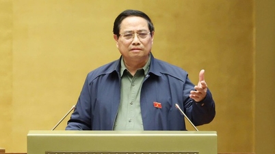
![[Photo] Prime Minister Pham Minh Chinh attends the 5th National Press Awards Ceremony on preventing and combating corruption, waste and negativity](https://vphoto.vietnam.vn/thumb/1200x675/vietnam/resource/IMAGE/2025/10/31/1761881588160_dsc-8359-jpg.webp)
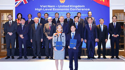
![[Photo] General Secretary To Lam attends the Vietnam-UK High-Level Economic Conference](https://vphoto.vietnam.vn/thumb/1200x675/vietnam/resource/IMAGE/2025/10/30/1761825773922_anh-1-3371-jpg.webp)
![[Photo] The Third Patriotic Emulation Congress of the Central Internal Affairs Commission](https://vphoto.vietnam.vn/thumb/1200x675/vietnam/resource/IMAGE/2025/10/30/1761831176178_dh-thi-dua-yeu-nuoc-5076-2710-jpg.webp)


Comment (0)