
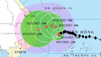
This afternoon (July 23), the tropical depression entered the eastern sea area of the northern East Sea. Currently, the movement of the tropical depression is unlikely to affect the mainland of Vietnam.
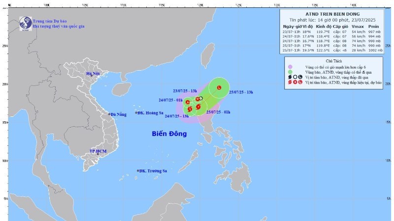
At 1:00 p.m., the center of the tropical depression was at about 18.0 degrees north latitude and 119.7 degrees east longitude, in the eastern sea of the northern East Sea.
The strongest wind near the center of the tropical depression is level 6-7 (39-61km/h), gusting to level 9; moving west-southwest at a speed of 10-15km/h.
It is forecasted that at around 1 a.m. on July 24, the tropical depression will continue to move west-southwest and is likely to strengthen to level 7, gusting to level 9 in the East Sea.
At 1 p.m. the same day, the tropical depression turned south-southeast, moving 5-10km per hour and was likely to strengthen into a storm in the northern East Sea. The strongest wind near the storm center was level 8, gusting to level 10.
Strong winds, big waves and thunderstorms at sea
Due to the influence of the tropical depression/storm, the eastern sea area of the northern and central East Sea has showers and thunderstorms; Phu Quy special zone has strong southwest winds of level 6, Song Tu Tay station has gusts of level 7.
In addition, on the night of July 23 and July 24, there will be showers and thunderstorms in the Gulf of Tonkin, the northern and central areas of the East Sea (including the Hoang Sa special zone). There is a possibility of tornadoes and strong gusts of wind during thunderstorms.
The meteorological agency warned that on the night of July 24 and July 25, the eastern sea area of the northern East Sea will have strong winds of level 6-7, near the storm center will have strong winds of level 8, gusting to level 10; waves 2-4m high; rough seas.
The sea area from Khanh Hoa to Lam Dong, the central East Sea area has strong southwest wind level 6, gusting to level 7-8; waves 2-4m high; rough sea.
Risk level of natural disasters due to strong winds at sea: Level 2, especially in the eastern sea area of the northern East Sea level 3.
The meteorological agency warned that all vessels operating in the above areas are at high risk of being affected by tornadoes, strong winds and large waves.
Source: https://baolaocai.vn/xuat-hien-thap-nhiet-doi-giat-cap-9-tren-bien-dong-kha-nang-manh-len-thanh-bao-post649570.html


Comment (0)