
BHG - Vietnam is a vast country, with four sacred poles of the Fatherland: the Eastern pole at Mui Doi, Van Thanh commune, Van Ninh district, Khanh Hoa province; the Western pole at Sin Thau commune, Muong Nhe district, Dien Bien province; the Northern pole at Lung Cu commune, Dong Van district, Ha Giang province; the Southern pole at Dat Mui commune, Ngoc Hien district, Ca Mau province. During my precious time as a journalist, I was extremely happy to set foot on the Northern and Southern poles of the Fatherland. These two locations are about 1,650 km apart but are connected and especially filled with my absolute love and pride for the beautiful mountains and rivers of my country.
Wearing the sacred red flag with yellow star, we set off to Ha Giang - the homeland's northernmost point, the proud land of blooming rocks. With infinite respect, our group visited the Vi Xuyen National Martyrs' Cemetery (Vi Xuyen town, Vi Xuyen district). This is the resting place of 1,864 martyrs' graves and 1 mass grave. Overwhelmed with emotion, everyone in the group expressed their deep gratitude for the great contributions of generations of heroes who fell to firmly protect the northernmost border of the country. Along the long journey, the driver played songs about Ha Giang, it was our first time coming to the northernmost point of the country, each member of our group had their own mood and emotions, but surely all shared the emotion, pride and deep gratitude when traveling along the road named "The Road of Happiness". The Happiness Road was built by more than 1,300 youth volunteers, more than 1,000 workers with more than 2 million working days. In conditions of lack of food, drinking water, harsh highland weather, sometimes hot, sometimes cold, working with extremely primitive tools such as hoes, shovels, crowbars, sledgehammers... but the young volunteers overcame everything, with their hands, minds, and high determination to open a nearly 200 km long road, contributing to bringing a prosperous life to the ethnic people here. The road is a strong testament, a miracle of the youth volunteers and the people of Ha Giang, a great achievement built from the noble sacrifice of blood and flowers, a tradition of great strength and solidarity of the Vietnamese people.
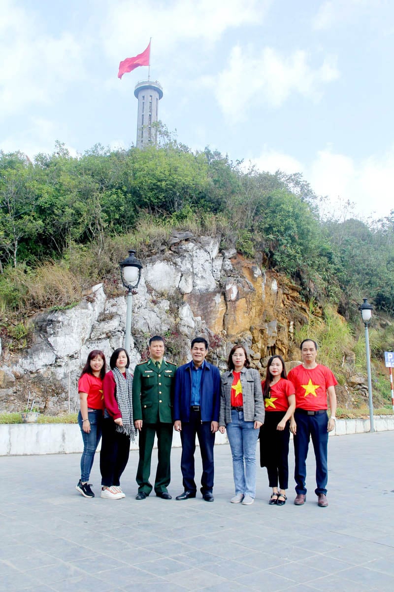 |
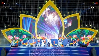
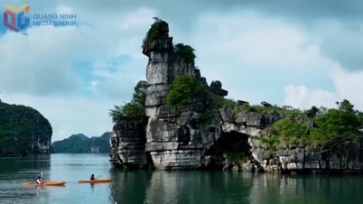
| The delegation of Vinh Phuc Provincial Journalists Association visited and took photos at Lung Cu National Flagpole (Lung Cu commune, Dong Van district, Ha Giang province) |
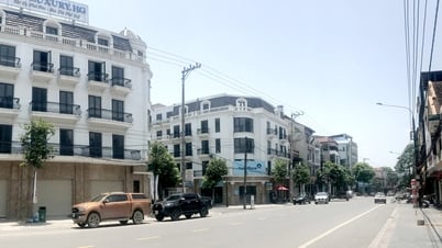
Passing through the vast rows of buckwheat flowers along the road, we arrived in Dong Van district when it was almost dark. Although quite tired after a long journey, almost immediately, our group was conquered by the atmosphere and people here. The ancient town of Dong Van at night is majestic with sparkling lights shining on the cliffs, the ethnic people here still preserve and organize many cultural activities with their own unique identity.
We visited Lung Cu Border Post (Lung Cu Commune, Dong Van District) early in the morning. The soldiers here are assigned to protect Lung Cu National Flagpole, manage and protect the border line of over 26km with 26 national border markers, in charge of Ma Le Commune and Lung Cu Commune of Dong Van District. The soldiers at the post stay day and night, firmly protecting the national sovereignty, especially the absolute safety of Lung Cu National Flagpole - the place marking the sacred territorial sovereignty of the country.
Lung Cu National Flagpole is located on the top of Lung Cu (also known as Dragon Mountain) at an altitude of nearly 1,500 m above sea level. From afar, the Flagpole stands tall among the rocky mountains, the sacred red flag with yellow star of the Fatherland fluttering in the wind, making any Vietnamese person feel great pride in their country's sovereignty. To reach the top of the Flagpole, you need to go through 839 steps, including 722 stone steps and 135 steel steps inside the Flagpole. The Flagpole was built according to the model of the Hanoi Flagpole, with a total height of 34.85 m. The body of the pole is designed in an octagonal shape, with 8 bronze drums and 8 green stone reliefs illustrating the stages through each historical period of the country as well as the people and customs of the ethnic groups in Ha Giang. In 2009, Lung Cu Flagpole was ranked as a National Historical Relic and Scenic Spot by the Ministry of Culture, Sports and Tourism.
We stopped at the foot of the Flagpole, stood solemnly, looked up at the sacred national flag and performed the flag-saluting ceremony amidst the cheers of the soldiers of Lung Cu Border Post. Wearing the red flag with yellow star shirt, looking up at the large national flag - that is a precious memory, a great national pride, a passionate patriotism of the members of our group. The sacred national flag at Lung Cu Flagpole is 54 square meters wide, symbolizing 54 ethnic groups living together in harmony and solidarity on the territory of Vietnam. Due to the strong wind on the top of Lung Cu, about once a week or 10 days, the soldiers of Lung Cu Border Post had to change the flag once because the flag was torn or damaged. Some people were extremely moved, crying without words when they were given these national flags as a memory, a keepsake that they would never forget.
Leaving the northernmost point of the country, I wished to one day set foot in the South, to the beloved southernmost point of my country. The wish came true when I returned to the South on a historic April day, when the whole country celebrated the 50th anniversary of the Liberation of the South and the reunification of the country. Along the roads of the provinces and cities: Can Tho, Soc Trang, Bac Lieu, Ca Mau... the days we went, the sky was filled with the red color of the Party flag, the national flag fluttering, proudly showing national pride.
“They say Ca Mau is very far away, at the end of the map of Vietnam” (Lyrics of the song “Ao Moi Ca Mau” by musician Thanh Son) but Ca Mau is really far away but close in the hearts of us, the children of the North… The southernmost point of the Fatherland is the tip of the cape, belonging to Dat Mui hamlet (Dat Mui commune, Ngoc Hien district, Ca Mau province). The name of Ngoc Hien district was named after the journalist, teacher, writer and Vietnamese patriot during the French colonial period, Phan Ngoc Hien - who rose up to lead the Hon Khoai uprising in Ca Mau, a part of the Southern uprising against the French colonial government that broke out in 1940.
We started our visit to Ca Mau Cape with a humorous remark from a staff member of the Ca Mau National Tourist Area: “Do you know which country Ca Mau borders? It is the sea. Ca Mau Cape is the only place in Vietnam that has 3 sides bordered by sea!”. Ca Mau Cape is surrounded by the East Sea and the Gulf of Thailand, and is the only coordinate in our country where you can watch the sun rise from the East Sea in the morning and set into the West Sea in the afternoon.
In the scorching sun of the Southern land, our group visited the symbolic end point of the Ho Chi Minh road on land: Km 2436 of the Ho Chi Minh road. The road starts from Pac Bo, Cao Bang province, passes through 28 provinces and cities and ends at the southernmost point of the country. This is considered the end point of the journey from Pac Bo - Cao Bang to Dat Mui - Ca Mau. The project was built in more than 2 years with a 19 m high pillar in the middle and 2 reliefs on both sides. On the right of the high pillar is a relief depicting the image of the fighting and defending the Fatherland of the people of Ca Mau. On the left of the high pillar is a relief depicting the construction and development of the people of Ca Mau. The materials used to make the 2 reliefs and the ceramic pillar were brought from the North for construction. This deeply and deeply expresses the love between the North and the South, the mountains and rivers, our country is a strip, a unified block, inseparable.
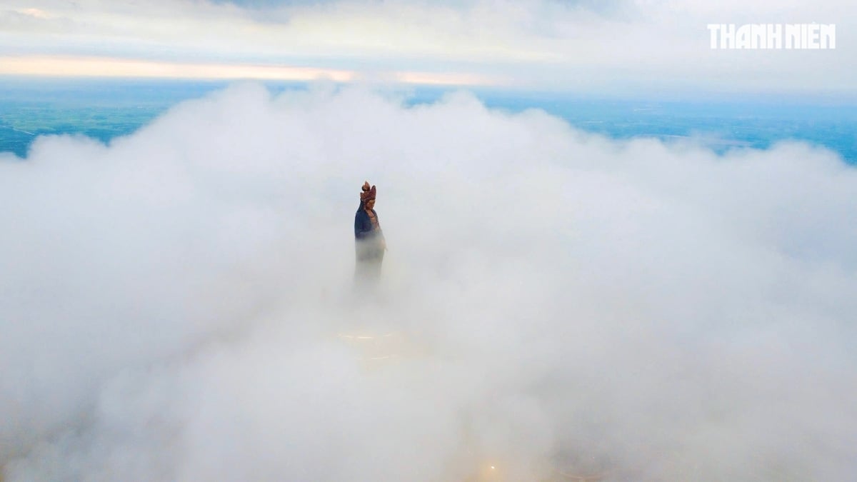
Continuing the journey, we visited Lac Long Quan Temple and Au Co Mother Statue in the Ca Mau Cape Tourist Area. Lac Long Quan Temple and Au Co Mother Statue are located facing the East Sea, a project of great significance, demonstrating the morality of "When drinking water, remember its source" of our people, reminding future generations to always and forever be determined to protect national sovereignty and show gratitude to ancestors who "went up the forest, down to the sea" to expand the territory.
With national pride, we visited the National Landmark with GPS number 0001. This is considered the southernmost point on the mainland of Vietnam, along with the following landmarks: the Easternmost point at Mui Doi, Van Thanh commune, Van Ninh district, Khanh Hoa province; the Westernmost point at Sin Thau commune, Muong Nhe district, Dien Bien province; the Northernmost point at Lung Cu commune, Dong Van district, Ha Giang province, creating 4 landmarks that clearly affirm the sovereignty and national boundaries of Vietnam. Near the GPS coordinate marker 0001, there are ancient maps on display, including the "An Nam Dai Quoc Hoa Do" from 1838 and the "Hoang Trieu Truc Tinh Dia Du Toan Do" from 1904, proving the sovereignty of Truong Sa - Hoang Sa islands as part of Vietnamese territory. This is like a strong affirmation of our country's sovereignty, which no force can violate. A project with profound meaning about the solidarity of our people is the Hanoi Flag Tower built in the Ca Mau Cape Tourist Area. In 2019, the Party Committee, the government and the people of Hanoi city built and presented Ca Mau province with a version of the Hanoi Flag Tower with a ratio of nearly 1:1 as a reminder that "no matter where you go, your heart still remembers Hanoi" - the pink heart of the whole country. The red flag with a yellow star flying proudly in the sun and wind of Ca Mau Cape is an endless pride, expressing great national pride.
Closing the journey to Ca Mau, our group visited the ship-shaped symbol with sails bearing the words "Ca Mau Cape" with coordinates 8037'30" North latitude - 104043' East longitude. All members of our group were moved and emotional when they saw and admired the meaningful and sacred symbol of the southernmost point of the Fatherland. The image of the ship and the sails full of wind heading out to sea is like the two verses that poet Xuan Dieu wrote about Ca Mau in 1960: "My Fatherland is like a ship/The bow of our boat is Ca Mau Cape". Ca Mau cape is a symbol of the Vietnamese people's aspiration to reach far. The mainland of Vietnam can stop at Ca Mau Cape, but the Vietnamese people, with their strength and intelligence, can set sail far away, reaching out to the ocean to stand shoulder to shoulder with friends from all over the world.
Our country is vast, but I have not had the chance to visit the two poles of the Fatherland. It is like a promise, a wish that in the future I will be able to visit the Eastern and Western poles of my Fatherland, to once again love journalism with great patriotism and pride.
Ngoc Lam - HNB Vinh Phuc
Source: https://baohagiang.vn/van-hoa/202505/yeu-nghe-bao-trong-tinh-yeu-dat-nuoc-5b00471/
![[Photo] Prime Minister Pham Minh Chinh chairs a meeting on the implementation of the Lao Cai-Hanoi-Hai Phong railway project.](https://vphoto.vietnam.vn/thumb/1200x675/vietnam/resource/IMAGE/2025/5/20/0fa4c9864f63456ebc0eb504c09c7e26)


Comment (0)