
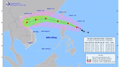
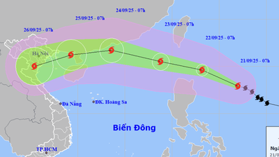
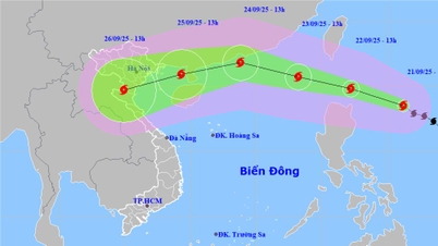
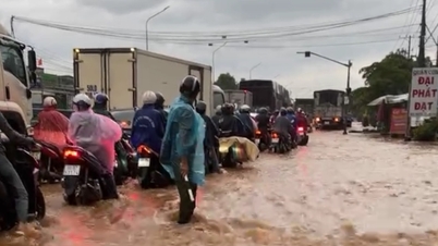
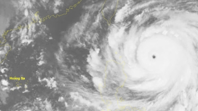
On the morning of September 18, the National Center for Hydro-Meteorological Forecasting said that last night, a tropical depression in the sea northwest of Luzon Island (Philippines) entered the East Sea.
At 1:00 a.m. on September 18, the center of the tropical depression was located at 19 degrees North latitude - 119.8 degrees East longitude, in the northeastern sea area of the North East Sea, with the strongest wind at level 7 (50-61 km/h), gusting to level 9, moving northwest at a speed of 15-20 km/h.

The National Center for Hydro-Meteorological Forecasting predicts that from now until the morning of September 19, the tropical depression is likely to strengthen into a storm in the northeastern sea area of the North East Sea. The storm's wind intensity is level 8, gusting to level 10, the danger zone is currently determined to be north of latitude 18 and east of longitude 115.5. Disaster risk level: level 3.
From September 19 to 20, the storm continued to move northwest at a speed of about 15km/hour, with the center of the storm on the morning of September 20 located in the southern area of Guangdong province (China). The wind intensity at this time is strong at level 8, gusting to level 10.
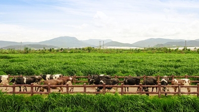
The National Center for Hydro-Meteorological Forecasting said that in the next 48-72 hours, the storm will tend to move mainly in a westerly direction, traveling about 10km per hour and gradually weakening. At sea, the northeastern area of the North East Sea will have winds gradually increasing to level 6-7, gusting to level 9; near the center of the storm, winds will be level 8, gusting to level 10, with rough seas. The meteorological agency continues to warn of dangerous weather for ships operating in the North East Sea.
Source: https://www.sggp.org.vn/ap-thap-nhiet-doi-da-vao-bien-dong-post813496.html

![[Photo] General Secretary To Lam presents the First Class Labor Medal to the Vietnam National Energy and Industry Group](https://vphoto.vietnam.vn/thumb/1200x675/vietnam/resource/IMAGE/2025/9/21/0ad2d50e1c274a55a3736500c5f262e5)

![[Photo] General Secretary To Lam attends the 50th anniversary of the founding of the Vietnam National Industry and Energy Group](https://vphoto.vietnam.vn/thumb/1200x675/vietnam/resource/IMAGE/2025/9/21/bb0920727d8f437887016d196b350dbf)


Comment (0)