
Forecast until 1am on October 20, storm Fengshen is moving northwest at a speed of about 20-25km/h, level 9 intensity, gust level 11. The heavily affected area is in the eastern sea of the North East Sea.
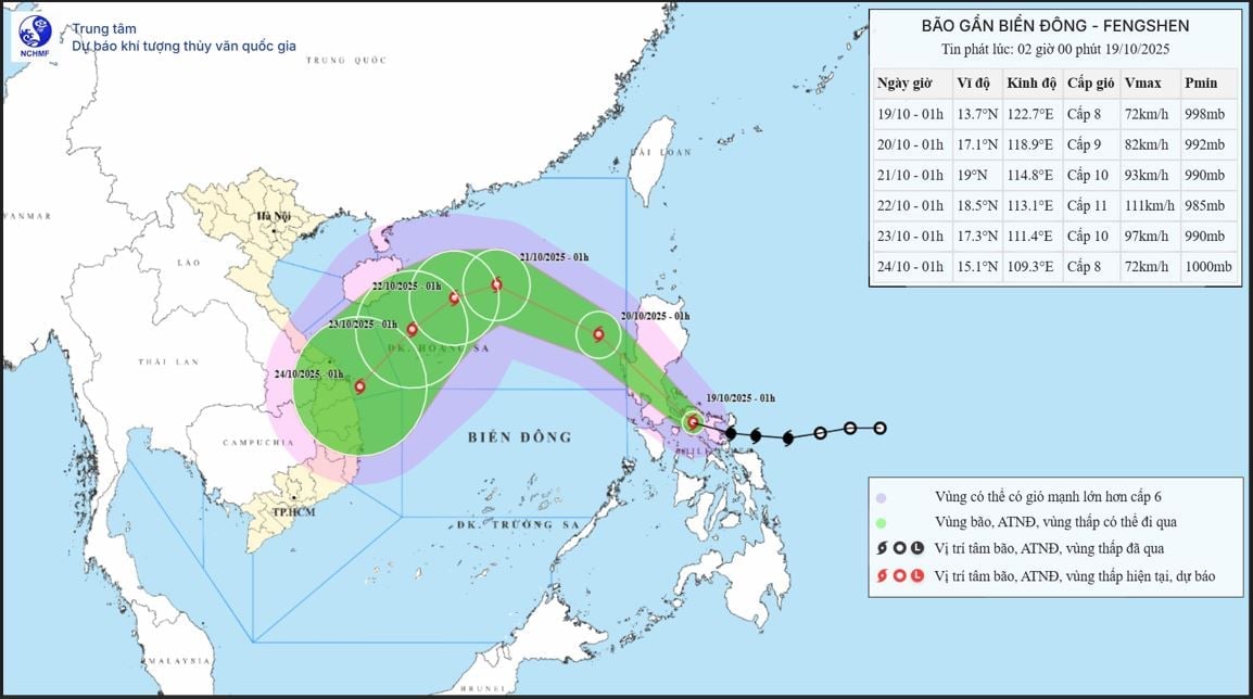 |
| The movement of storm FENGSHEN. Photo: nchmf |
According to the National Center for Hydro-Meteorological Forecasting, at about 1:00 a.m. on October 19, the center of storm Fengshen was at about 13.7 degrees North latitude; 122.7 degrees East longitude, in the eastern central region of the Philippines. The strongest wind near the center of the storm was level 8 (62-74 km/h), gusting to level 10. Moving in the West Northwest direction at a speed of about 20 km/h.
Storm forecast (in the next 24 to 72 hours):
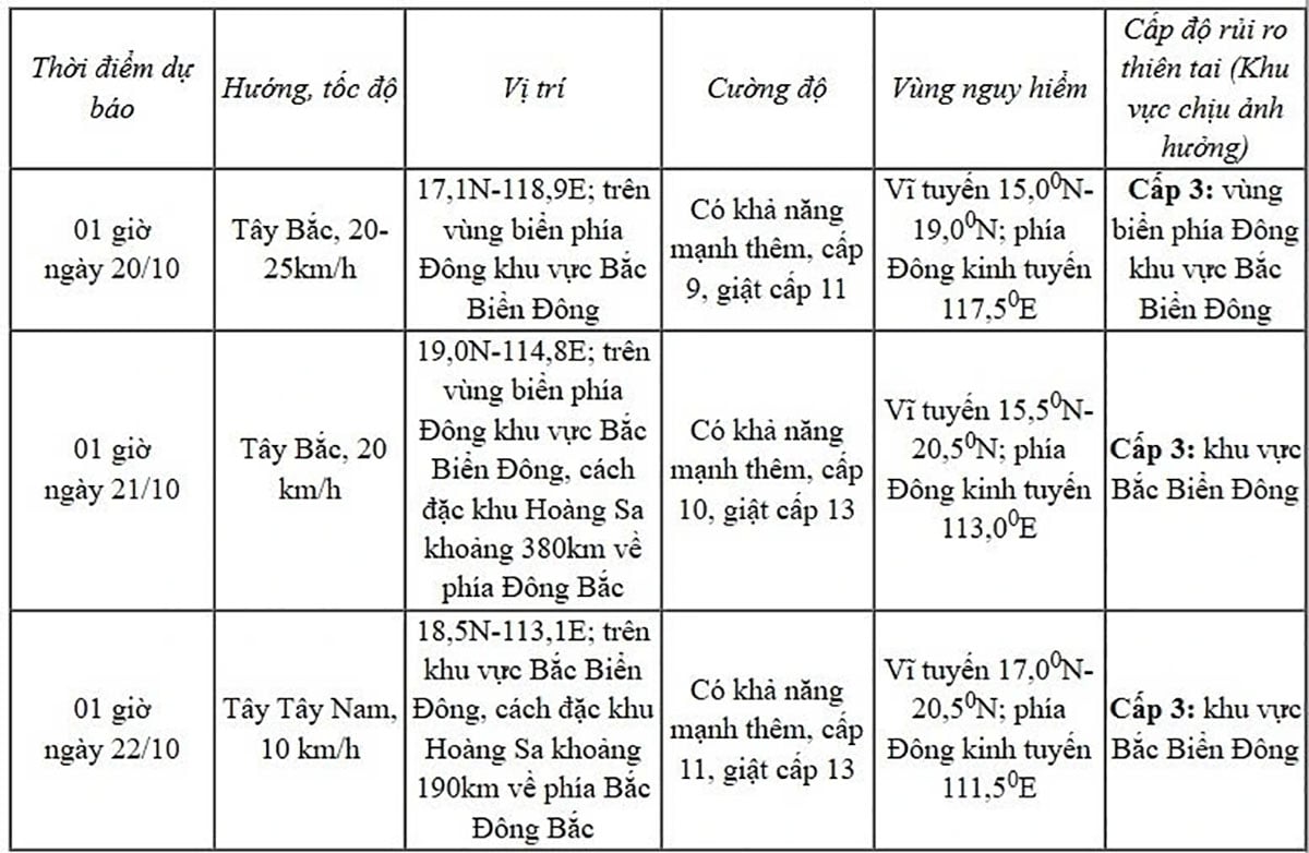 |
| Photo: National Center for Hydro-Meteorological Forecasting |
From the next 72 to 120 hours, the storm will move mainly in the southwest direction, about 10-15km per hour and gradually weaken.
According to the forecast of the storm's impact, the eastern sea area of the North East Sea will have winds gradually increasing to level 6-7; the area near the storm's center will have strong winds of level 8-9, gusting to level 11, with waves 2.5-5.0m high. The sea will be very rough.
Warning: Between October 20 and 22, the North East Sea area (including Hoang Sa special zone) is likely to be affected by strong winds of level 10-11, gusting to level 13.
All vessels operating in the danger zone are susceptible to storms, whirlwinds, strong winds and large waves.
According to PV/VOV.VN
Source: https://baovinhlong.com.vn/thoi-su/202510/bao-fengshen-dang-tien-vao-khu-vuc-bac-bien-dong-82205ee/

![[Photo] Collecting waste, sowing green seeds](https://vphoto.vietnam.vn/thumb/1200x675/vietnam/resource/IMAGE/2025/10/18/1760786475497_ndo_br_1-jpg.webp)

![[Photo] General Secretary To Lam attends the 95th Anniversary of the Party Central Office's Traditional Day](https://vphoto.vietnam.vn/thumb/1200x675/vietnam/resource/IMAGE/2025/10/18/1760784671836_a1-bnd-4476-1940-jpg.webp)


Comment (0)