
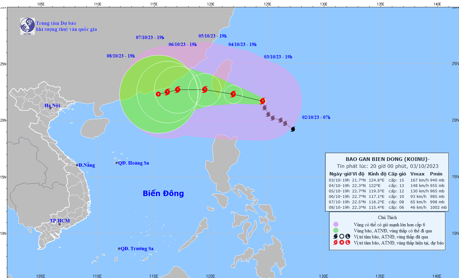
The strongest wind near the storm center is level 14-15 (150-183km/h), gusting over level 17, moving northwest, about 10km/h.
Forecast by 7pm on October 4, the storm is 110km east-southeast of Taiwan, the strongest wind near the storm center is level 13-14, gusting to level 17, moving in the West-Northwest direction, about 10km/h. By 7pm on October 5, the storm is 280km east-southeast of Fujian (China), the strongest wind near the storm center is level 12, gusting to level 15, moving in the West-Northwest direction, about 10km/h moving into the East Sea and gradually weakening.
At 7:00 p.m. on October 6, the storm in the sea southeast of Guangdong province (China), the strongest wind near the storm center was level 10, gusting to level 12, moving west, about 10km/h and gradually weakening.
From the next 72 to 120 hours, the storm will move mainly in the West Southwest direction, about 5km per hour, and its intensity will continue to weaken.
The northeastern sea area of the North East Sea has winds gradually increasing to level 6-7, from the night of October 4 to level 8-10, near the storm center level 11-12, gusting to level 15; the sea is very rough. Also in this sea area, the waves are 2-4m high; from the night of October 4, the waves are 4-6m high, near the storm center waves are 6-8m high.
Source


![[Maritime News] More than 80% of global container shipping capacity is in the hands of MSC and major shipping alliances](https://vphoto.vietnam.vn/thumb/402x226/vietnam/resource/IMAGE/2025/7/16/6b4d586c984b4cbf8c5680352b9eaeb0)


Comment (0)