
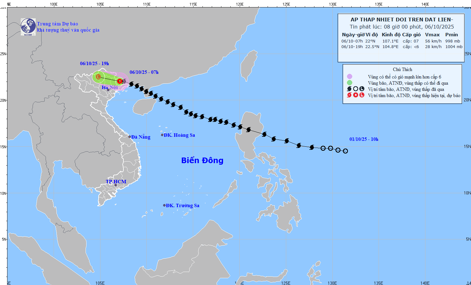
Accordingly, at 7:00 a.m. on October 6, the center of the tropical depression was at about 22.0 degrees North latitude; 107.1 degrees East longitude, in the southern area of Guangxi province (China). The strongest wind near the center of the tropical depression was level 7 (50-61 km/h), gusting to level 9. Moving westward at a speed of 20-25 km/h.
At 7:00 p.m. on October 6, the tropical depression in the mountainous area of Northern Vietnam with wind speed below level 6; moving in the West Northwest direction at a speed of 20-25 km/h and weakening into a low pressure area. The affected area is the Northern Gulf of Tonkin, the mainland of Quang Ninh and Lang Son with a level 3 natural disaster risk level.
Due to the influence of a tropical depression, on the morning of October 6, the northern area of Bac Bo Gulf (including Bach Long Vi special zone) had strong winds of level 6, gusts of level 8, waves 2-3 m high, rough seas (dangerous for ships).
On the morning of October 6, on land in Quang Ninh and Lang Son areas, there were strong winds of level 5, in some places level 6, gusting to level 7-8.
From the morning of October 6 to the end of the night of October 7, mountainous and midland areas of the North will have heavy rain and thunderstorms, with average rainfall of 100-200 mm, and in some places very heavy rain of over 300 mm.
Warning of risk of heavy rain (>150 mm/3 hours); Northern Delta and Thanh Hoa have moderate to heavy rain with common rainfall of 50-150 mm, locally very heavy rain over 200 mm.
Source: https://baotintuc.vn/xa-hoi/bao-so-11-suy-yeu-thanh-ap-thap-nhiet-doi-20251006083934356.htm


Comment (0)