
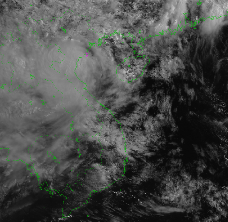
According to the National Center for Hydro-Meteorological Forecasting, due to the impact of storm No. 3, in Bach Long Vi special zone, there were strong winds of level 10, gusting to level 12; in Co To special zone, there were strong winds of level 8, gusting to level 11; in Cat Ba (Cat Hai special zone), there were strong winds of level 6, gusting to level 8; in Cua Ong, there were strong winds of level 9, gusting to level 12;
Bai Chay has strong winds of level 8, gusting to level 9; Quang Ha has strong winds of level 8; Tien Yen has strong winds of level 7, gusting to level 9; Thai Binh station has strong winds of level 7, gusting to level 8; Mong Cai has strong winds of level 6, gusting to level 9; Phu Lien has strong winds of level 6, gusting to level 8...
In the Northern Delta and coastal areas, Thanh Hoa and Nghe An, there will be moderate rain, heavy rain, and in some places very heavy rain with common rainfall of 50-100mm, in some places over 130mm.
The strongest wind in the storm center is level 9 (75-88 km/h), gusting to level 11. In the next 3 hours, the storm will move in a West Southwest direction, at a speed of about 15 km/h.
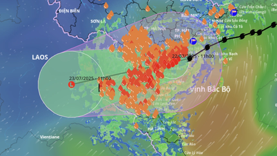
According to Mr. Mai Van Khiem, Director of the National Center for Hydro-Meteorological Forecasting, it is forecasted that after 10am this morning, storm No. 3 will make landfall in the southern Hai Phong and Ninh Binh areas with an intensity of about level 9, gusting to level 10-11, and deep inland with an intensity of about level 6-7, gusting to level 8.
Due to the influence of storm No. 3, the provinces along the Gulf of Tonkin have had heavy rain from yesterday, July 21, until today, with local rainfall reaching over 200mm in some places.
Rainfall is forecast to continue to increase today and tomorrow, with widespread rainfall ranging from 200-300mm, some places may exceed 500mm. The focus of the rain is still on the provinces of Hung Yen, Ninh Binh, Thanh Hoa, Nghe An. Other areas may have less rain but rainfall may still reach 100-200mm. In addition to the risk of heavy rain causing urban flooding, we also warn of the risk of flash floods and landslides.
Coastal areas from Quang Ninh to Nghe An have strong winds of level 7-8, areas near the storm center have winds of level 9-10, gusting to level 13; inland areas of the provinces/cities of Hai Phong, Hung Yen, Bac Ninh, Hanoi, Ninh Binh and Thanh Hoa have strong winds of level 6, gusting to level 7-8. Winds of level 9-10 can knock down trees, electric poles, and rip off roofs, causing very heavy damage.
Source: https://cand.com.vn/doi-song/bao-so-3-ap-sat-dat-lien-cach-hai-phong-70-km-hung-yen-10-km--i775545/


Comment (0)