
Storm No. 3 Wipha makes landfall from South Hai Phong to North Thanh Hoa; wind level in Hanoi can reach level 5-6, gusting to level 8. Hanoi has many high-rise buildings, so pay attention to very strong winds.
Mr. Nguyen Van Hiep, Deputy Director of the Northern Hydrometeorological Station, Department of Hydrometeorology, Ministry of Agriculture and Environment has just provided information about storm No. 3 (storm Wipha) affecting the Hanoi area.
Accordingly, from 10am to 3pm today (July 22), the eye of the storm will enter the area of South Hai Phong - North Thanh Hoa. From the evening and night of July 21, the coastal area of Quang Ninh - Nghe An will gradually increase to level 7-9, near the eye of the storm level 10-11, gusting to level 14.
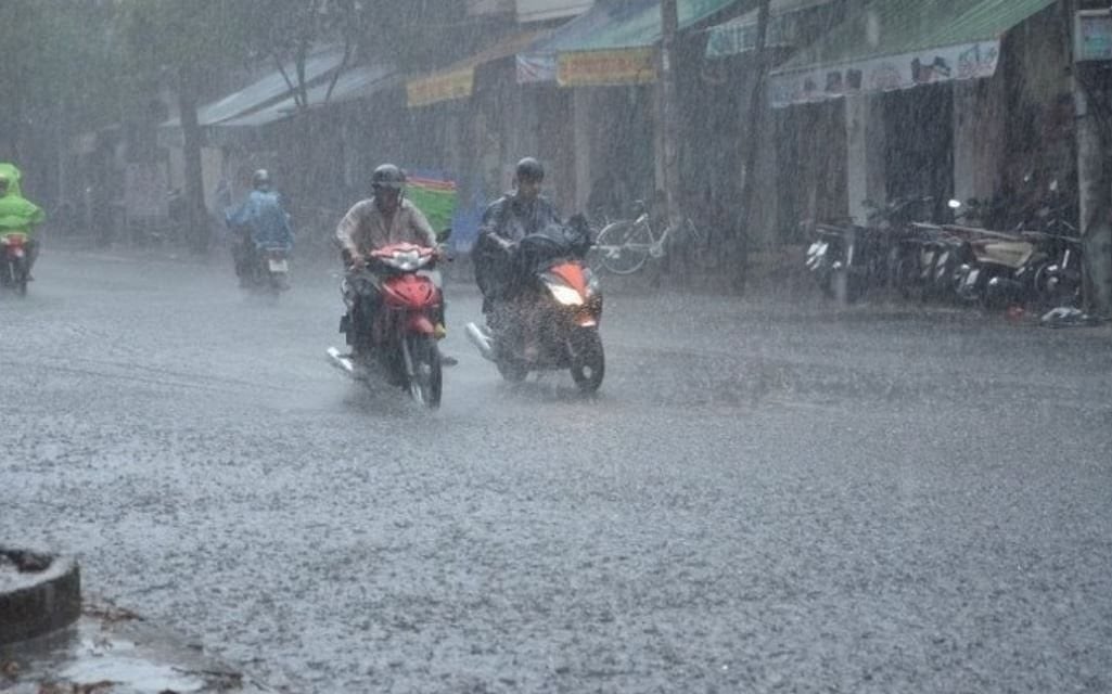 |
Regarding the amount of rain during this storm, the Hanoi area during the whole period (July 21 to 23) was generally at 100-200mm, with some places over 300mm. Illustration photo: congly.vn |
Inland areas including Hai Phong, Hung Yen, Bac Ninh, Hanoi, Ninh Binh, Thanh Hoa have winds gradually increasing to level 6, gusting to level 7-8. Particularly, it is necessary to pay attention to very strong winds in Hanoi, occurring locally in small areas. In addition to storm winds and large-scale gusts, it is necessary to be vigilant for winds in thunderstorms.
Mr. Nguyen Van Hiep added that Hanoi has many high-rise buildings, so the wind passing through here is much stronger than the wind measured at the stations. People and the community need to pay attention to avoid danger in stormy conditions.
Regarding the amount of rain during this storm, the Hanoi area will see a general rainfall of 100-200mm during the entire period (July 21-23), with some places experiencing over 300mm. People should be aware of the risk of flooding in low-lying areas due to intense rain in a short period of time.
Flooding in inner-city and low-lying areas is forecast to range from 0.2-0.5m, deeper in some places, and lasting about 30-60 minutes.
However, according to Mr. Nguyen Van Hiep, this is the time around the beginning and middle of the rainy and stormy season, there is still a lot of humidity in the air, after the storm makes landfall there is still a risk of rain after the storm so there is a high possibility of unusual rain.
Regarding floods on rivers, Mr. Nguyen Van Hiep added that currently the water level is not too high, during this storm, most floods are at alert level 1, some rivers are at alert level 2.
According to Vietnamnet
* Please visit the Society section to see related news and articles.
Source: https://baolamdong.vn/bao-so-3-bao-wipha-do-bo-dat-lien-ha-noi-bi-anh-huong-nhu-the-nao-383198.html

![[Photo] General Secretary To Lam attends the 1st Congress of the Central Party Committee of the Fatherland Front and Central Mass Organizations](https://vphoto.vietnam.vn/thumb/1200x675/vietnam/resource/IMAGE/2025/9/23/2aa63d072cab4105a113d4fc0c68a839)


![[Photo] Prime Minister Pham Minh Chinh chairs the first meeting of the Central Steering Committee on housing policy and real estate market](https://vphoto.vietnam.vn/thumb/1200x675/vietnam/resource/IMAGE/2025/9/22/c0f42b88c6284975b4bcfcf5b17656e7)


Comment (0)