
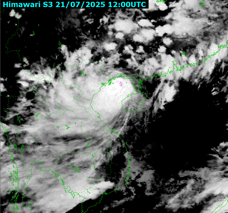
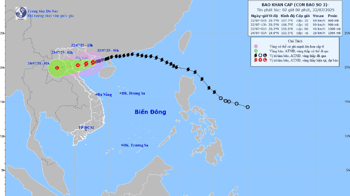
According to the National Center for Hydro-Meteorological Forecasting, at 7:00 p.m., the center of the storm was located at approximately 20.9 degrees North latitude; 108.5 degrees East longitude, approximately 86 km from Quang Ninh, approximately 210 km east of Hai Phong , approximately 230 km from Hung Yen, approximately 257 km east-northeast of Ninh Binh.
Strongest wind: Level 9-10 (75-102 km/h), gusting to level 13. In the next 3 hours, the storm will move in the West Southwest direction, at a speed of about 10 km/h.
Due to the impact of storm No. 3, from the evening and night of July 21, coastal areas from Quang Ninh to Nghe An will have winds gradually increasing to level 7-9, areas near the storm center will have winds of level 10-11, gusting to level 14; inland areas of Hai Phong, Hung Yen , Ninh Binh and Thanh Hoa provinces/cities, winds of level 6, gusting to level 7-8. Winds of level 10-11 can cause trees, electric poles, and roofs to fall, causing very serious damage. The level of impact according to wind level is detailed in Appendix 1.
From July 21 to July 23, in the Northeast region, the Northern Delta, Thanh Hoa and Nghe An, there will be heavy to very heavy rain and thunderstorms with common rainfall of 200-350mm, locally over 600mm; other places in the Northern region and Ha Tinh will have moderate rain, heavy rain, locally very heavy rain and thunderstorms with common rainfall of 100-200mm, locally over 300mm. Warning of the risk of heavy rain (>150mm/3h). Heavy rain in a short period of time can cause flash floods, landslides in mountainous areas, and flooding in low-lying areas.
In addition, heavy rain will cause rivers in the North, Thanh Hoa, and Nghe An to experience a flood with an amplitude of 3-6 m from tonight until July 25. Small rivers, Thao River, and the upper Ma River may reach alert levels two and three. The Lo, Da, Cau, Thuong, Luc Nam, Hoang Long Rivers and the upper Ca River are forecast to reach alert levels one and two, and in some places exceed alert level two. The lower reaches of the Red River and Thai Binh River are below alert level one; the lower reaches of the Ma River and Ca River fluctuate around alert level one.
NDS
Source: https://baothanhhoa.vn/bao-so-3-tang-cap-thanh-hoa-du-bao-mua-lon-nhat-tap-trung-vao-dem-nay-va-sang-mai-255601.htm


![[Photo] National Assembly Chairman Tran Thanh Man visits Vietnamese Heroic Mother Ta Thi Tran](https://vphoto.vietnam.vn/thumb/1200x675/vietnam/resource/IMAGE/2025/7/20/765c0bd057dd44ad83ab89fe0255b783)


Comment (0)