
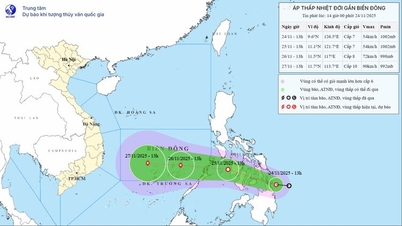
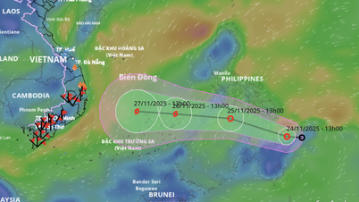
Forecast of location and direction of tropical depression at 1:00 p.m. on November 24 - Photo: VNDMS
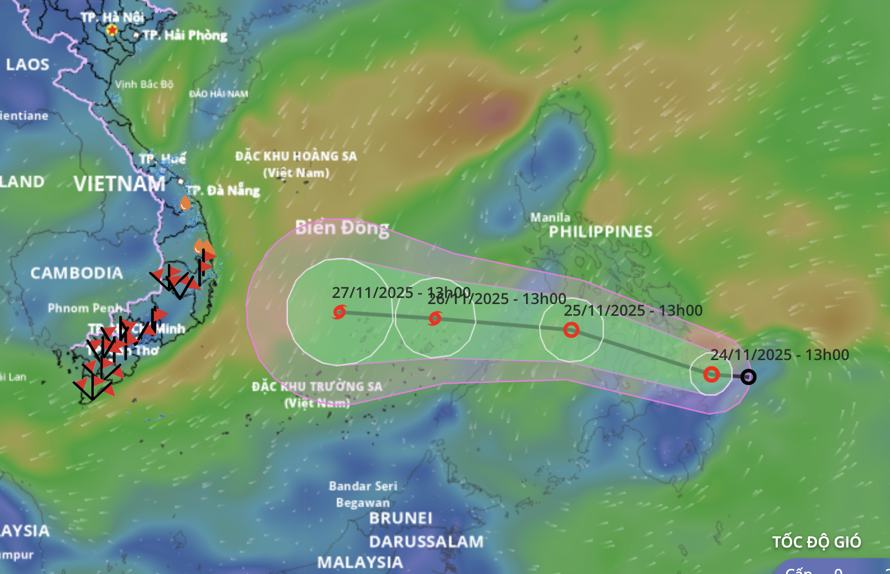
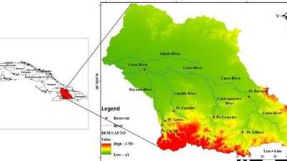
According to the National Center for Hydro-Meteorological Forecasting at 1:00 p.m. this afternoon, the center of the tropical depression is in the sea east of the Philippines, the strongest wind near the center of the tropical depression is level 7 (50-61 km/h), gusting to level 9.
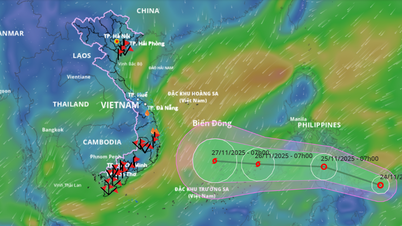
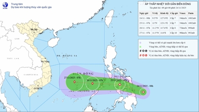
It is forecasted that today and tomorrow, the tropical depression will move west-northwest at a speed of about 20-25km/h through the central Philippines. Around the night of November 25 to the morning of November 26, the tropical depression will enter the East Sea.
On November 26, when it is about 1,000km from the mainland of the South Central region, the tropical depression is likely to strengthen into a storm.
If it strengthens into a storm, it will be the 15th storm in the East Sea this year.
The strongest intensity forecast when passing through the northern area of Truong Sa special zone is expected to reach level 10 (89-102km/h), gusting to level 13.
The storm then moved westward, towards the mainland of the South Central region, with the main impact from the Gia Lai - Lam Dong area (the old Binh Dinh - Binh Thuan area), with the main impact period between November 28 and 30.
Regarding the impact on land (initial assessment and may change), when entering coastal waters, the storm may reduce its intensity due to the impact of cold air and low sea surface temperature in the South Central Coast region. The intensity when affecting the mainland may be at the level of a level 8-9 storm or a tropical depression.
It is expected that from November 28 to 30, the area from Da Nang to Lam Dong will likely experience widespread heavy rain, with the heaviest rain concentrated along the coastal strip.
In the immediate future, from the evening of November 25, the sea area east of the central and southern East Sea will have winds gradually increasing to level 6-7, near the storm center will have strong winds of level 8, gusting to level 10, with waves 3-5m high.
During the night of November 26 to 28, the central and southern areas of the East Sea (including the waters north of Truong Sa special zone) are likely to be affected by strong winds of level 9-10, gusting to level 13.
Vessels operating in the above mentioned dangerous areas are susceptible to the impact of storms, whirlwinds, strong winds and large waves.
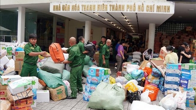
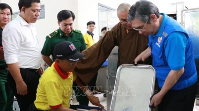
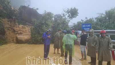
To proactively respond to the tropical depression that is likely to strengthen into a storm, on November 24, the National Civil Defense Steering Committee issued a telegram requesting ministries, branches, and People's Committees of provinces and cities from Quang Tri to An Giang , especially the provinces in the South Central region, to urgently focus on overcoming the consequences, restoring production and business, and stabilizing people's lives after the recent historic rain and flood. At the same time, be ready to prepare to respond to the next natural disaster.
Provinces and cities from Quang Tri to An Giang immediately notify captains and owners of vehicles and boats operating at sea to proactively prevent and have appropriate production plans, ensuring safety of people and property.
At the same time, prepare forces and means to deploy rescue work when there is a situation.
The National Steering Committee for Civil Defense also requested ministries and branches, according to their functions, state management tasks and assigned tasks, to proactively direct and coordinate with localities to respond to tropical depressions that are likely to strengthen into storms and floods.
Tuoitre.vn
Source: https://tuoitre.vn/bien-dong-kha-nang-co-bao-so-15-cac-tinh-nam-trung-bo-san-sang-ung-pho-dot-thien-tai-moi-20251124132049236.htm

![[Photo] National Assembly Chairman Tran Thanh Man receives a business delegation from the Europe-ASEAN Business Council](/_next/image?url=https%3A%2F%2Fvphoto.vietnam.vn%2Fthumb%2F1200x675%2Fvietnam%2Fresource%2FIMAGE%2F2025%2F11%2F24%2F1763989198212_ndo_br_bnd-7394-jpg.webp&w=3840&q=75)


![[Photo] Prime Minister Pham Minh Chinh attends the patriotic emulation congress of the banking sector](/_next/image?url=https%3A%2F%2Fvphoto.vietnam.vn%2Fthumb%2F1200x675%2Fvietnam%2Fresource%2FIMAGE%2F2025%2F11%2F24%2F1763981997729_tt-nhnn-jpg.webp&w=3840&q=75)


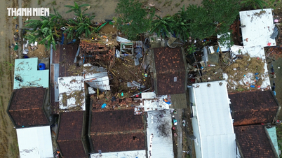
![[Photo] Next to the "mountain of trash" after the flood, Tuy Hoa residents strive to rebuild their lives](/_next/image?url=https%3A%2F%2Fvphoto.vietnam.vn%2Fthumb%2F1200x675%2Fvietnam%2Fresource%2FIMAGE%2F2025%2F11%2F24%2F1763951389752_image-1-jpg.webp&w=3840&q=75)


Comment (0)