
Two main spatial axes
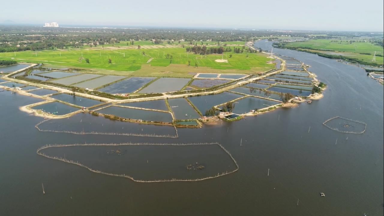
According to the project, the planning area has an area of over 12,600 hectares, including the communes of Duy Thanh, Duy Vinh, Duy Nghia, Duy Hai (Duy Xuyen); Binh Giang, Binh Duong, Binh Trieu, Binh Dao, Binh Minh (Thang Binh). The North borders Hoi An city; the East borders the East Sea; the South borders Binh Sa, Binh Hai communes (Thang Binh); the West borders Binh Phuc commune (Thang Binh) and Huong An town (Que Son).
It is a functional area for developing services and tourism associated with urban and rural development; creating a premise for linking development with the space along National Highway 1 and the western region of the province, and at the same time forming the basis for forming a coastal tourism strip of Quang Nam from Dien Ban - Hoi An to Tam Ky - Nui Thanh.
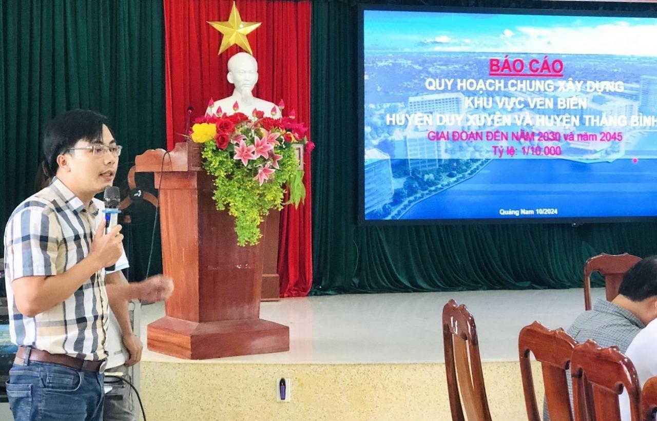
Mr. Nguyen Hiep Dinh - representative of the consulting unit drafting the project said that the spatial development structure of the area is oriented to develop according to the model of "Two parallel axes and one ecological green belt".
With two main spatial axes: the urban - service - tourism space axis along the coast and Vo Chi Cong street; the urban - industrial - ecological corridor axis along the western route of Truong Giang river. The green belt is the space along the Thu Bon river, Truong Giang river, the coast surrounded by landscape and ecological space, creating a green - civilized - modern urban area.
The project also forms 3 areas to promote development including: area 1 is the coastal and riverside space; area 2 is the green core area of the Truong Giang river ecological corridor and area 3 is the buffer zone (transition from urban, industrial area to urban, tourist area).
Need to invest in synchronous infrastructure
At the review conference, delegates said that the project must be consistent with the plans and projects that have been and are being implemented in Thang Binh district such as: General planning for the construction of Chu Lai Open Economic Zone; Construction planning for Thang Binh district, period up to 2030; General planning for Binh Minh urban area; at the same time, creating leverage to exploit local cultural and tourism values such as the relic site of Lang Ba Cho Duoc, the fishing festival, etc.
Mr. Nguyen Tan Quat - Chairman of the Vietnam Fatherland Front Committee of Binh Minh commune suggested that it is necessary to re-evaluate the current status of electricity use in urban areas and forecast electricity demand in the coming time; at the same time, maintain green areas along the coast, invest in building Binh Minh bus station, have a plan to treat wastewater discharged into the marine environment; plan healthcare, schools... suitable to the population size in localities.
Mr. Dang Van Hung - Secretary of the Party Committee of Binh Duong commune said that in the area of 2 green core areas - the ecological corridor of Truong Giang river, the location and development orientation of the project is only concentrated in the area of Duy Thanh and Duy Vinh communes (Duy Xuyen), not mentioning the communes along Truong Giang river such as Binh Duong, Binh Giang, Binh Dao and Binh Trieu (Thang Binh).
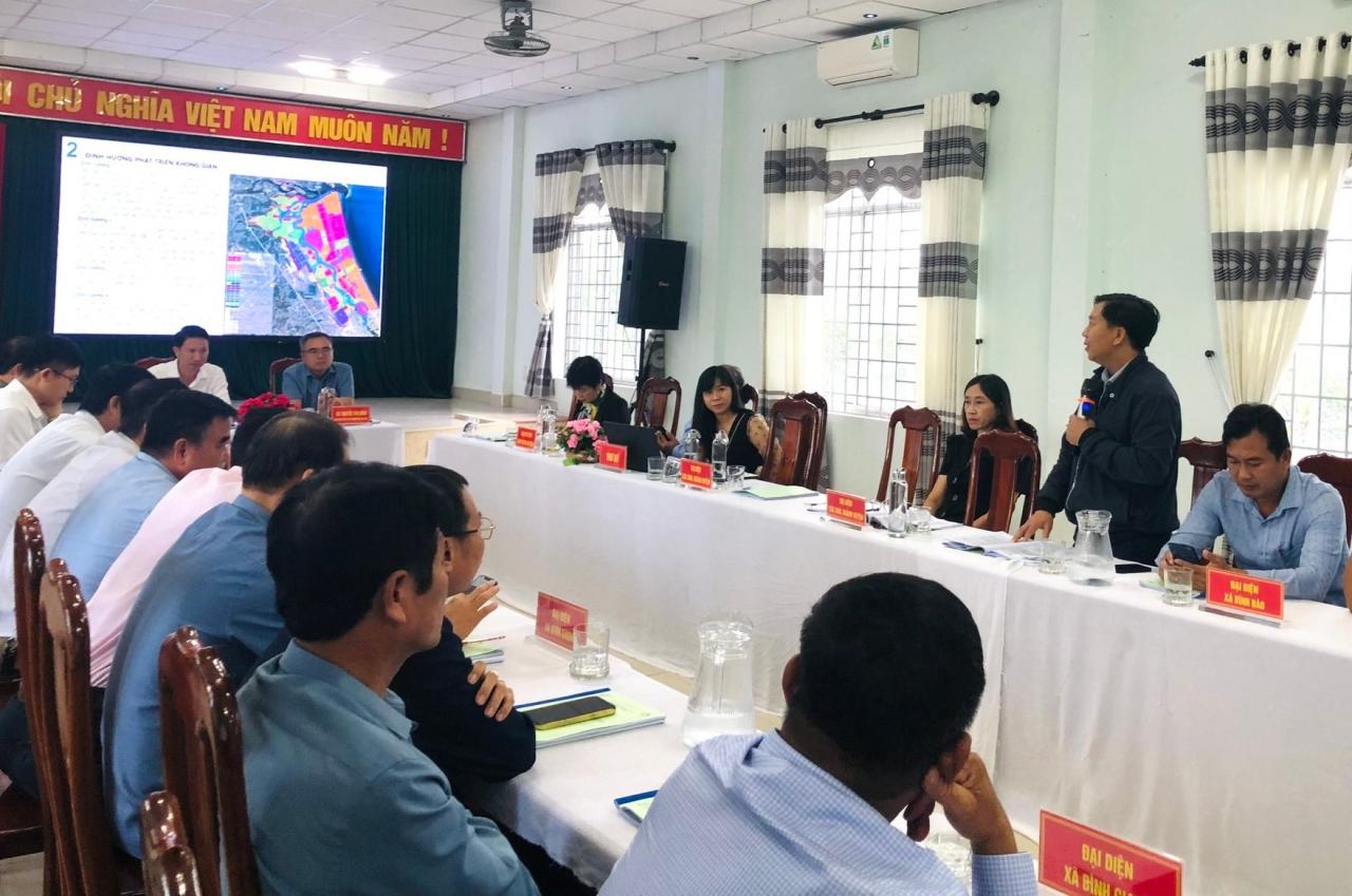
Mr. Hung suggested that it is necessary to survey, evaluate and bring the communes along the Truong Giang River through Thang Binh into the green core area - the ecological corridor of the Truong Giang River to form a riverside and coastal tourism chain connecting with area No. 1.
In addition, it is necessary to expand existing traffic routes, connecting with key traffic routes such as Vo Chi Cong Street, National Highway 14E to serve the needs of tourism development, industry, and people's travel. Priority should be given to phased investment in projects but infrastructure and essential items must be synchronized so that the project can be implemented soon.
Mr. Bui Anh Tuan - Head of Planning Management Department (Department of Construction) said that according to the project, by 2045 the planned area will become the central urban area of the northeast of Quang Nam province. It will be a new tourist destination in the Central region and a center for innovative technology in the region, leading in the application of high technology in agricultural production. The entire corridor area of Truong Giang and Thu Bon rivers will become an urban green space, a chain of ecological parks.
"We will expand and develop more traffic routes and drainage ditches in the East to facilitate trade and treat wastewater and rainwater, avoiding flooding," said Mr. Bui Anh Tuan.
Source: https://baoquangnam.vn/quy-hoach-chung-xay-dung-khu-vuc-ven-bien-huyen-duy-xuyen-va-huyen-thang-binh-can-ket-noi-ha-tang-dong-bo-3145306.html


![[Photo] National Assembly Chairman Tran Thanh Man visits Vietnamese Heroic Mother Ta Thi Tran](https://vphoto.vietnam.vn/thumb/1200x675/vietnam/resource/IMAGE/2025/7/20/765c0bd057dd44ad83ab89fe0255b783)


Comment (0)