
Mobilizing nearly 160,000 billion VND to build Thanh Hoa urban area
On January 8, 2024, Thanh Hoa Provincial People's Committee issued Decision 106/QD-UBND approving the Thanh Hoa Urban Development Program (including Thanh Hoa city and Dong Son district), Thanh Hoa province to 2040.
Viewpoints, Thanh Hoa urban development program must be consistent with the approved provincial planning and general urban planning. In particular, mobilize and effectively promote resources to invest in the construction and development of Thanh Hoa urban area in a modern, civilized, sustainable direction... ensuring compliance with Resolution No. 06-NQ/TW dated January 24, 2022 of the Politburo on planning, construction, management and sustainable development of Vietnamese urban areas to 2030, with a vision to 2045.
The goal is that by 2040, Thanh Hoa urban area will meet the standards of a type I urban area, with appropriate standards such as: urban area, economic structure, population density, urban landscape, application of science and technology...
In particular, the roadmap for implementing the targets is determined for each annual and 5-year period, in accordance with the general urban planning and socio-economic development plan approved by competent authorities.
Thanh Hoa urban development program is built on the basis of the entire administrative boundaries of Thanh Hoa city and the entire area of Dong Son district. Accordingly, before 2025, Dong Son district will be merged into Thanh Hoa city.
By 2025, Thanh Hoa urban area will consist of 37 wards, suburban area will consist of 11 communes. By 2030 and 2040, continue to expand the inner city area, review and evaluate areas that meet the legal conditions to establish wards in the city.
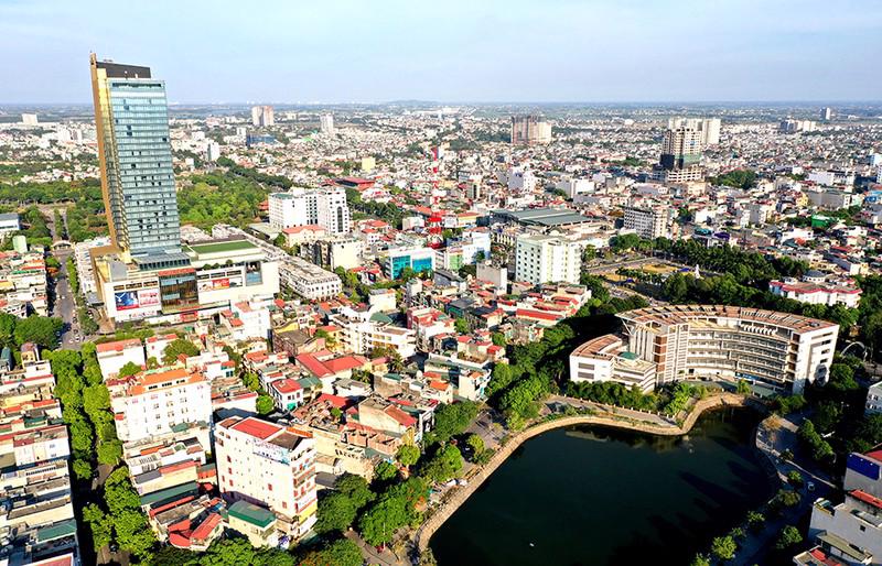
Thanh Hoa urban area was formed on the basis of administrative boundaries of Thanh Hoa city and Dong Son district after merger.
Regarding infrastructure, focus on investing in developing priority key projects, along with urban landscape architecture that meets urban classification standards and criteria, including: the 2.5th Western Ring Road, Dong Son District, 21km long; the traffic road from Dong Ninh Commune, Dong Son District to Thieu Trung Commune, Thieu Hoa District, about 4.1km long; the road from Dong Nam Commune to the Western Ring Road in Dong Quang Commune, about 4.1km long; the South Song Ma Avenue, Phase 2, about 15.5km long; the North Song Ma Avenue from National Highway 1A to the coastal road, 14km long; build about 105.67km of new main roads in the entire urban area according to the approved urban master plan... At the same time, build the Xu Thanh Cultural Park with an area of 31.5ha; build the Southeast park of the city with an area of 70ha.
The program also sets out detailed planning goals for a number of urban areas, urban functional areas, and new urban areas in the direction of green urban areas, applying high and smart technology. Prioritize mobilizing, attracting, and calling on investors to effectively implement step-by-step planning of urban area projects, urban functional areas following the green model, applying high and smart technology, and implementing design and construction of works according to green building criteria.
In addition, sustainable development with appropriate spatial organization of economic and social activities; basically forming an infrastructure system to ensure convenient connection with regions and territories in the country and internationally; comprehensive socio-economic development; material and spiritual life of the people is improved, ecological environment is sustainable; national defense and security are ensured. Making Thanh Hoa urban area a livable city.
Regarding economic structure, carry out the shift towards modern industrial and service economic structure, closely linking industry and agriculture on the basis of agricultural and rural industrialization along with the strong development of the service sector with service sectors creating many added values, especially the trade and tourism service sector. Expand and develop high-tech types, causing little environmental pollution, creating great value. Complete the Logistics Center, warehouse, wharf (Logistic), urban social housing serving workers.
The total investment capital required to implement the Thanh Hoa Urban Development Program is estimated at VND 158,831.57 billion. Of which, from now to 2025, it is VND 40,892.57 billion; from 2026 to 2030, it is VND 51,636.5 billion; from 2031 to 2040, it is VND 66,302.5 billion.
Investment in development to form 12 urban areas with their own functions and strengths
Notably, the Decision approving the Thanh Hoa Urban Development Program has set out specific development programs and plans, including determining the formation and development of specific urban areas, in accordance with the approved general plan.
Specifically, area 1, with an area of 1,035 hectares, includes the wards: Dong Tho, Dien Bien, Truong Thi, Lam Son, Ba Dinh, Ngoc Trao, Tan Son, and part of Dong Ve ward (north of Nha Le river). With the function of being the core of the existing city center associated with the current administrative, political, economic and cultural center of the province.
Area 2, with an area of 1,275 hectares, includes the wards: Nam Ngan, Dong Huong, Dong Hai. With the function of being a new urban area to the east of the existing central core, connected to the administrative, political, cultural, sports and commercial service center of the city. Forming an attractive area including commercial centers, entertainment areas and high-quality new urban areas along Le Loi Avenue, Nguyen Hoang Avenue, Nam Song Ma associated with the landscape along the Ma River.
Area 3, with an area of 1,427 hectares, includes the wards: Dong Son, Quang Thinh, part of Dong Ve ward (south of Nha Le river), part of Quang Thanh ward (west of Hung Vuong avenue). With the function of being a developing urban area southeast of the existing central core associated with the existing medical and educational center of the province.
In Thanh Hoa urban area, 12 urban areas will be developed with their own functions and strengths. (Photo: Hoi An Park in Thanh Hoa City).
Forming a new central space in the South combining renovation and embellishment of existing residential areas and mixed spaces with the core being existing universities and hospitals; service works on both sides of Vo Nguyen Giap Avenue, Quang Trung, CSEPD Street, Hung Vuong Avenue.
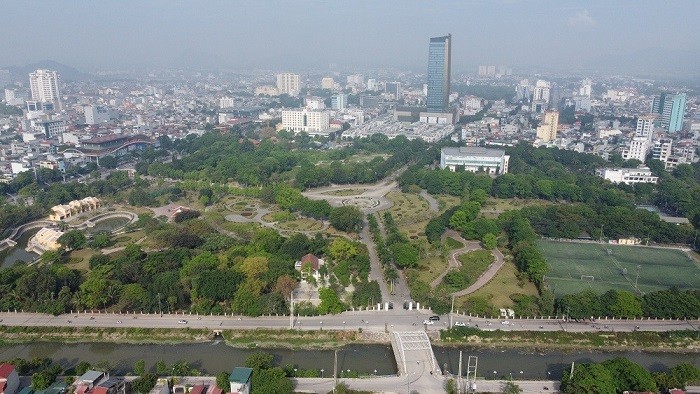
Located in the center of Thanh Hoa city, Lam Son square - where economic, political and social events, exhibitions and major fairs of Thanh Hoa province often take place. In addition, this is also a place of entertainment for locals and tourists.
Area 4, with an area of 1,633 hectares, includes the wards: An Hung, Quang Thang, Dong Tan, Phu Son. With the function of a residential area and a landscape area southwest of the existing central core. The organization of the ecological residential space in the middle of the landscape area is created by the Mat Son mountain cluster, Nhoi Mountain, Vuc Mountain and Nha Le River.
Restore the environment of the quarry area after exploitation into green areas, services, entertainment and tourism associated with the Nui Nhoi Scenic Relic Area and the Nha Le River system and Bac Canal.
Area 5, with an area of 1,959 hectares, includes the wards of Ham Rong, Dong Cuong, Dong Linh. Function: An area to preserve and promote the value of historical and cultural relics, natural landscapes, develop low-density urban areas associated with eco-tourism, community tourism, entertainment and sports services. Organize a tourism space with the core being the Ham Rong scenic relic area and a support area including a research center, archaeological introduction and exhibition, hotel and restaurant area in Dong Cuong ward.
Area 6, with an area of 1,473 hectares, includes the wards of Thieu Duong, Thieu Khanh, and Thieu Van commune. With the function of an ecological urban area along the Ma River, located between Do Mountain and Ham Rong Mountain. Arrange ecological housing areas combined with villages along the dike in the Thieu Duong, Thieu Khanh areas and along the Van Khanh drainage canal. Preserve, restore and promote the value of the archaeological site of Do Mountain, the Duong Dinh Nghe Temple, Vom Pagoda and cultural and religious works in the area.
Maintain the Ma Riverbank landscape and agricultural landscape of the area and form Ma Riverbank parks with themes of botanical gardens, archaeology and historical and cultural celebrities.
Area 7, with an area of 2,237 hectares, includes the wards of Tao Xuyen, Long Anh and the communes of Hoang Quang and Hoang Dai. Function: Is a new, green, smart, modern urban development area associated with urban-level commercial services and is a new, modern, synchronous urban area in the direction of a smart city at the Northeast gateway. Organizing the landscape axis of the North Ma River, creating an ecological urban image associated with the natural landscape along the banks of the Ma River with a highlight at the gateway area to the North of Nguyet Vien Bridge.
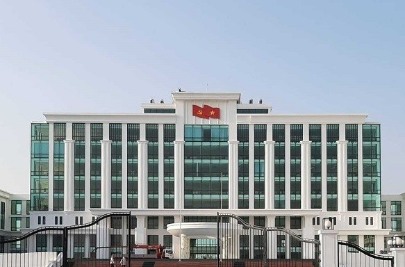
Thanh Hoa City People's Committee Headquarters.
Area 8, with an area of 3,338 hectares, includes the wards of Quang Hung, Quang Phu, Quang Tam, Quang Dong, Quang Cat and part of Quang Thanh ward (east of Hung Vuong Avenue). With the function of a new urban development area to the Southeast connecting with Sam Son city. Developing urban-level commercial service works along National Highway 47, Nam Song Ma Avenue, Hung Vuong Avenue, Vo Nguyen Giap Avenue and the Eastern Ring Road No. 2, National Highway 10; Le Mon Port Area and Quang Hung general water port; Developing education and training services, technical services...
Area 9, with an area of 1,693 hectares, includes: Dong Son district town and Dong Tien and Dong Thanh communes. With the function of an expanded urban area associated with the current Rung Thong town. Renovating and embellishing existing residential areas and developing new residential areas combined with mixed-use service works in areas on both sides of National Highway 45 and National Highway 47. Protecting ecological landscapes, preserving and exploiting the Rung Thong scenic relic.
Area 10, with an area of 2,419 hectares, includes the communes of Dong Khe, Dong Minh, Dong Ninh, Dong Hoang, Dong Hoa. Its function is to develop an ecological urban area associated with key transportation services and warehouses around the Dong Xuan intersection; develop an ecological area and agricultural tourism experience in the west of Dong Son district.
Area 11, with an area of 2,214 hectares, includes the communes: Dong Thinh, Dong Yen, Dong Van, Dong Phu. With the function of being an urban, industrial and service development area in the West of Thanh Hoa city. Arranging the urban service, commercial, residential and industrial areas in the West associated with the development axis from the city to Tho Xuan Airport.
Area 12, with an area of 2,118 hectares, includes the communes of Dong Nam, Dong Quang, Dong Vinh. With the function of an ecological urban area, resort tourism and high-quality agricultural production. Organize ecological urban areas combining organic farms and high-tech agriculture; resort tourism urban areas associated with the Hoang Nghieu historical relic site; arrange reserve land funds to build a high-quality medical service urban area. Organize environmental protection and exploit the landscape along the Mo River, Nha Le River, Truong Tue Canal and large irrigation and drainage canals in the area; arrange reservoirs and water retention areas to avoid flooding during the urbanization process.
Source


![[Infographic] Vietnam-Senegal traditional friendship](https://vphoto.vietnam.vn/thumb/1200x675/vietnam/resource/IMAGE/2025/7/23/4c96a604979345adb452af1d439d457b)


Comment (0)