
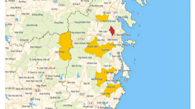
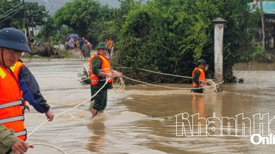
Statistics show that 7 points/traffic routes were flooded and cut off (including 1 national highway, 2 provincial roads, and 4 points in Ba Long and Dakrong communes). In addition, there were 12 landslide points (1 national highway, 1 provincial road, 8 points in La Lay, Huong Hiep and Dakrong communes). Students had to stay home from school at 2 schools in Vinh Dinh commune. 26 households in Ba Long commune lost power.
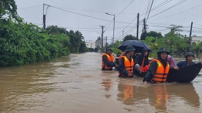
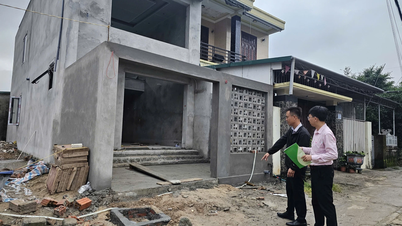
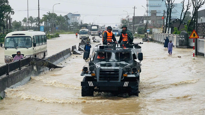
To proactively respond to floods, 11 households/45 people in Khe Sanh commune were evacuated to a safe place due to landslides causing part of the house to collapse, threatening to cause the collapse of neighboring houses (10 households).
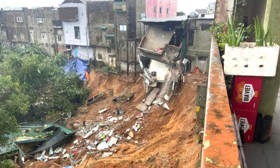 |
| Landslides collapsed houses in Khe Sanh commune, threatening many other houses in the area. |
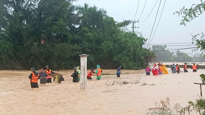
Floods left one person missing in La Lay commune; 69.3 hectares of crops and 10 hectares of perennial trees were damaged; and 847 livestock and poultry were swept away.
In Khe Sanh commune, heavy rain and floods caused landslides at the foot of the bridge in Ruong village, block 6; landslides at the edge of the bridge in Block 6. La Lay commune had a landslide at Km9+400 of National Highway 15D, with a volume of about 15m 3 . At Duc bridge, Ba Long commune, grass and rubbish filled the road 10-20cm deep; the inner Ta Lang bridge was filled with mud about 10cm deep, about 50m long. Many bridge points and Da Noi ferry terminals were filled with 15-20cm of mud in each section, estimated at about 2,500m 3 . In Dakrong commune, the Sa Tram-Pa Lin border patrol route from Km15 to Km19 had 6 landslides, estimated at about 2,000m 3 of soil; the Ho Chi Minh road had a landslide at 2 points (Km3 landslide with a volume of about 100m 3 , at Km25 landslide about 150m 3 ).
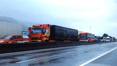
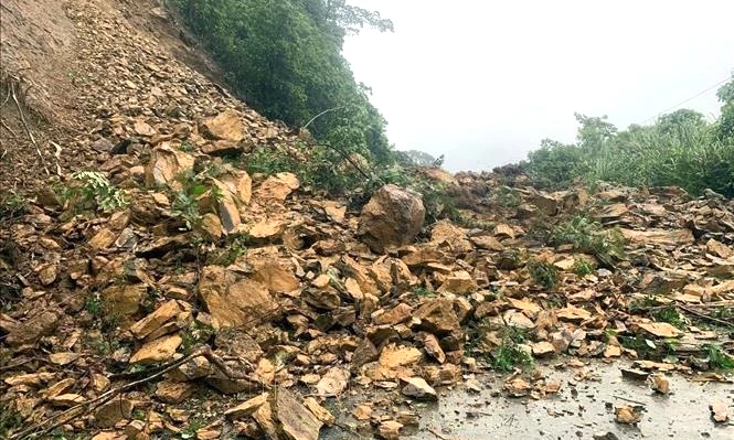 |
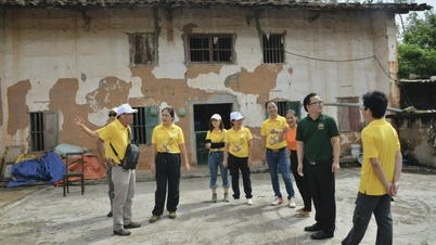
| A traffic route was eroded by flood. |
In addition, in Ba Long commune, 2 motorboats sank and 4 cars were flooded. In Chan Ro hamlet, Dakrong commune, the 110kV electric pole had its foundation eroded; 5 desktop computers, 5 printers, 2 scanners, 1 vaccine refrigerator, 1 generator, 3 fans, 1 TV screen were damaged and many documents were wet and swept away.
Currently, National Highway 49C section Km37+500-Km40+200 through Dong Duong, An Nhon, Xuan Vien villages in My Thuy commune is flooded 0.2-0.3m; Provincial Road 588a at Ba Long spillway Km11+240 is flooded about 0.7m; Provincial Road 582 section Km3+550-Km4+350 in Dien Sanh commune is flooded 0.2-0.3m.
12 landslide points/routes include: National Highway 9B at Km14 in Kim Ngan commune, 1 point; Provincial Road 587 had a negative slope collapse at Km6+300 in Khe Sanh commune, measuring 12x4x7m, with 1m of asphalt remaining. In addition, there were 10 landslide points in La Lay commune, 1 point in Huong Hiep, and 8 points in Dakrong.
Nguyen Hoang
Source: https://baoquangtri.vn/xa-hoi/202511/gan-20-diem-sat-lo-ngap-lut-chia-cat-do-mua-lu-3843e29/
![[Photo] President Luong Cuong receives Speaker of the Korean National Assembly Woo Won Shik](/_next/image?url=https%3A%2F%2Fvphoto.vietnam.vn%2Fthumb%2F1200x675%2Fvietnam%2Fresource%2FIMAGE%2F2025%2F11%2F21%2F1763720046458_ndo_br_1-jpg.webp&w=3840&q=75)
![[Photo] National Assembly Chairman Tran Thanh Man holds talks with President of the Senate of the Czech Republic Milos Vystrcil](/_next/image?url=https%3A%2F%2Fvphoto.vietnam.vn%2Fthumb%2F1200x675%2Fvietnam%2Fresource%2FIMAGE%2F2025%2F11%2F21%2F1763715853195_ndo_br_bnd-6440-jpg.webp&w=3840&q=75)
![[Photo] Visit Hung Yen to admire the "wooden masterpiece" pagoda in the heart of the Northern Delta](/_next/image?url=https%3A%2F%2Fvphoto.vietnam.vn%2Fthumb%2F1200x675%2Fvietnam%2Fresource%2FIMAGE%2F2025%2F11%2F21%2F1763716446000_a1-bnd-8471-1769-jpg.webp&w=3840&q=75)

![[Photo] General Secretary To Lam receives President of the Senate of the Czech Republic Milos Vystrcil](/_next/image?url=https%3A%2F%2Fvphoto.vietnam.vn%2Fthumb%2F1200x675%2Fvietnam%2Fresource%2FIMAGE%2F2025%2F11%2F21%2F1763723946294_ndo_br_1-8401-jpg.webp&w=3840&q=75)


Comment (0)