
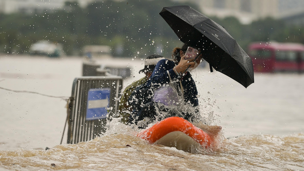
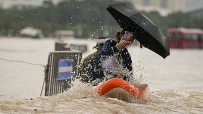
The specific points are as follows: Thien Duc route, section under the railway bridge, is flooded 30cm deep; Thang Long Avenue (TL) section Km8+200 is flooded 20cm deep; TL section under tunnel No. 9 is flooded 10cm deep; TL section under tunnel No. 5 is flooded 10cm deep; TL section under tunnel No. 6; TL section Km9+400, frontage road must be flooded 10cm deep.
Routes: National Highway 32: Km14+500; National Highway 32: Km17+700 flooded 15cm deep; Road 423: Trung Vo Bridge: Km3+164; Road 421B: Km11+300: Dong Yen Bridge; Road 423: Bridge 72 II Km8+400 flooded 50cm deep; Branch 2 of Hanoi - Hai Phong Expressway; Tay Mo Road flooded 50cm deep; DLTL (section Km5+700 on both sides of the service road); Pham Hung Road (section adjacent to Mai Dich overpass).
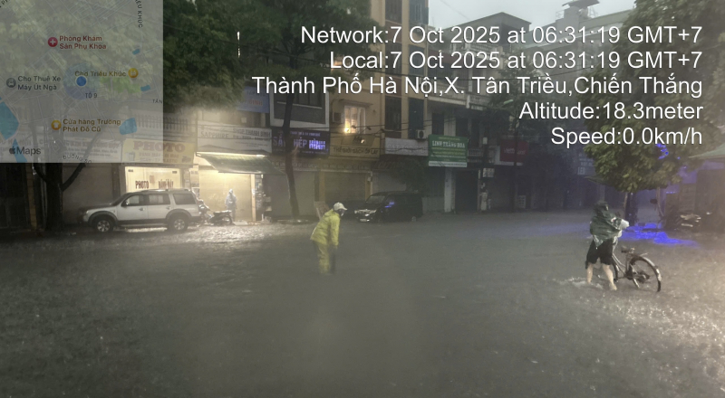
Ngoc Lam and Nguyen Dinh Chieu streets were flooded 20-30 cm deep; Tran Binh street (section from Hospital 19-8); Trieu Khuc street (section from alley 66 to Trieu Khuc communal house) was flooded about 25 cm deep; Ho Me Tri street (section 100m from Luong The Vinh); Luong The Vinh street (section house number 499); Tay Mo street (section from Tay Mo Ward People's Committee - alley 127) was flooded about 25 cm deep.
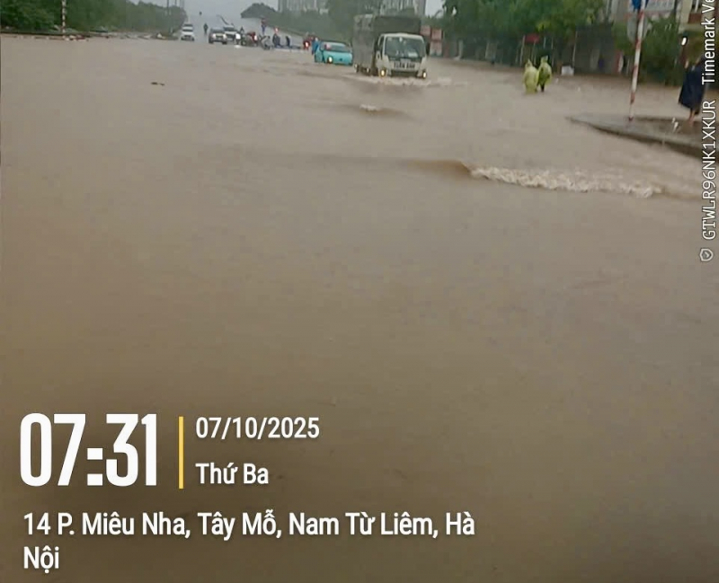
Streets with average flooding depth of 20-30 cm include: Mieu Nha Street (from the railway - high-tech entrance); Do Nha Street (greeting gate); Mieu Nha Street (on both sides of Nga Bridge); Xuan Phuong Street (alley 339); Nguyen Xuan Khoat Street; Trinh Van Bo Street extension; Tay Tuu Street (intersection with Dam Street); Pham Hung Street (intersection with Duong Dinh Nghe); Cau Dien Street (intersection with Trinh Van Bo); Thanh Lam Street; Ngoa Long Street (intersection with Cau Dien); Phuong Canh Street (intersection with Hoe Thi); Van Tien Dung Street (intersection with Cau Dien); Ho Tung Mau Street (intersection with Mai Dich intersection); Doan Ke Thien Street (intersection with Than Vy); Ke Gian Street (intersection with Pham Van Dong); Phan Tay Nhac Street (intersection fromFPT school); Le Duc Tho Street (intersection with My Dinh Stadium); Chau Van Liem Street (section at Thang Long Highway intersection); Nhat Tao Street (section at alley 1-39); Tran Vy Street (section at Doan Ke Thien intersection); Tran Huu Duc Street (section at Do Xuan Hop intersection); Nguyen Hoang Street (section at Pham Hung intersection); National Highway 2 (Km3+300-Km3+550); Road 23b (Km0+750-Km1+00); Cau Buu Street (section at Xa La-Vien K intersection); Pham Tu Street (section at Vien K); Cau Coc Street (section at alley 43-67).
Nguyen Huy Tuong Street (Khuat Duy Tien intersection); Dai Mo Street (alley 24); Ngoc Truc Street (alley 31-Dai Mo intersection); Lac Long Quan Street (house number 130-Vong Thi intersection); Nguyen Trai Street (University of Social Sciences and Humanities); Thuy Khue Street (La Pho slope to Chu Van An High School); Khuat Duy Tien Street (from To Huu-Nguyen Trai intersection); Nguyen Xien Street; To Huu Street (alley 19-Luong The Vinh); Co Nhue Street (SN145-205 section); National Highway 3 (Km19+500 section); Phung Hung Street (house number 20-193 section).
Tay Thang Long Street (Phuc Ly market section); Nguyen Tuan Street (Le Van Luong-Nguy Nhu Kon Tum intersection); Trung Kien Street (Dinh Dam section); Xuan La Street (Vo Chi Cong-Xuan Dinh section); Phan Van Truong Street (house number 103-lane 54 section); under Thang Long bridge to Vuc De; Me Tri Street (Pham Hung intersection).
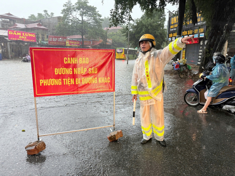
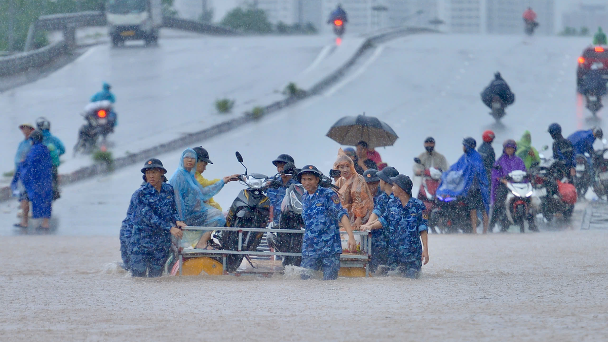
The Hanoi Department of Construction has informed the VOV traffic channel about the depth of flooding and traffic congestion (if any) to warn road users; at the same time, it has placed warning signs on flooded roads, clearly stating the maximum depth on the road surface at both ends of the flooded location. For areas where vehicles cannot move in deep flooding, the road management contractor will arrange for people to guide and regulate traffic.
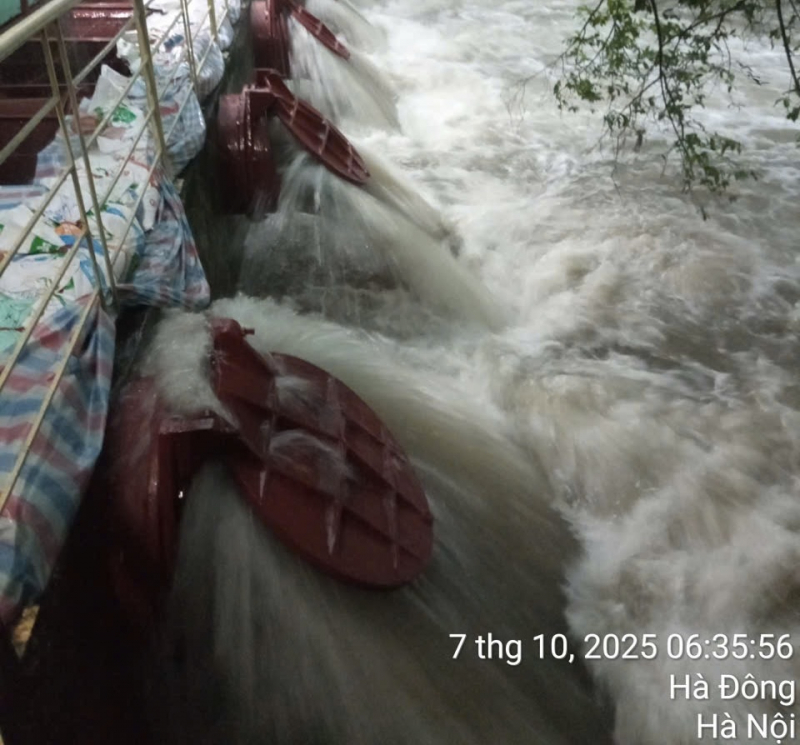
In addition, to ensure drainage for the area, Hanoi Drainage One Member Co., Ltd. is continuing to operate the pumping stations Yen So (14/20), Dong Bong 2, Co Nhue, Dong Tru, Da Sy, Ha Tri, Mau Luong, DPS, Cau Chui, Dong Tru... to lower the water level on the system according to regulations. Deploying on-call work, solving drainage, and collecting garbage at the intake in the entire management area. At the same time, coordinating and contacting the Department of Agriculture and Environment to operate the pumping stations Yen Nghia, Khe Tang, Dao Nguyen to lower the water level of Nhue River to support urban drainage.
Mr. Nguyen Duc Hung, Director of the Hanoi Technical Infrastructure Management Center (Hanoi Department of Construction) said that the center has requested the forces and means of drainage maintenance units to continue to organize according to the on-call plan, focus on cleaning, checking and clearing to ensure clear flow, operate sluice gates and pumping stations to lower the water level on the entire system to respond to rain developments, and regularly update reports in a timely manner according to weather developments.
Source: https://cand.com.vn/Xa-hoi/ha-noi-van-hanh-nhieu-tram-bom-tieu-thoat-nuoc-122-diem-ung-ngap-i783803/


![[Photo] Super harvest moon shines brightly on Mid-Autumn Festival night around the world](https://vphoto.vietnam.vn/thumb/1200x675/vietnam/resource/IMAGE/2025/10/07/1759816565798_1759814567021-jpg.webp)


Comment (0)