
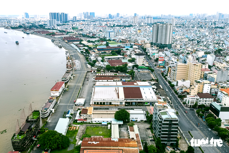
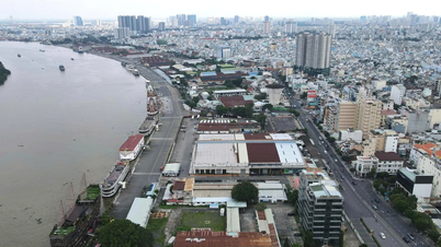
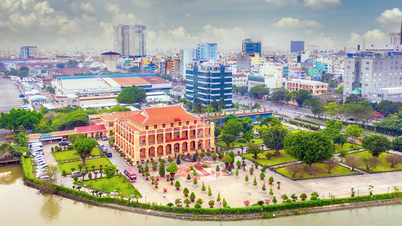
Ben Nha Rong land area seen from above, on the left is Saigon River, on the right is Nguyen Tat Thanh Street
When I heard the news that the new Secretary of the Ho Chi Minh City Party Committee, Tran Luu Quang, announced the decision of the City Party Committee to stop the policy of allocating land to investors for the Nha Rong - Khanh Hoi complex project with an area of 32 hectares and a length of 1.8 km in the Nha Rong - Khanh Hoi wharf area, I was extremely surprised and could not believe my ears until the press officially reported the news.
Having been a member of the City Planning and Architecture Council for more than 20 years, I understand that giving up a large project that brings great economic benefits and of course has to endure pressure from many parties is a very difficult decision.
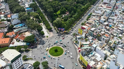
The strip of land about 10km long from the foot of Saigon bridge running along the riverbank to Nha Rong port is considered the most beautiful and sacred strip of land because it not only has land, water, and two banks, but is also the first piece of land where our ancestors gathered to establish Saigon.
When the French built Saigon, they were very conscious of developing this strip of land into the "front" of the city.
It is not only a place to exploit maritime economy but also a place where the quintessence of architecture and landscape converges, and more than that, it is a harmony between people and nature.
Because of the recognition of the importance of the Saigon River in regulating the climate, during the nearly 100 years of the French colonial period and the later period, planners and designers have cherished the Saigon River and considered the river as a giant machine regulating the climate of the entire city.
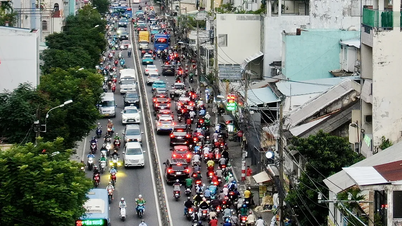
All the French-era buildings in Bach Dang (District 1) and Khanh Hoi (District 4), which expanded to Binh Thanh District after 1954, were built according to the principle of low on the outside and high on the inside; the offices and hotels were only two stories high and not in a continuous row to welcome the wind and light from the river, especially the warm, salty air of the sea.
All the roads that were built run directly to the river wharf (Bach Dang port, Khanh Hoi) to catch the wind and these roads act as pipes to carry cool wind deep into the heart of the city, such as Nguyen Binh Khiem, Ton Duc Thang, Hai Ba Trung, Dong Khoi, Nguyen Hue, Ham Nghi, Doan Nhu Hai, Hoang Dieu... People standing on Nguyen Van Troi bridge can still feel the wind blowing from the river.
Another point considered a plus for the Saigon River bank is its heritage and cultural values. Although there are many historical and architectural heritages on both sides of the Saigon River, they are unevenly distributed and somewhat scattered.
Most concentrated are the river banks in District 1, part of District 4 and Binh Thanh (old).
Including Nha Rong port, water tower, Thu Ngu flagpole, customs office, Riverside and Majetic hotels, Ton Duc Thang Museum, Me Linh park with Tran Hung Dao statue, Ba Son dock, riverside park, Saigon bridge. All of these works are about 100 years old.
We are possessing a river space, the Saigon river bank is extremely precious not only in terms of landscape beauty but also in terms of spiritual value, full of heritage, architectural works and spirituality. Partly given by Mother Nature, partly by many generations working together to build.
Any wrongdoing with this Saigon River will cost us dearly and will be a mistake to our future generations.
A huge complex like a windbreak, blocking the view to and from the river rises, it also breaks the seamless unity of the riverbank at the western end.
If a similar complex were to be built at the end of the 10km stretch, the value of this stretch of river would be greatly reduced; the interior would become stuffy, stuffy and irritating to the eyes. Fortunately, that will not happen now.
Soon the city will have more than 3 hectares of green park, stretching nearly 2km right next to Nha Rong port.
This location, along with Bach Dang Wharf Park, will become an ideal meeting place for city residents on weekends and during festivals throughout the year. The Saigon River bank will have a new look, greener, fresher, more communal and more friendly.
Along with that, the leaders of Ho Chi Minh City decided to convert the function of the 37,000m2 prime land at No. 1 Ly Thai To into a public park with three frontages: Ly Thai To - Hung Vuong - Tran Binh Trong.
In the context of the city lacking green parks and relaxation spaces, these decisions are truly meaningful. City residents expect to see more green parks and recreation spaces from projects that have been "suspended" for too long.
The difficult decision that the Ho Chi Minh City Party Committee made regarding the above two plots of land is, in my opinion, courageous, in accordance with heaven and earth, and in accordance with the people's wishes.
Source: https://tuoitre.vn/khu-dat-nha-rong-va-so-1-ly-thai-to-lam-cong-vien-mot-quyet-dinh-hop-long-dan-20251021085852614.htm


Comment (0)