

Vinh Te Canal
The name of history
The flow of nearly 200 years of An Giang province's establishment began with the event: In October of the 13th year of Minh Mang (November 1832 in the solar calendar), King Minh Mang completed the largest administrative reform of the Nguyen Dynasty, dividing the five towns into six provinces. Vinh Thanh town alone was divided into two provinces (Vinh Long, An Giang), with a total of six provinces. Considering that Vinh Long had a large land area and richer people than any other district, the king ordered the separation of Vinh An and Vinh Dinh districts of this province, merging them with Chau Doc land, and establishing a new province, An Giang. "On the eastern bank of Hau Giang River, Dong Xuyen district was established, the newly established hamlets were established as 1 canton, and 2 cantons of Dinh Vinh district were taken as dependents. On the western bank of Hau Giang River, Tay Xuyen district was established, 4 cantons of Vinh An district were taken as dependents. Dong Xuyen and Tay Xuyen districts were established as Tuy Bien prefecture; Vinh An and Vinh Dinh districts were established as Tan Thanh prefecture".
Thus, according to historical documents, at this time, the naming of districts was based on the direction, creating an “administrative map”, the geographical location of each locality in that name. This is also very suitable according to the naming customs and practices of the people of the South: The clearer and easier to orient, the better. The place names “Bac Vam Nao”, “Nam Vam Nao”… were also born from this cultural factor.
In nearly 200 years of having a name, An Giang province has gone through many times of establishment, dissolution, merger, separation, and administrative boundary adjustment. During the resistance war against French colonialism and American imperialism, depending on each stage and period, we divided administrative boundaries, either according to the enemy's government, or according to the specific characteristics and conditions of each locality, suitable for combat conditions. Also during these two centuries, many names have become history, closely associated with the residents.
History records that after 1757, the wave of legal immigration to the new land took place more strongly. However, the Chau Doc and Tan Chau areas were still very sparsely populated, so King Gia Long called them Chau Doc Tan Cuong. After completing the digging of Thoai Ha and Vinh Te canals, Nguyen Van Thoai recruited people and established Thoai Son village on the bank of Thoai Ha canal, next to Nui Sap in 1822; established 5 villages along the banks of Vinh Te canal (Vinh Nguon, Vinh Te, Vinh Lac, Vinh Gia, Vinh Dieu), forming Tinh Bien prefecture in the mid-19th century. Thoai Ngoc Hau recruited migrants to reclaim land and establish settlements on both banks of Vinh Te canal, by 1827 there were 20 communes and villages such as: Vinh Te, Vinh Nguon, An Nong, Vinh Thong, Vinh Lac (Lac Quoi), Vinh Bao (Vinh Gia), Vinh Dieu... These place names have never been lost, and are always mentioned in the history of protecting and building the homeland; in the life and circulation of residents; in the management of administrative units of the State at all levels.
According to scientists, the division, establishment, and naming of administrative units are completely objective, scientific, suitable for practice, and meet the requirements of State administrative management of a country. The 193-year administrative history of An Giang began with the administrative reform of Minh Mang in 1832, when 12 provinces were established from the citadels in the South. France had experience in State administrative management, establishing administrative units in the South, in An Giang, serving the governance, and at the same time was also a scientific content in State administrative management. The revolutionary government established regions and provinces in accordance with the conditions of resistance against foreign invaders, with the optimal use of the area and terrain to fight the resistance in the most beneficial way. The country was unified, the Central Government successively had policies and decisions to arrange administrative units in accordance with the socio-economic development, population, and urbanization in general, including An Giang province in particular.
Demands of the times
Once again, the process of national development requires the arrangement and merger of administrative units at all levels. Only then can we create more powerful potential for each locality and region, creating a solid foundation to enter the era of development after 50 years of peace. This policy also hopes to create a breakthrough in development, promote resources, and create a new development space for localities and the whole country, in accordance with the Party's policies and resolutions.
Along with the merger process, there are calculations on the names of new administrative units. According to the project of An Giang province, almost all the names of the current district level will continue to be used, extending the tradition of place names for the future. The administrative unit of Long Xuyen city is expected to keep the name of a central ward, Long Xuyen ward. Similarly, Chau Doc ward, Tinh Bien ward, An Phu commune, Thoai Son commune... These names both retain the familiarity of the old administrative unit and help limit disruption in terms of direction and geographical location of the new administrative unit. People will easily identify which areas the new "Long Xuyen", "Chau Doc", "Tan Chau"... are located in.
In addition, the tradition of naming according to direction from the time of the Nguyen Dynasty kings when establishing An Giang province has also been noted and studied by today's generation. In addition to the name of the district-level locality (old) located in the center, adding the directions "East", "West", "Central", "North", "South" for neighboring communes and wards, also aims to determine the direction, easy to remember, easy to circulate.

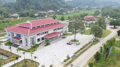
A corner of Cu Lao Gieng
Some place names are preserved, respecting the long-standing cultural and historical traditions here. We can cite the "first island" - Gieng island (Dien, Rieng, Gieng, Ven, Dau Nuoc...), now 3 communes: Tan My, My Hiep, Binh Phuoc Xuan (Cho Moi district). According to research by MSc. Bui Thi Bich Ngoc, Dr. Ho Thi Lien Huong (Faculty of History, University of Social Sciences and Humanities, Vietnam National University, Hanoi), this is one of the islands in Tam Phong Long area that was exploited early from the end of the 18th century. This place still retains traces of the early land reclamation and settlement of families and clans Nguyen, Ung, Che, Tra, Kha... Among them, there is Mr. Ung Van Khiem (former Minister of Foreign Affairs, Minister of the Interior). Because of the special historical factors, the name Cu Lao Gieng was retained and given to the new commune after the arrangement, while emphasizing the vision of developing tourism, ecology, agriculture, etc. in the new period, continuing the achievements that had been achieved before.
Or as the name Vinh Te ward, is expected to be established from Nui Sam ward, Vinh Te commune and the area of Vinh Chau commune. The new ward will be larger than 64km2, with a population of 40,222 people. This name recalls the time when the Nguyen Dynasty dug canals. With its strategic position as a "fence", An Giang land has 3 famous canal projects that are still famous today. They are: Thoai Ha canal (1818), Vinh Te canal (1819 - 1824), Vinh An canal (1843 - 1844). The name also shows gratitude to the person who made the first contribution in digging the canal - the famous mandarin Thoai Ngoc Hau Nguyen Van Thoai.

Consulting the people on the arrangement of new administrative units
The process of naming a new administrative unit is not simple, it requires carefulness, analysis, and consideration from many historical and cultural aspects... However, if viewed in general, naming depends on people - "the land depends on people to have names". No matter what name it has, that land is the homeland, the land of every An Giang citizen. After arranging and starting to build a new locality, "people depend on the land to live", from the vast fertile land to build more outstanding achievements for today and tomorrow!
Source: https://baoangiang.com.vn/-nguoi-nho-dat-de-song-dat-nho-nguoi-co-ten--a419215.html


Comment (0)