

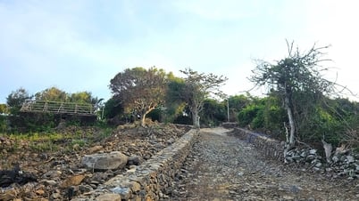
Many roads in Thai Nguyen City are flooded due to prolonged heavy rain.
On June 20 and 21, many localities in the mountainous and midland areas of the North recorded heavy rainfall, in some places exceeding 300mm, causing flooding from 2m to 3m deep in low-lying areas. The risk of flash floods, landslides and floods on small rivers is high.
The National Hydrometeorological Agency continuously issues warnings and recommends that people closely monitor weather developments to proactively prevent accidents.
Mr. Vu Anh Tuan, Deputy Head of Weather Forecast Department, National Center for Hydro-Meteorological Forecasting (Department of Hydro-Meteorology, Ministry of Agriculture and Environment ), said: From 7:00 p.m. on June 20 to the afternoon of June 21, the common rainfall in the mountainous and midland provinces of the North fluctuated between 30mm and 80mm.
Particularly in the provinces of Ha Giang, Tuyen Quang, Thai Nguyen, and Bac Kan , rainfall is generally from 100mm to 200mm. Some places have rainfall exceeding 200mm, especially Dong Hy district (Thai Nguyen) recorded rainfall of up to 376mm.
According to Mr. Tuan, heavy rain continued to expand to the southeast. From 2:00 p.m. to 4:00 p.m. on June 21, heavy rain spread to Lang Son, Bac Giang, Bac Ninh and Hung Yen provinces, causing the affected area to increase rapidly.
Explaining the cause of the prolonged heavy rain, Mr. Vu Anh Tuan said: In recent days, a low pressure trough (also known as a monsoon trough) has been active in the southern part of mainland China, in the latitude range of 24-26 degrees North, causing localized rains in the mountainous areas of the North. By the night of June 20 and the morning of June 21, this low pressure trough was pushed south, combined with wind convergence at an altitude of 3,000 to 5,000m and the impact of a low vortex in the Northwest region, creating conditions for widespread heavy rain.
"In addition, the weak cold air moving down from the north also contributes to enhancing the activity of the low pressure trough, causing a significant increase in rainfall in this area," said Mr. Tuan.
Proactively respond to the risk of flooding in low-lying areas along rivers
Adding to the hydrological situation, Ms. Nguyen Thi Nhu Quynh, Deputy Head of Hydrological Forecasting Department, National Center for Hydro-Meteorological Forecasting, said: Due to the impact of the compressed low pressure trough and high-altitude wind convergence, in the past 24 hours, the mountainous and midland areas of the North have experienced heavy to very heavy rain. Particularly in Thai Nguyen province, many measuring stations have recorded rainfall exceeding 300mm.
Heavy rainfall in a short period of time has significantly increased the risk of flooding in low-lying areas along rivers and urban areas. In Thai Nguyen, many areas have been flooded 2-3m deep, seriously affecting people's lives and production.
Due to heavy rain in the basin, the water levels of rivers are rising rapidly. In the Cau River system, both upstream and downstream have recorded rising water levels. Particularly at Dap Cau (downstream of Cau River), the water level is likely to exceed alert level 1. Other rivers in the Red River and Thai Binh River systems are still below alert level 1, but are showing a tendency to fluctuate strongly.
The National Center for Hydro-Meteorological Forecasting also warned of the risk of flooding on small rivers in the Northern region, with flood amplitudes ranging from 2 to 5 meters. During this period, the flood peak on small rivers is likely to reach alert level 1 to alert level 2. The water level downstream of Thao River and Lo River is still below alert level 1, but needs to be closely monitored.
Faced with the complicated situation of floods and rains, the hydrometeorological agency has continuously issued early warnings. At the same time, it is recommended that people in high-risk areas closely monitor weather forecasts, proactively coordinate with local authorities to deploy prevention, avoidance and timely response plans, and limit damage to people and property.
Thu Cuc
Source: https://baochinhphu.vn/nguy-co-ngap-lut-va-lu-quet-do-mua-lon-keo-dai-102250621201622664.htm


![[Maritime News] Wan Hai Lines invests $150 million to buy 48,000 containers](https://vphoto.vietnam.vn/thumb/402x226/vietnam/resource/IMAGE/2025/6/20/c945a62aff624b4bb5c25e67e9bcc1cb)


![[Infographic] Party Committee of the Ministry of Culture, Sports and Tourism: Marks of the 2020 - 2025 term](https://vphoto.vietnam.vn/thumb/402x226/vietnam/resource/IMAGE/2025/6/22/058c9f95a9a54fcab13153cddc34435e)


Comment (0)