The ship of the Southern Marine Surveying Team of the Center for Marine Surveying and Mapping (SEAMAP) - Vietnam Department of Surveying, Mapping and Geographic Information slowly arrived at Vung Tau port in the late afternoon. I stood on the wharf watching the sunburned faces step down. These people had spent many days drifting on the open sea, sleeping amid the roaring engine, eating amid the rough waves, and working all night to collect every parameter of the seabed topography.
They are not fishermen, nor are they sailors, but "ocean surveyors" - silent warriors drawing maps of the ocean floor, setting the first sovereign coordinates for the Fatherland from the deepest place.
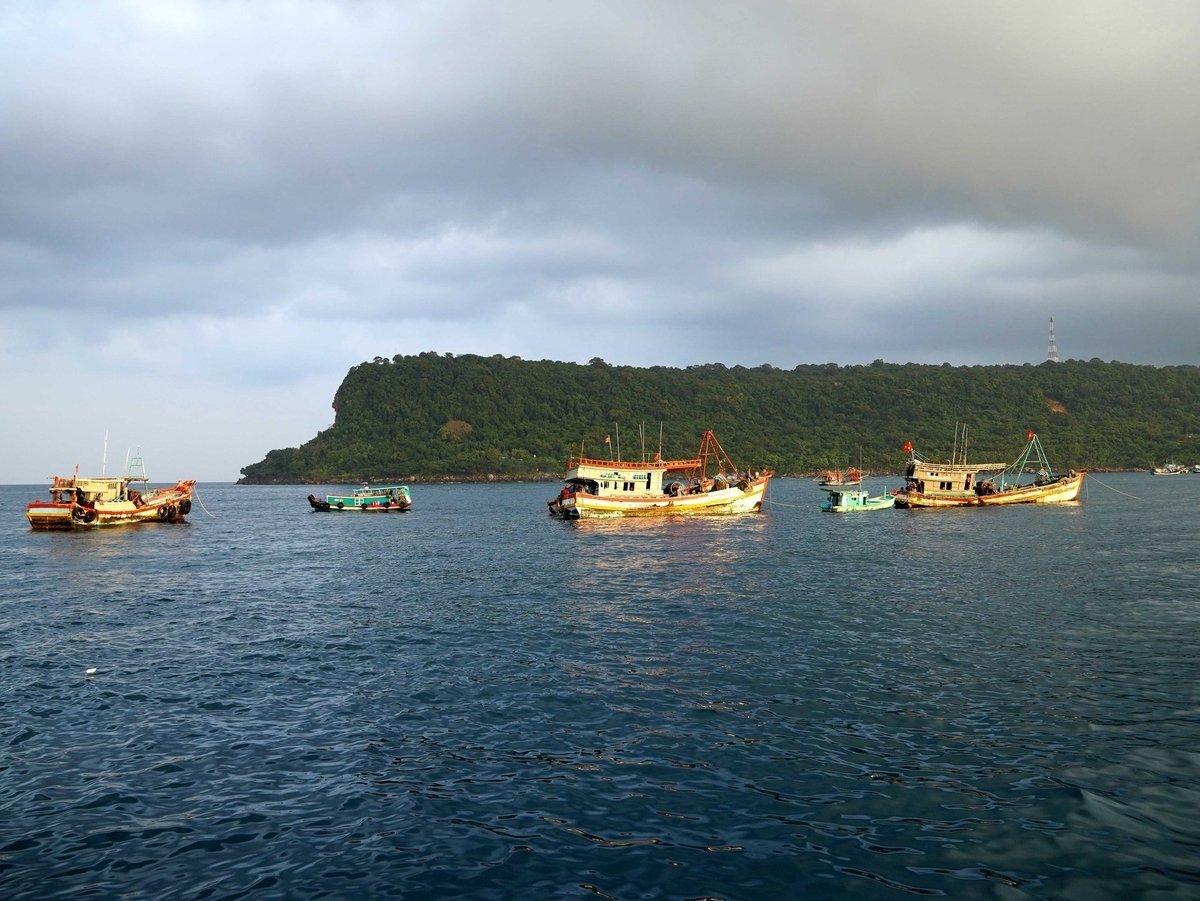
A survey ship measuring the seabed terrain takes engineers out to sea to collect each parameter of the seabed terrain. Photo: Doc Lap.
20-year-old aspirations amid the waves
Meet Minh Nhat, an officer of the Center for Geodesy and Marine Mapping (SEAMAP) in the narrow ship's hold, where the Multibeam depth sounder, Side scan sonar, Differential Global Satellite Navigation System (DGNSS) are still shaking slightly after the big waves. A young man with a small, thin figure, deep and bright eyes as if holding the whole sky and sea in them.
Nhat was born in 2003, his hometown is Quang Binh . Having just graduated from the Faculty of Land Management, Hanoi University of Natural Resources and Environment, the young man in his early twenties chose to drift in the open sea instead of working in an office or at a technology company with a stable salary.
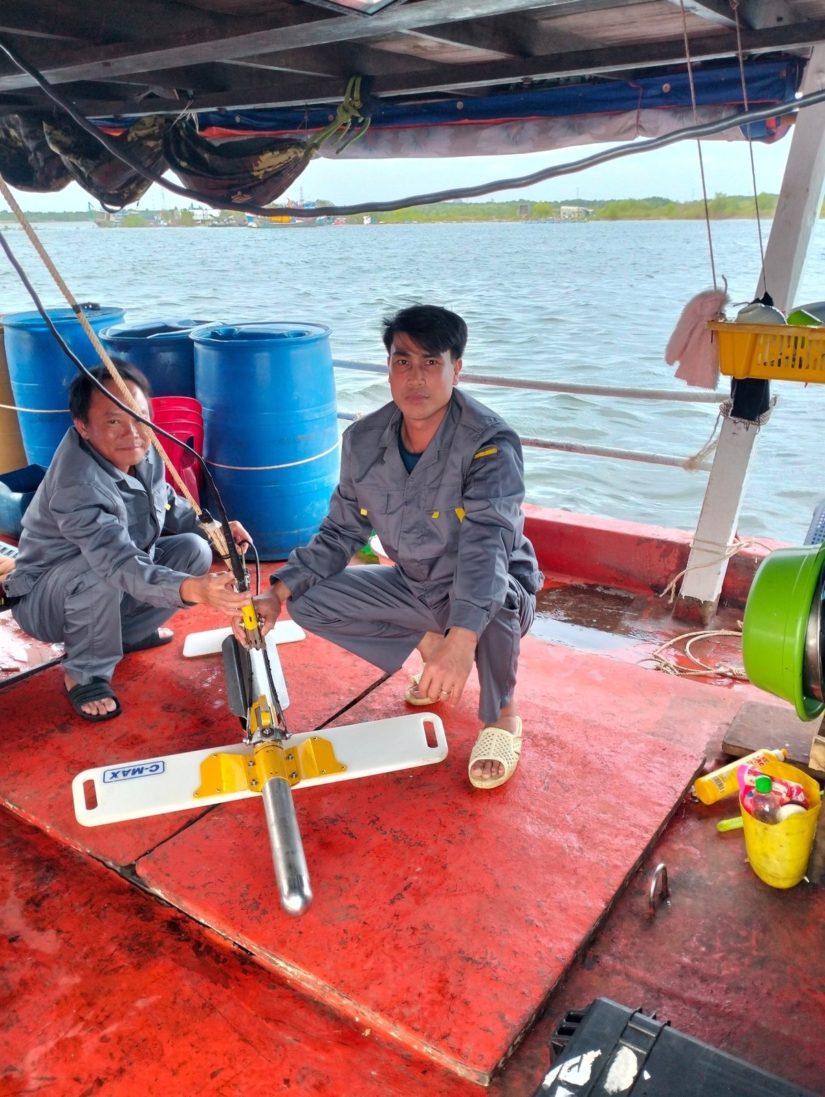
Engineers prepare machines to perform the task of measuring the seabed topography. Photo: Son Cuong.
Amidst the sound of waves and wind, Nhat recounted the sleepless nights spent watching the machine, every second, every minute having to monitor and check signals from satellites, depth gauges, sonar scanners… To have a map of the seabed accurate to every centimeter, the whole crew had to work continuously 12-14 hours a day, in a space of only a few square meters, in a world of endless blue. Nhat said, his voice deep and determined:
In Nhat’s eyes, I saw the image of a young generation of Vietnam stepping out into the ocean, not only with aspirations for their own future, but also with a deep sense of national responsibility. He said: “Every meter of the seabed we measure today will be data to affirm sovereignty over the sea and islands in the future.”
Seafaring courage
If Minh Nhat is the face of the young generation with the aspiration to reach out to the ocean, then Mr. Luong Hoang Linh (born in 1983) is the embodiment of the "steel generation", those who have devoted their youth to the storms of the ocean. I met him when he had just completed the project of measuring sonar scanning the coastal and island slopes of Kien Giang province in 2025 after a long survey trip. With a tanned skin "burned" by the sea breeze, calloused hands, a solid body like a tree trunk in the coastal forest, the young man was once known as a true "sea wolf".
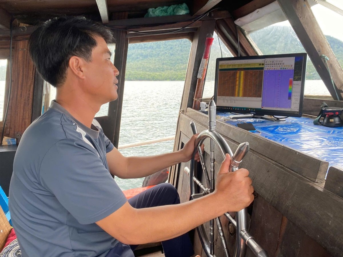
Mr. Luong Hoang Linh, the boat driver once known as a true “sea wolf”. Photo: Son Cuong.
“There were months when I spent more time at sea than at home,” Linh said lightly as if he were telling a daily story, but behind it were many holidays at sea, many birthdays of children that could only be wished over the phone or radio, many times when the child was sick and the father could only look at the sea with a broken heart.
For nearly twenty years in the marine surveying profession, Mr. Linh has participated in dozens of large and small projects, from the Northeast sea, the Central coast, to the Southwest sea. There were journeys that lasted 30 consecutive days. There were nights when the waves were so big that the entire crew had to use ropes tied around their waists and hooked to the railing to ensure safety and not be thrown off the deck. However, the depth measuring equipment still had to run, data still had to be collected, because the sea waits for no one, and every second of interruption could cause the entire survey line to have to start over.
“When I saw the complete map displayed on the system, I felt like I had just placed a sovereignty marker. It was not a land marker, but precise data on the seabed - data that the world had to recognize,” he recounted the moments that few people had.
Every sea has a 'geomorphic shape'
Mr. Nguyen Son Cuong, Deputy Director of SEAMAP Center, is a "real seafarer" who has spent most of his life drifting at sea to carry out the task of measuring the topography of the seabed.
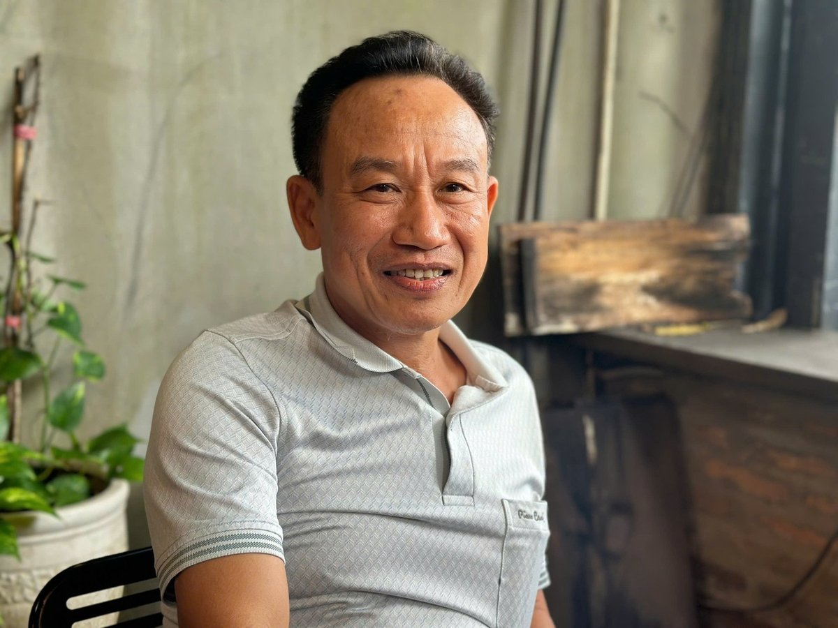
Mr. Nguyen Son Cuong, Deputy Director of SEAMAP Center - who spends most of his life drifting in the middle of the ocean to carry out the task of measuring the topography of the seabed. Photo: Nguyen Thuy.
Mr. Cuong said proudly: “On land, people hold a pen to sign a document of sovereignty. But at sea, we hold measuring devices, record each coordinate and each depth value to confirm sovereignty with scientific data. That is the 'legal passport' of the Fatherland under the deep sea.”
He led me down to the multi-beam sounder room - where hundreds of ultrasonic waves are sent to the seabed every second, reflecting back into vivid terrain images displayed on the screen. Next to it is a DGNSS satellite positioning device that provides coordinates and depths accurate to the centimeter; a system that measures the speed of sound propagation in water; and a 3D data processing model that recreates the seabed terrain like a giant floating painting. Amidst the rumbling of the engine and the flashing lights of the device, Mr. Cuong shared: “Every sea area has a 'geomorphic shape'.
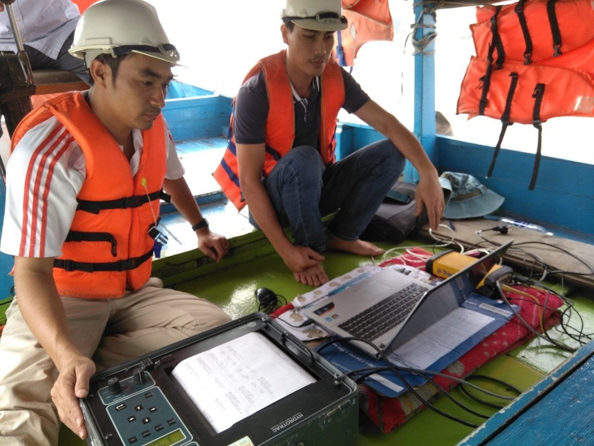
The entire crew had to work continuously 12-14 hours a day, in a space of only a few square meters, in a world of endless green. Photo: Son Cuong.
Mr. Nguyen Trung Thanh, Party Secretary and Deputy Director of SEAMAP Center, added that marine surveyors do not just go to collect data. They are carrying out a national strategic mission. An accurate seabed map can determine Vietnam's advantage in international negotiations, marine economic planning, resource exploitation, and even protecting every inch of sacred offshore water.
But behind that pride are worries that cannot be hidden. Mr. Thanh confided: “The marine survey profession is considered a special field, no less arduous than the oil and gas or maritime industry. We have to live in harsh conditions: noise from ship engines, lack of fresh water, lack of electricity, limited food, no phone signal, not being close to family. But the current treatment policy is not commensurate.”
He compared that, although working long hours at sea, a petroleum engineer receives a particularly high allowance, with his own insurance, social security, and salary policies. Meanwhile, a marine surveyor does not have a corresponding policy.
“We have made many requests, not for our own benefit, but to retain high-quality human resources. Without appropriate remuneration, it will be difficult to attract the younger generation to stay in the profession for a long time. And if we lose the marine surveying and measuring engineers, who will establish sovereignty data for the country in the middle of the ocean?”
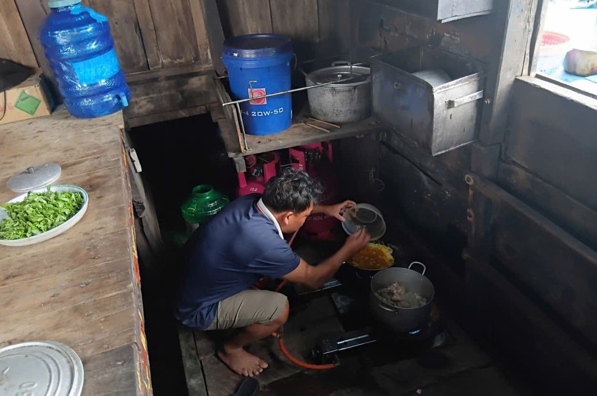
The difficult and deprived living conditions on board the ship of marine surveyors. Photo: Son Cuong.
In the small room amidst the sound of waves lapping at the wharf, I understood that this was not just the concern of a manager, but a call from the ocean, a reminder for the country to cherish the people who are silently protecting the Fatherland from the deepest sea.
Dawn is breaking on the sea. The SEAMAP Center ship begins to leave the dock. Arms are raised in greeting. I hear the sound of the engine like the heartbeat of the Fatherland beating in the heart of the ocean. And I understand, the journey to protect the sea never ends.
Source: https://nongnghiepmoitruong.vn/nhung-nguoi-di-ve-dia-hinh-day-bien-d781433.html








![[Video] Hue Monuments reopen to welcome visitors](https://vphoto.vietnam.vn/thumb/402x226/vietnam/resource/IMAGE/2025/11/05/1762301089171_dung01-05-43-09still013-jpg.webp)










![Dong Nai OCOP transition: [Part 2] Opening new distribution channel](https://vphoto.vietnam.vn/thumb/402x226/vietnam/resource/IMAGE/2025/11/09/1762655780766_4613-anh-1_20240803100041-nongnghiep-154608.jpeg)





Comment (0)