
 |
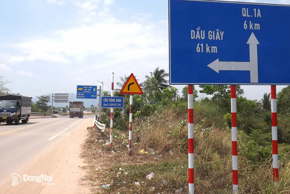
| A sign directing vehicles from National Highway 55 to turn onto the Phan Thiet - Dau Giay Expressway. Photo: V. Phong |
Tourists can choose new routes to explore the green landscapes on their journey from Dong Nai, Binh Duong, Ho Chi Minh City, and the southwestern provinces to the Lang Biang plateau, taking in the majestic mountain scenery of the country.
Lush green pathways
Following the advice of Mr. Phu, a Da Lat native working in Ho Chi Minh City who had undertaken many trips exploring new routes, one day in early March of the lunar calendar, I decided to choose National Highway 55 to travel to Bien Hoa instead of National Highway 20 via Bao Loc Pass.
From the Dai Binh intersection (where National Highway 55 meets National Highway 20, about 3km from the center of Bao Loc city, Lam Dong province), turning left onto National Highway 55, the first impression is one of familiar scenery with densely populated houses, resembling a bustling town, quite different from many years ago. The section through Loc Thanh commune is densely populated, with a smooth, paved road creating a pleasant feeling. Further along, through Loc Nam commune (Bao Lam district, Lam Dong province), the road has some potholes, but they are not too numerous or extensive, so the feeling of fatigue is not overwhelming.
Beyond Loc Nam commune lies Da Mi commune (Ham Thuan Bac district, Binh Thuan province), where houses become sparser, replaced by a lush, majestic landscape of green hills and mountains. Looking to the left, far below, the Ham Thuan - Da Mi hydroelectric reservoir is still shrouded in a captivating mist. With hills on one side and a deep ravine on the other, the road isn't too steep or winding, making it relatively easy for tourist vehicle drivers like myself.
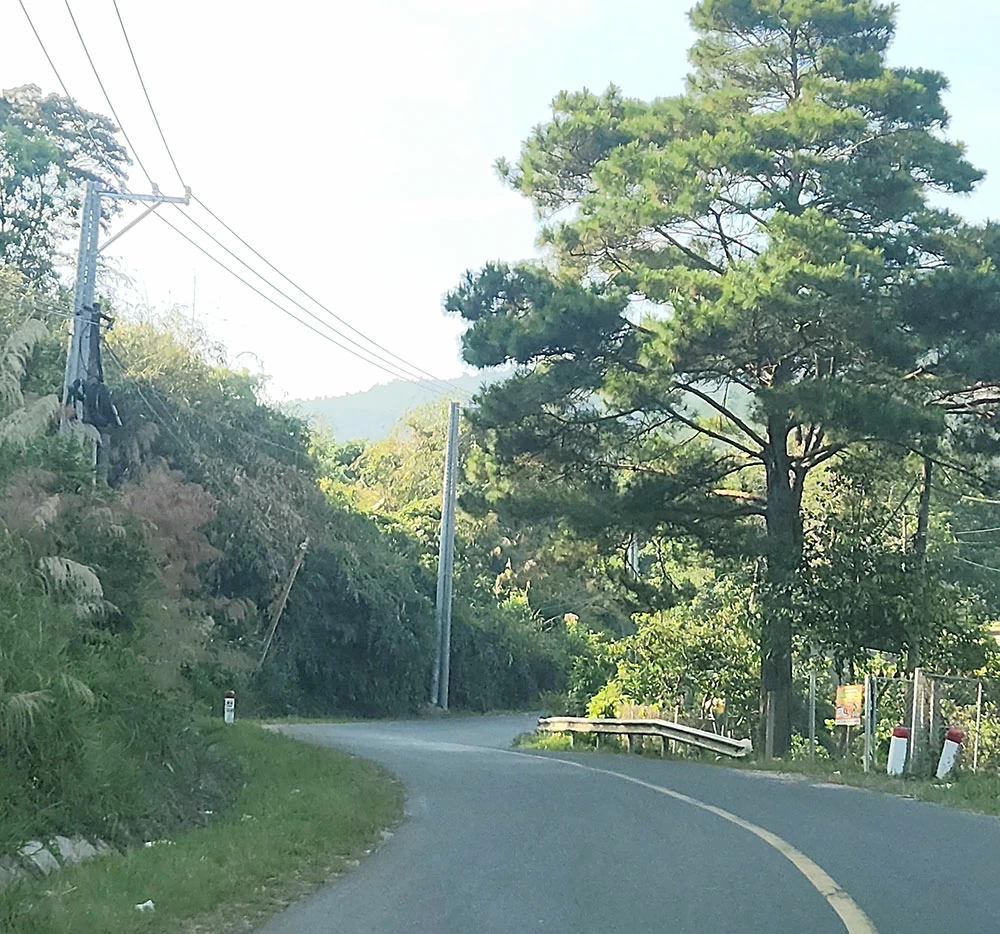 |
| A lush green mountain pass on National Highway 55. |
The road is designed to follow the foothills and slopes of the mountains, so it's not as steep as National Highway 28B, nor is it as winding with sharp curves as National Highway 28. In particular, the road surface quality is much better than the rough, potholed National Highway 28, while National Highway 28B's surface has peeled off, creating countless potholes and large craters.
Continuing our journey, the car passed over bridges and villages with place names deeply rooted in the culture of the indigenous people, such as Ta Pao, La Ngau, Dong Kho... The road was good, and traffic was light, making it quite comfortable for the driver. As we got closer to National Highway 1 and the Phan Thiet - Dau Giay Expressway, the road widened as we passed through Tanh Linh and Ham Tan districts. Memories flooded back as I recalled a business trip in 2000-2001, when I and my colleagues "hunted" wild elephants in Tanh Linh for several days, and the feeling of capturing the first photograph of a wild elephant being tranquilized and chained up in the middle of the natural forest…
A quarter of a century has passed, and the houses, buildings, and roads have changed so rapidly that I hardly recognize them. Before, the road from Tan Minh intersection to Suoi Cat commune and then to the district's central town was narrow and unpaved, with many sections showing exposed earth and rocks, and puddles forming when it rained; sometimes you could travel 2-3 kilometers without seeing a single house. But now, the population is quite dense, spread evenly along both sides of Provincial Road 720, giving it a completely different appearance.
Having not been there in a long time, when I reached the Ta Pao bridge, I had to stop the car to ask a local for directions: "After crossing the bridge, turn left and drive straight for more than 30km until you reach the Phan Thiet - Dau Giay expressway." While admiring the recently harvested rice fields and the buffaloes slowly grazing, a sign indicated we had entered Ham Tan district. After a while of driving through prosperous villages, my car arrived at the Song Dinh bridge (Song Phan commune, Ham Tan district, Binh Thuan province). On the other side of the bridge, a large sign indicated the way to the expressway and the direction towards Dau Giay, Ho Chi Minh City, or towards Phan Thiet, Nha Trang.
Adding more useful options for travelers.
After turning onto National Highway 51 from the Ho Chi Minh City - Long Thanh - Dau Giay Expressway, I drove straight to Bien Hoa City, the clock showing 12:30 PM. In total, the journey from Da Lat to the center of Bien Hoa took just over 6 hours, about 1-1.5 hours faster than taking National Highway 20 over the Bao Loc Pass. This doesn't account for traffic jams caused by frequent collisions and accidents on the Bao Loc Pass recently, which can increase travel time to 8-9 hours.
It's unfortunate for those stuck in traffic on the Bao Loc pass, as there are no decent restaurants or rest areas to wait for the road to clear. Even worse, drivers who forget to fill up their gas tanks may find themselves in tears when their car runs out of fuel in the middle of the pass due to traffic congestion, forcing them to sit in their cars with the air conditioning on, waiting for traffic authorities to direct traffic before finally managing to crawl along the 10km pass.
In recent years, traffic volume on National Highway 20 has increased dramatically, especially with the appearance of heavy trucks and container trucks traveling through the pass, causing speeds to slow down considerably when going up and down. Particularly when 2-3 oversized, overweight trucks carrying bauxite ore lead the way, other vehicles are forced to crawl along, hesitant to overtake due to the unfamiliar, narrow, and steep road. Especially during holidays like April 30th or the beginning of summer, the number of tourist buses (5-7 seats to 45 seats) carrying tourists on vacation increases even more, increasing the risk of traffic jams and significantly prolonging waiting times. Sometimes, travelers have to wait 9-10 hours for a journey from Ho Chi Minh City or eastern provinces like Binh Duong and Dong Nai to Da Lat.
Therefore, during peak travel season, National Highway 55 is a good option for tourists who want a relaxing trip, saving travel time by avoiding the Bao Loc Pass and instead taking National Highway 55 for both directions, while also enjoying the majestic mountain scenery. If time permits, tourists can also stop by and learn more about the culture and cuisine of the local ethnic minorities to enrich their travel and exploration journey.
For the past 2-3 years, during holidays and Tet (Lunar New Year), many people have chosen National Highway 28B to travel from Dong Nai and Ho Chi Minh City to Da Lat, with a travel time of only 5-5.5 hours. However, the road is increasingly deteriorating and is currently under construction for repair and expansion along the entire route, making travel quite inconvenient and damaging to vehicles. Therefore, if you search on Google, many people agree that the route via National Highway 55 is currently the most harmonious and useful route for tourists traveling to Da Lat, avoiding the Bao Loc Pass.
In particular, tourists traveling from Da Lat to the eastern and southwestern provinces should prepare a backup plan in case the Bao Loc Pass experiences serious traffic congestion. National Highway 55 is the only effective "rescue" option to avoid wasting time waiting for traffic to resume.
National Highway 55 is a 219km long road connecting the provinces of Ba Ria - Vung Tau, Binh Thuan, and Lam Dong. It starts in Ba Ria city, passes through Long Dat and Xuyen Moc districts (Ba Ria - Vung Tau province), Ham Tan, La Gi town, Ham Thuan Nam, Tanh Linh, and Ham Thuan Bac districts (Binh Thuan province), Bao Lam district (Lam Dong province), and ends in Bao Loc city. This is an East-West arterial road linking the provinces of the Southeast and Central Highlands regions. National Highway 55 intersects with National Highway 1 at Tan Nghia town, Ham Tan district, and intersects with the Phan Thiet - Dau Giay Expressway at Song Phan commune (Ham Tan district).
A section of National Highway 55 was formed from the road previously used for the construction of the Ham Thuan - Da Mi hydroelectric power plant. According to the Road Network Planning for the period 2021-2030, with a vision to 2050, approved by the Prime Minister in Decision No. 1454/QD-TTg dated September 1, 2021, National Highway 55 will be extended to the Dak Glong district, Dak Nong province, with its end point intersecting National Highway 28, for a total length of 290km.
Van Phong
Source: https://baodongnai.com.vn/dong-nai-cuoi-tuan/202505/rong-ruoi-tren-quoc-lo-55-6761eb7/


![[Video] Sunset at Lap An Lagoon – Where the sun sets over the fishing nets](https://vphoto.vietnam.vn/thumb/1200x675/vietnam/resource/IMAGE/2026/05/31/1780192137701_beach-landscape-sea-water-nature-grass-745871-pxhere-com.jpeg)


Comment (0)