

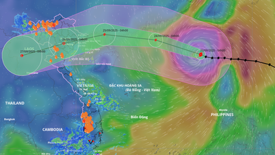
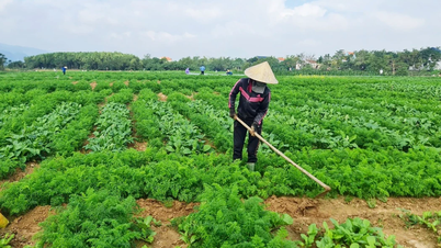
Flood levels in the Long Xuyen quadrangle area are forecast to rise in the coming days.
The peak tide of this period is likely to appear on September 10-11 (July 19-20 of the lunar calendar). The highest water level during this period on the Hau River in Long Xuyen ward is likely to be 5-10cm above alert level 3; on Ong Chuong canal in Cho Moi commune is likely to be 20-30cm above alert level 2.
In the Long Xuyen quadrangle, the highest and lowest water levels on canals and ditches will gradually rise in the coming days; on Vinh Te canal at Xuan To, the average water level will rise from 8 - 10cm/day.
Water levels on Cai Lon - Cai Be rivers tend to rise following the West Sea tide until September 10, then gradually decrease.

Flood risk map of urban areas in Long Xuyen, water level scenario on Hau River at Long Xuyen station reaches 245cm (5cm below alarm level 3).
Flood warning area includes urban areas of Long Xuyen ward, Binh Duc ward, My Phuoc ward, My Hoa Hung commune and Cho Moi commune. Flooding time is in the morning (from 6:30 am to 8:30 am); in the evening (from 5:30 pm to 7:00 pm). Maximum flood depth is from 5 - 30 cm.
The flood risk warning level on the Hau River in Long Xuyen is level 2; the flood risk warning level on Ong Chuong Canal in Cho Moi is level 2.
Due to the impact of high tides in the lower reaches of the river, combined with floods in the upper reaches of the Mekong River and heavy rain in the region, there is a possibility of flooding and local inundation in some low-lying areas, riverside areas, canals, roads and areas with low ground elevation, areas without dike systems, and important sewers in urban areas in Long Xuyen, Binh Duc, My Phuoc wards, My Hoa Hung commune and Cho Moi commune.
In addition, large fluctuations in water levels and low water levels warn of the risk of landslides on river banks, canals and streams.
News and photos: THUY TRANG
Source: https://baoangiang.com.vn/an-giang-canh-bao-lu-tren-cac-song-a461128.html


![[Photo] Closing of the 1st Congress of Party Delegates of Central Party Agencies](https://vphoto.vietnam.vn/thumb/1200x675/vietnam/resource/IMAGE/2025/9/24/b419f67738854f85bad6dbefa40f3040)


![[Photo] Editor-in-Chief of Nhan Dan Newspaper Le Quoc Minh received the working delegation of Pasaxon Newspaper](https://vphoto.vietnam.vn/thumb/1200x675/vietnam/resource/IMAGE/2025/9/23/da79369d8d2849318c3fe8e792f4ce16)


Comment (0)