
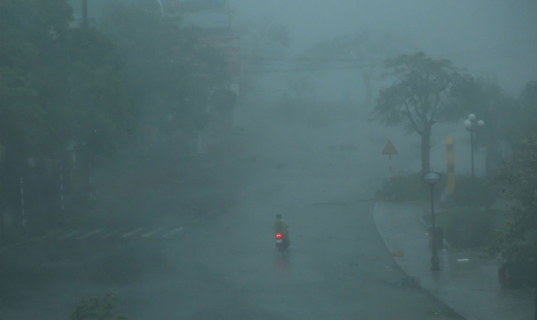
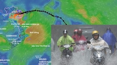
Early this morning, storm number 3 Wipha directly affected the coastal provinces of the North, many places recorded strong winds up to level 12 and very heavy rain. The storm center is currently only 90km from Quang Ninh and is expected to make landfall from the afternoon to the evening of July 22.
The storm's wind gusted to level 12 at Bach Long Vi outpost island.
Over the past hours, coastal monitoring stations have continuously recorded increasing winds. Specifically:
At Bach Long Vi island, the wind was strong at level 10, gusting to level 12.
At Cua Ong (Quang Ninh), strong wind level 9, gust level 12.
At Co To island, strong wind level 8, gust level 11.
Other areas such as Bai Chay, Mong Cai, Tien Yen, and Quang Ha all had strong winds of level 6-8, gusting to level 8-11.
Heavy rain also appeared widely in the delta and coastal areas of the North, Thanh Hoa, Nghe An with common rainfall from 50-100mm, some places over 130mm.
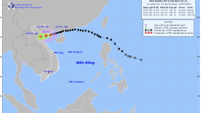
Forecast of path and landing time of storm No. 3
At 01:00 on July 22, the storm center was right in the Gulf of Tonkin, 90km from Quang Ninh and 120km from Hai Phong . The strongest wind near the storm center was level 10 (89-102km/h), gusting to level 13.
Today, the storm is forecast to move mainly in the West-Southwest direction at a speed of 10-15km/h. By 1pm on July 22, the storm center will be in the coastal waters of the provinces from Quang Ninh to Ninh Binh, with winds remaining at level 10, gusting to level 13.
The storm will then move inland from Hai Phong to Thanh Hoa and gradually weaken. By 1:00 a.m. on July 23, the storm center will be on land with winds reduced to level 8, gusting to level 10.
Warning of dangers at sea and on land
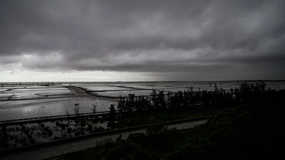
At sea: The entire northern Gulf of Tonkin has waves 2-6 meters high, with rough seas. The area near the storm's center has strong winds of level 9-10, gusting to level 13, extremely dangerous for all types of ships.
On land: Coastal areas from Quang Ninh to Nghe An will have strong winds of level 7-8, areas near the storm's eye (expected Hai Phong, Quang Ninh, Hung Yen, Ninh Binh) will have strong winds of level 9-10, gusting to level 13. Areas further inland, including Hanoi, will have strong winds of level 6, gusting to level 7-8. Coastal areas from Hung Yen to Quang Ninh need to be on guard against storm surges of 0.5-1.0m. Water levels at monitoring stations such as Hon Dau and Cua Ong may rise very high (3.9-5.0m), causing a risk of serious flooding in coastal areas and river mouths on the afternoon of July 22.
This is the most dangerous stage of the storm. People need to strictly follow safety instructions:
Absolutely no activities at sea or coastal areas.
Coastal localities from Quang Ninh to Nghe An need to complete securing houses and evacuating people from dangerous areas this morning.
Beware of the risk of very heavy rain (over 150mm/3 hours) which can cause urban flooding, flash floods and landslides in mountainous and midland areas.
Storm No. 3 Wipha is reaching its peak intensity.
It is forecasted that on the morning of July 22, storm No. 3 will reach its peak intensity in the Gulf of Tonkin with winds of level 11, gusts of level 14, causing waves up to 6 meters high. On land from Quang Ninh to Nghe An, winds may gust to level 14, accompanied by an exceptionally heavy rain with local rainfall of over 600mm, warning of a very high risk of flooding, flash floods and landslides.
The storm's circulation will cause a very heavy rain over a large area from the night of July 21 to July 23. The focus of the rain is in the Northeast region, the Northern Delta, Thanh Hoa and Nghe An with total rainfall of 200-350mm, locally over 600mm. Other places in the North and Ha Tinh will have rain from 100-200mm, locally over 300mm.
Major meteorological agencies in the region and around the world are also closely monitoring Typhoon Wipha. In general, forecasts have a high consensus on the storm's trajectory and severity. The US Navy's Joint Typhoon Warning Center (JTWC) assessed Typhoon Wipha, when in the Gulf of Tonkin, as equivalent to a Category 1 storm on the US Saffir-Simpson hurricane scale. The JTWC's forecast trajectory is similar to Vietnam's assessment. The Japan Meteorological Agency (JMA) classified Typhoon No. 3 as a "typhoon". JMA forecasts that the strongest sustained winds (in 10 minutes) can reach 110 km/h, with a pressure at the center of the storm of about 975 hPa, indicating that this is a strong storm.
Hanoi Radio will continue to inform you about the latest developments of storm No. 3 Wipha as it enters the Gulf of Tonkin and makes landfall in breaking news broadcast live on television and digital platforms.
Source: https://baolaocai.vn/bao-so-3-bach-long-vi-bat-dau-co-gio-giat-cap-12-post649395.html


![[Photo] National Assembly Chairman Tran Thanh Man visits Vietnamese Heroic Mother Ta Thi Tran](https://vphoto.vietnam.vn/thumb/1200x675/vietnam/resource/IMAGE/2025/7/20/765c0bd057dd44ad83ab89fe0255b783)


Comment (0)