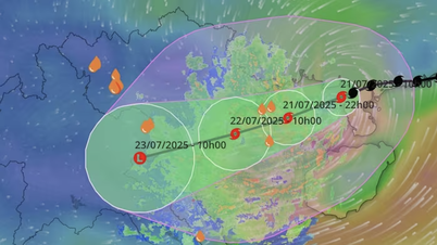
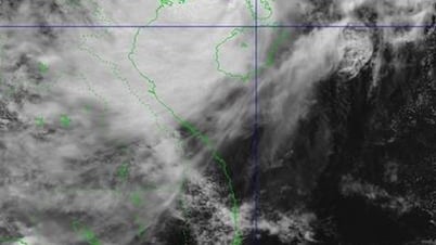
Early morning of July 21, storm No. 3 (Wipha) tends to change direction to the West Southwest. At 7:00 am, the storm center was at about 21.3 degrees North latitude - 109.9 degrees East longitude, only about 222km east of Quang Ninh - Hai Phong . The strongest wind has now decreased to level 9, gusting to level 11. The moving speed is 15-20km/hour.
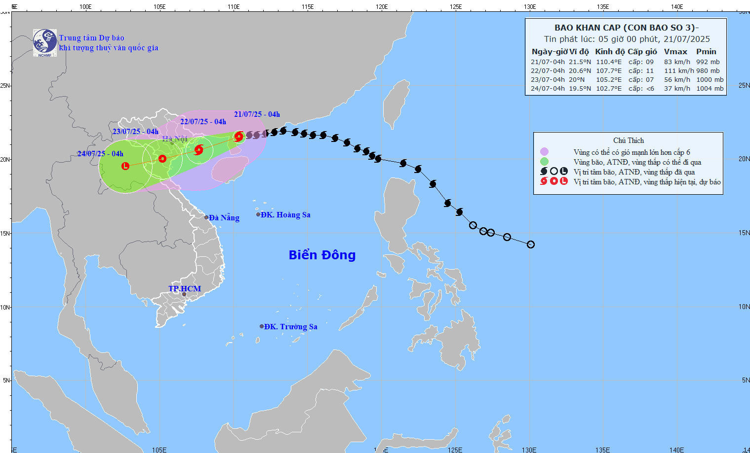
The National Center for Hydro-Meteorological Forecasting warns that from tonight and tonight, July 21, the coastal winds from Quang Ninh to Nghe An will gradually increase to level 7-9, near the storm center level 10-11, gusting to level 14. Deeper inland, the winds will be level 6, gusting to level 7-8. Meteorological experts say that level 10-11 winds are strong enough to knock down large trees, electric poles, and blow off weak roofs.
The National Center for Hydro-Meteorological Forecasting also warned that the cloud circulation of storm No. 3 is very large. The entire Northeast region, the Northern Delta and Thanh Hoa, Nghe An will have very heavy rain of 200-350mm, many places over 600mm. The remaining areas of the North and Ha Tinh will have rain of 100-200mm, some places over 300mm. Rain intensity over 150mm/3 hours can cause flash floods, landslides, deep flooding in low-lying areas and urban areas.
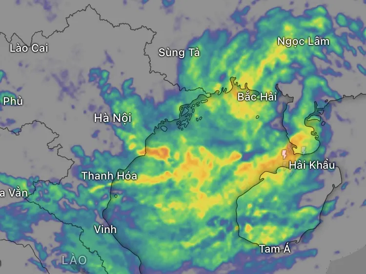
It is forecasted that in the next 48 hours (from July 21 to the night of July 22), the Northeast region, the Northern Delta, Thanh Hoa and Nghe An will have 170-280mm of rain, locally over 450mm; other places in the North and Ha Tinh will have 80-160mm of rain, some places over 250mm.
Particularly, the area from Quang Tri to Da Nang, the Central Highlands and the South also has thunderstorms, locally heavy rain of 10-30mm, in some places over 70mm.
During the day and night of July 23, the North, Thanh Hoa, Nghe An, and Ha Tinh continued to have moderate to heavy rain, with some places experiencing very heavy rain of 30-70mm, locally over 150mm. The total rainfall from July 21 to 23 in the Northeast, the Northern Delta, Thanh Hoa, and Nghe An reached 200-350mm, with some places experiencing over 600mm. Other places in the North and Ha Tinh reached 100-200mm, with some places experiencing over 300mm. From July 24 to 25, the North and North Central regions continued to have moderate to heavy rain, with some places experiencing very heavy rain.

The meteorological agency warned that people in the North and North Central regions should pay special attention to the risk of flash floods and landslides caused by this storm. Major cities such as Hanoi, Hai Phong and urban areas in Bac Ninh, Ninh Binh and Nghe An provinces should be on guard against widespread flooding.
Source: https://www.sggp.org.vn/bao-so-3-doi-huong-vao-vinh-bac-bo-gay-mua-tren-600mm-post804653.html








![[Photo] National Assembly Chairman Tran Thanh Man visits Vietnamese Heroic Mother Ta Thi Tran](https://vphoto.vietnam.vn/thumb/1200x675/vietnam/resource/IMAGE/2025/7/20/765c0bd057dd44ad83ab89fe0255b783)











Comment (0)