
 |
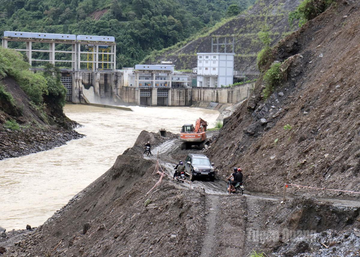
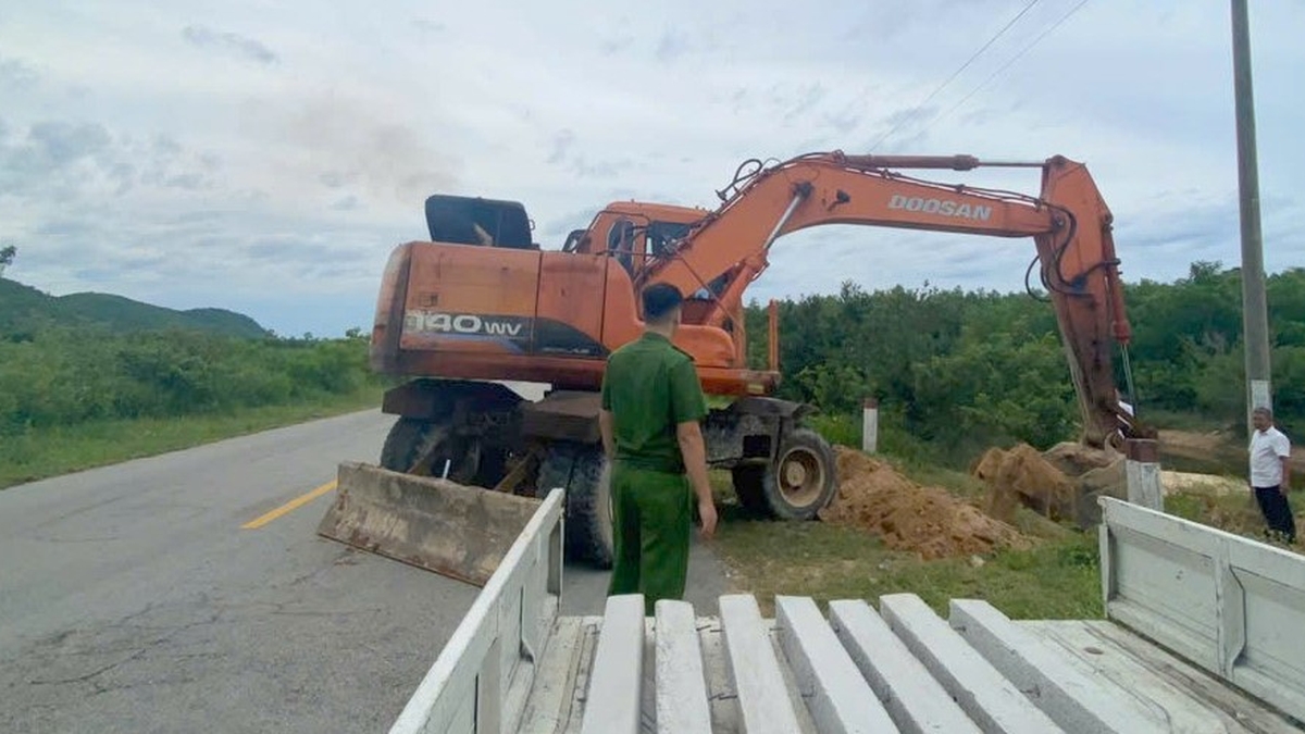
| This location is right next to the river, with the potential for further landslides if heavy rain continues. |
It is worth mentioning that this situation has been occurring for nearly a year now, especially after prolonged floods during the rainy season last year. However, up to now, the landslide has not been completely resolved. Many locations of the roadbed have been eroded, deep and long gullies have formed, some of which are just wide enough for one lane of traffic to move close to the edge of the cliff, close to the Gam River that is rolling down below.
Currently, the construction unit is urgently mobilizing machinery and equipment to level the soil and create a temporary road surface to ensure traffic flow. However, with the large amount of landslides and the weakened roadbed structure, these measures are only temporary.
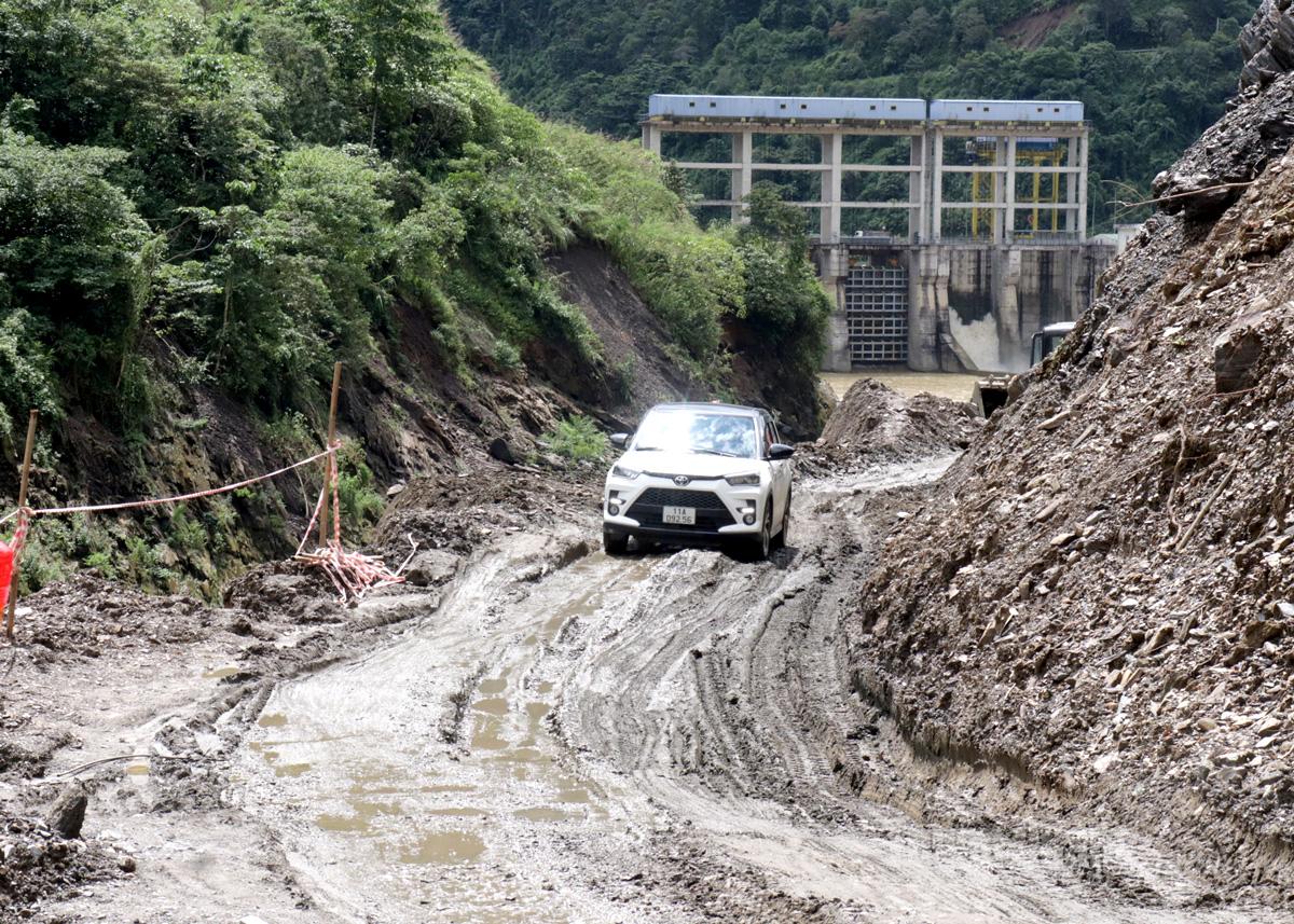 |
| Vehicles moving through this section are very difficult. |
Mr. Nguyen Van Khoi, a resident of Bac Me commune who often passes through this area, said: "When it rains, this road is almost impossible to travel on, it is extremely slippery and dangerous. We are very worried, especially during the rainy season."
National Highway 34 is the inter-provincial traffic route connecting Tuyen Quang and Cao Bang . Therefore, the authorities need to soon have a fundamental solution and invest in sustainable reinforcement of section Km63+64 to ensure long-term traffic safety and avoid the risk of being cut off during the rainy season.
Hong Cu
Source: https://baotuyenquang.com.vn/xa-hoi/202507/can-giai-phap-cap-thiet-cho-doan-duong-nguy-hiem-tai-km-6364-quoc-lo-34-f011423/


![[Photo] National Assembly Chairman attends the seminar "Building and operating an international financial center and recommendations for Vietnam"](https://vphoto.vietnam.vn/thumb/1200x675/vietnam/resource/IMAGE/2025/7/28/76393436936e457db31ec84433289f72)


Comment (0)