
Specifically, National Highway 19C has 5 flooded spots. Of which, the section passing through Dong Xuan commune has 3 flooded spots: Km50+00-Km57+00 (flooded 7000m long, 1.5m deep); Km59+600-Km60+200 (flooded 600m long, 1.0m deep); Km61+100-Km62+400 (flooded 1300m long, 1.5m deep).
The section passing through Xuan Phuoc commune has 2 flooded points: Km64+550-Km64+950 (flooded 400m long, 0.6m deep); Km73+500-Km73+800 (flooded 300m long, 1.0m deep).
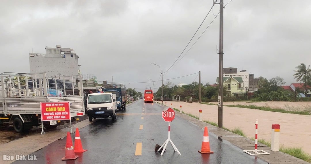 |
| Authorities put up signs warning people not to travel in dangerous flooded areas. |
There are 6 flooded spots on National Highway 25. Of which, the section passing through Phu Hoa 1 commune has 4 flooded spots: Km8+600-Km9+100 (flooded 500m long, 0.3m deep); Km14+400-Km14+800 (flooded 400m long, 1.5m deep); Km16-Km23 (flooded 7000m long, 0.4m deep); Km26+650-Km27+750 (flooded 1100m long, 0.6m deep).
The section passing through Son Hoa commune has 2 flooded points: Km36+600-Km36+700 (flooded 100m long, 0.3m deep); Km39+850-Km40+050 (flooded 200m long, 0.3m deep).
National Highway 29 has 3 flooded points: at Km63+200-Km64+200 (Son Thanh commune); Km68+700 (Duc Binh commune); Km78+650-Km79+550 (Song Hinh commune).
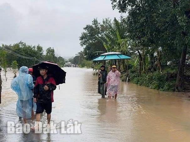 |
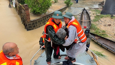
Many traffic routes were recorded to be flooded from 0.3-1.3m deep. |
In addition, on routes DT.641, DT.642, DT.647, DT.650, DT.693, DT.698 passing through the communes of Tuy An Bac, Dong Xuan, Phu Mo, Ma Drak, Cu Prao, and Krong Ana, there are traffic points with deep flooding, from 0.3 to 1.3 meters long.
In Yang Mao commune, the overflow culvert on the rural road from Ea Han village to Yang Han village, Ea Lueh village in Yang Mao commune, the water is still about 0.9 to 1.0 m deep, causing traffic jam.
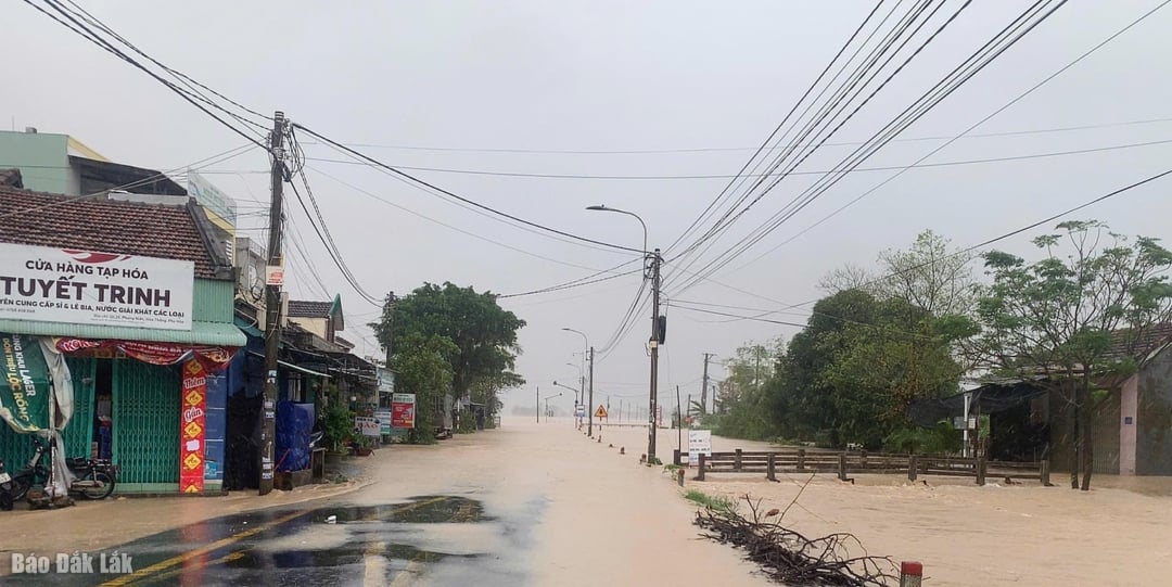 |
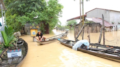
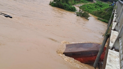
| A flooded area on Highway 25. |
In addition, there are 3 flooded points, but traffic is still possible, including: section Km68+350-Km68+600, on National Highway 19C, through Xuan Phuoc commune and section Km80-Km81, through Song Hinh commune and section Km107+00, through Ea Ly commune.
In addition, landslides have occurred on some national and provincial highways, threatening safety on the route. Specifically, on National Highway 29, many sections of the roadbed and curbs have been eroded at the drainage culvert at Km77+160 (T+P); some sections of the roadbed and curbs have been locally eroded at Km64+800 (T), Km79+580-Km79+640 (P); the road surface is muddy and potholes have appeared on the section Km83-Km86/QL.29, about 815m2, but have not yet affected traffic on the route.
National Highway 19C has a landslide and silting of the road surface at Km99+00-Km101+00 with a volume of about 650m3, blocking one lane. Currently, units are organizing cleanup to ensure traffic safety.
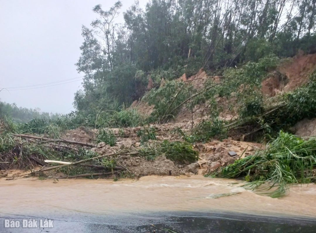 |
| Many landslides continue to be recorded on national and provincial highways. |
On National Highway 26, DT.646, DT.692, there are landslides and silting of the roadbed, but it has not affected the traffic situation on the route. Currently, units are organizing to clean up to ensure traffic safety.
In addition, some roads managed by the commune level are also damaged and flooded, such as: the traffic axis from Yang Mao commune to Krong A, one side of the bridgehead of the Cement Concrete Bridge, on the side of village 2, the roadbed has collapsed and concrete slabs have drifted away, the bridge surface is damaged, causing traffic jams. The bridge on the section between Buon Tong Rang B and Ea Lueh village was completely washed away, traffic was cut off. Some rural traffic routes in the commune have landslides, rocks affecting traffic, the locality has organized to fix the problem and ensure traffic.
For the North-South railway, at Km1168+310, north of Chi Thanh tunnel in Tuy An Bac commune, heavy rain eroded the railway bed, about 12 meters long and 1.0 meter deep; currently the water is still flowing strongly. The railway industry has temporarily stopped running trains through this area.
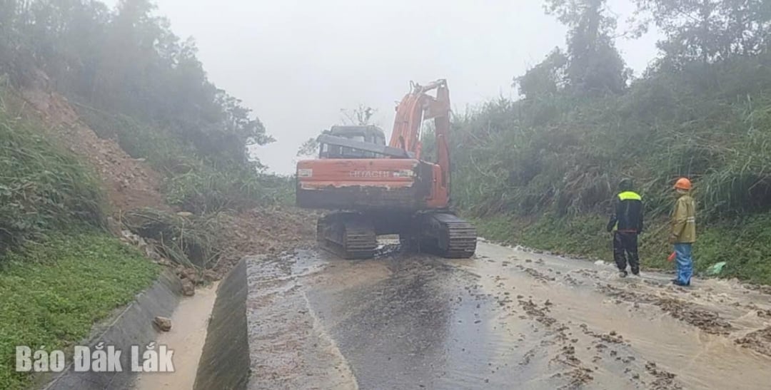 |
| Road management units are cleaning up a landslide that just occurred on Highway 19C. |
Currently, the Department of Construction is organizing the dredging of the drainage system; clearing soil and rocks to fill the road surface and longitudinal ditches, and filling potholes with crushed stone to ensure traffic safety on the routes; at the same time, continuing to coordinate with the Traffic Police Department and local authorities to be on duty, set up barriers, put up warning signs, divert traffic, and guide vehicles to find safe directions.
Source: https://baodaklak.vn/kinh-te/202511/canh-bao-cac-tuyen-duong-sat-lo-ngap-nuoc-do-mua-lu-8c40b3e/

![[Photo] President Luong Cuong receives President of the Senate of the Czech Republic Milos Vystrcil](/_next/image?url=https%3A%2F%2Fvphoto.vietnam.vn%2Fthumb%2F1200x675%2Fvietnam%2Fresource%2FIMAGE%2F2025%2F11%2F20%2F1763629737266_ndo_br_1-jpg.webp&w=3840&q=75)
![[Photo] National Assembly Chairman Tran Thanh Man holds talks with South Korean National Assembly Chairman Woo Won Shik](/_next/image?url=https%3A%2F%2Fvphoto.vietnam.vn%2Fthumb%2F1200x675%2Fvietnam%2Fresource%2FIMAGE%2F2025%2F11%2F20%2F1763629724919_hq-5175-jpg.webp&w=3840&q=75)
![[Photo] Lam Dong: Panoramic view of Lien Khuong waterfall rolling like never before](/_next/image?url=https%3A%2F%2Fvphoto.vietnam.vn%2Fthumb%2F1200x675%2Fvietnam%2Fresource%2FIMAGE%2F2025%2F11%2F20%2F1763633331783_lk7-jpg.webp&w=3840&q=75)


Comment (0)