
 |
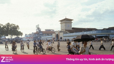
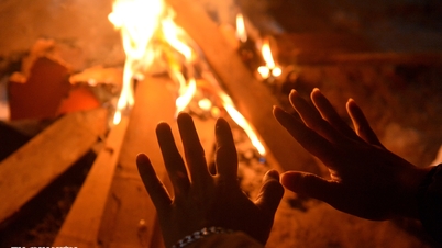
Tourists watch the sunrise at Da Lat's "lovebird hill". Photo: Quynh Danh . |
On November 18, a landslide appeared at Mimosa Pass (Xuan Huong Ward - Da Lat) at Km224+700, from Duc Trong District (old) to Da Lat. About 20m of negative slope collapsed, the metal guardrail system slid from its original position about 1.5m from the roadbed.
From 5:30 p.m. on November 18, Mimosa Pass will ban all trucks weighing 15 tons or more. Authorities have diverted traffic to and from Da Lat.
- Duc Trong - Da Lat : Go from Lien Khuong roundabout to National Highway 27, turn right at the forest entrance intersection on DT.725 to Da Lat.
- Don Duong - Da Lat : Phi Nom intersection, go to Highway 27, at the forest entrance intersection, turn right on DT.725 to Da Lat.
- Lam Ha - Da Lat : From the forest entrance intersection, turn left on DT.725 to Da Lat.
The 11 km long Mimosa Pass (part of Highway 20) is the main southern route to Da Lat, alongside Prenn and Sacom Passes (trucks are prohibited). On November 17, Prenn Pass (Xuan Huong Ward - Da Lat) also suffered a landslide on the negative slope, with long cracks on the road surface. Two-way traffic had to be temporarily suspended.
Previously, on the night of November 16 and early morning of November 17, thousands of cubic meters of rock and soil poured down Khanh Le Pass (connecting Nha Trang - Da Lat), burying a passenger bus and causing many casualties. In addition, D'ran Pass, connecting Xuan Truong Ward - Da Lat (Lam Dong) with Song Pha Pass, Lam Son Commune ( Khanh Hoa ) is still temporarily closed to traffic due to landslides.
Many information on social networks said that Da Lat was "isolated" after many passes leading to the central area collapsed. The People's Committee of Xuan Huong Ward - Da Lat said this was not true, traffic between Da Lat and neighboring areas was still smooth by moving through the remaining routes, according to the instructions of the Lam Dong Department of Construction.
 |
The turning point from Lien Khuong highway connects to the road leading to Tuyen Lam Lake tourist area to reach the center of Da Lat. Photo: Minh An. |
Ho Chi Minh City - Da Lat (Lam Dong)
From Ho Chi Minh City there are 2 easy directions, replacing Prenn and Mimosa passes.
- Ta Nung Pass : Follow National Highway 1 to Dau Giay intersection (Dong Nai), then follow National Highway 20 to Duc Trong (Lam Dong). At Lien Khuong airport roundabout, turn right onto National Highway 27 (direction Don Duong - Da Lat), at the forest gate intersection, turn right onto DT.725 road to the center.
- Sacom Pass : Follow National Highway 1 to Dau Giay intersection (Dong Nai), then follow National Highway 20 to Duc Trong (Lam Dong). At Lien Khuong airport roundabout, continue straight and turn right when you see the sign "Tuyen Lam Lake Tourist Area", then follow Sacom Pass to the center.
Khanh Hoa - Da Lat (Lam Dong)
Nha Trang - Da Lat
Vehicles follow National Highway 1 to Binh Thuan (old), then go up to Lam Dong via 3 routes: National Highway 55 (towards Da Mi Pass), National Highway 28 (Gia Bac Pass) or National Highway 28B (Dai Ninh Pass).
- Dai Ninh Pass : From Nha Trang, follow the Nha Trang - Cam Lam highway (old Ninh Thuan) and continue on Cam Lam - Vinh Hao to Binh Thuan (old). At Dai Ninh intersection, turn right on Highway 28B and follow Dai Ninh Pass. After the pass, continue to Ta Hine intersection, turn right on Highway 20 to enter Da Lat via Sacom Pass.
- Gia Bac Pass : From Nha Trang, follow the Nha Trang - Cam Lam - Vinh Hao highway. At Ma Lam intersection (Ham Thuan Bac commune), turn right and continue on Highway 28. After the pass, continue to Di Linh intersection and turn right on Highway 20 to enter Da Lat via Sacom Pass.
- Da Mi Pass : Similar to the direction from Nha Trang to Binh Thuan (old) on the Nha Trang - Cam Lam - Vinh Hao highway, meet Ma Lam intersection (Ham Thuan Bac commune) turn right on National Highway 28. At Ham Tri intersection, turn left onto Provincial Road 714 to La Da, Da Mi. At La Da intersection, turn right on National Highway 55 to continue on Da Mi pass to Bao Loc. When you meet National Highway 20 intersection, turn right and move along Sacom pass to Da Lat.
Phan Rang (old Ninh Thuan) - Da Lat
Tourists can travel along National Highway 27 up Ngoan Muc Pass (Song Pha) to reach Da Lat. However, this pass is long and steep, with many curves. According to warnings, the risk of landslides still exists, especially in prolonged rainy weather conditions. Authorities are also on duty on the pass to proactively respond.
Source: https://znews.vn/da-lat-bac-tin-bi-co-lap-do-sat-lo-post1604044.html

![[Photo] Lam Dong: Panoramic view of Lien Khuong waterfall rolling like never before](/_next/image?url=https%3A%2F%2Fvphoto.vietnam.vn%2Fthumb%2F1200x675%2Fvietnam%2Fresource%2FIMAGE%2F2025%2F11%2F20%2F1763633331783_lk7-jpg.webp&w=3840&q=75)
![[Photo] National Assembly Chairman Tran Thanh Man holds talks with South Korean National Assembly Chairman Woo Won Shik](/_next/image?url=https%3A%2F%2Fvphoto.vietnam.vn%2Fthumb%2F1200x675%2Fvietnam%2Fresource%2FIMAGE%2F2025%2F11%2F20%2F1763629724919_hq-5175-jpg.webp&w=3840&q=75)
![[Photo] President Luong Cuong receives President of the Senate of the Czech Republic Milos Vystrcil](/_next/image?url=https%3A%2F%2Fvphoto.vietnam.vn%2Fthumb%2F1200x675%2Fvietnam%2Fresource%2FIMAGE%2F2025%2F11%2F20%2F1763629737266_ndo_br_1-jpg.webp&w=3840&q=75)


Comment (0)