

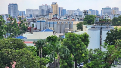
Super typhoon Ragasa on the morning of September 20 - Photo: WD
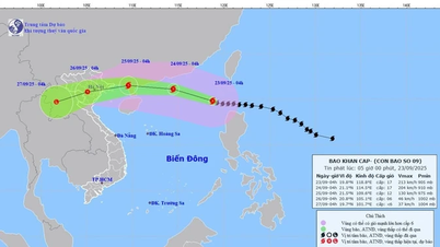
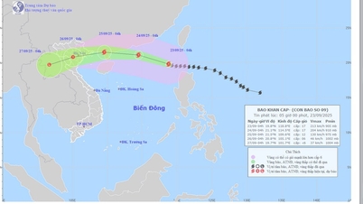
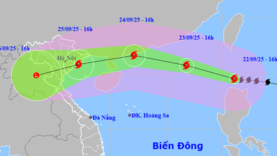
According to the National Center for Hydro-Meteorological Forecasting, this morning, super typhoon Ragasa was about 750km east of Luzon Island (Philippines). The strongest wind near the center of the storm is level 11 (103-117km/h), gusting to level 14. The storm is still moving west-northwest at a speed of about 15km/h.
This is forecast to be a "super storm" with maximum wind speed reaching level 15-16, gusting to level 17.
According to Mr. Le Dinh Quyet - Head of Forecasting Department of Southern Hydrometeorological Station, when operating at sea, the storm will be very strong.
The storm is moving mainly northwestward, close to mainland southern China. Therefore, the super typhoon will be weakened by friction.
"Due to the wide and strong storm circulation, when entering the East Sea, it will attract wind, causing strong disturbances affecting the South. The weather will be rainy in many places, heavy rain will occur with thunderstorms, lightning, and gusts of wind. The weather in the sea areas of Ho Chi Minh City and Lam Dong will have strong winds and big waves from September 23 to 25," Mr. Quyet predicted.
Source: https://tuoitre.vn/dau-tuan-toi-nam-bo-va-tp-hcm-mua-lon-do-anh-huong-sieu-bao-ragasa-20250920082059924.htm


![[Photo] General Secretary To Lam attends the 1st Congress of the Central Party Committee of the Fatherland Front and Central Mass Organizations](https://vphoto.vietnam.vn/thumb/1200x675/vietnam/resource/IMAGE/2025/9/23/2aa63d072cab4105a113d4fc0c68a839)


![[Photo] Prime Minister Pham Minh Chinh chairs the first meeting of the Central Steering Committee on housing policy and real estate market](https://vphoto.vietnam.vn/thumb/1200x675/vietnam/resource/IMAGE/2025/9/22/c0f42b88c6284975b4bcfcf5b17656e7)


Comment (0)