
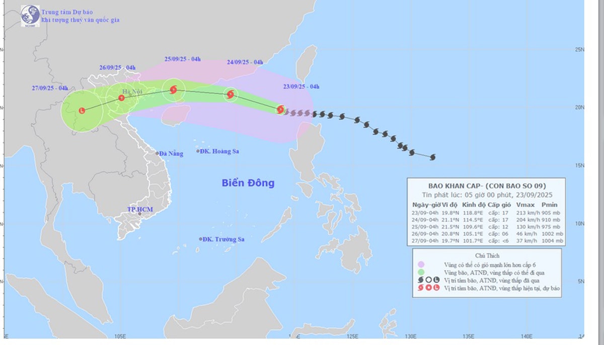
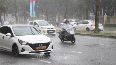
According to the National Center for Hydro-Meteorological Forecasting at 4:00 a.m. this morning, September 23, super typhoon Ragasa was located at about 19.8 degrees North latitude, 118.8 degrees East longitude, in the northeastern sea area of the North East Sea.
The storm is moving in the West Northwest direction at a speed of about 20 km/h, with winds near the center reaching level 17 (equivalent to 202 - 221 km/h), gusting above level 17.
Forecast at 4:00 a.m. on September 24, the Storm is about 450 km east of Leizhou Peninsula (China), still maintaining wind speed of level 16 - 17, gusting above level 17.
At 4:00 a.m. on September 25, the storm center was located on the mainland south of Guangzhou province (China), weakening to level 12, gusting to level 15.
At 4:00 a.m. on September 26, the storm continued to move west-southwest, weakening into a tropical depression, with winds of level 6, gusts of level 8, in the northern region of Vietnam.
Due to the influence of the storm, the northern sea area of the North East Sea has strong winds of level 8-9, then increasing to level 10-14, the area near the center of the super storm has winds of level 15-17, gusts above level 17, waves over 10.0 m high; rough seas.
From September 24, the eastern sea of Bac Bo Gulf will have winds gradually increasing to level 6-7, gusting to level 9.
From the evening and night of September 24, the Bac Bo Gulf area (including Van Don and Co To special zones) will have winds gradually increasing to level 8-9, waves 2-4 m high, areas near the storm's center will have winds of level 10-12, gusts of level 14, waves 4-6 m high; the sea will be very rough.
Storm surge in coastal areas in the coastal areas of Quang Ninh - Hai Phong provinces has storm surge height of 0.5 - 1 m. There is a high risk of landslides of sea dykes, sea embankments, destruction of aquaculture areas, ships and boats anchored along the coast due to strong winds, rising sea levels and big waves.
On land from early morning of September 25, coastal areas from Quang Ninh to Thanh Hoa will have winds gradually increasing to level 6-7, then increasing to level 8, areas near the storm center will have winds of level 9-10, gusting to level 12; areas deep inland in the Northeast will have strong winds of level 6-7, gusting to level 8-9.
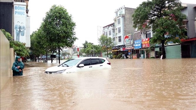
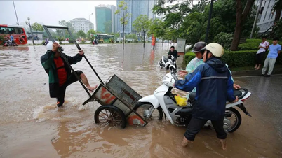
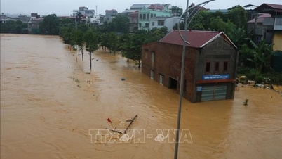
Impact on Hai Phong area:
From September 24, the sea area of Bach Long Vi special economic zone will have winds gradually increasing to level 6 - 7, gusting to level 9.
From the evening and night of September 24, the sea area of Bach Long Vi special economic zone, the sea area of Cat Hai - Lan Ha bay, the sea area of Hon Dau island will have winds gradually increasing to level 8 - 9, waves 2 - 4 m high, the area near the storm center will have winds of level 10 - 12, gusts of level 14, waves 4 - 6 m high; the sea will be very rough.
From early morning on September 25, coastal areas of Hai An Ward, Dong Hai Ward, Nam Trieu Ward, Do Son Ward, Nam Do Son Ward, Duong Kinh Ward, Chan Hung Commune, Hung Thang Commune, Kien Hai Commune had winds gradually increasing to level 6 - 7, then increasing to level 8, near the storm center level 9 - 10, gusting to level 12.
On land, from early morning on September 25, communes/wards located deep inland of Hai Phong city have strong winds of level 6, gusting to level 8-9.
Impact of strong winds: All vessels, anchorages, aquaculture areas, sea dykes and other activities in the above sea areas are at very high risk of being affected by storms, whirlwinds, strong winds and big waves.
PVSource: https://baohaiphong.vn/sieu-bao-ragasa-da-vao-bien-dong-du-bao-ngoai-khoi-hai-phong-bien-dong-du-doi-521528.html


![[Photo] Prime Minister Pham Minh Chinh inspects and directs the work of overcoming the consequences of floods after the storm in Thai Nguyen](https://vphoto.vietnam.vn/thumb/1200x675/vietnam/resource/IMAGE/2025/10/08/1759930075451_dsc-9441-jpg.webp)

![[Photo] Prime Minister Pham Minh Chinh attends the World Congress of the International Federation of Freight Forwarders and Transport Associations - FIATA](https://vphoto.vietnam.vn/thumb/1200x675/vietnam/resource/IMAGE/2025/10/08/1759936077106_dsc-0434-jpg.webp)


![[Photo] Closing of the 13th Conference of the 13th Party Central Committee](https://vphoto.vietnam.vn/thumb/1200x675/vietnam/resource/IMAGE/2025/10/08/1759893763535_ndo_br_a3-bnd-2504-jpg.webp)


Comment (0)