
 |
| Floods are still complicated, need to be vigilant for landslides. |
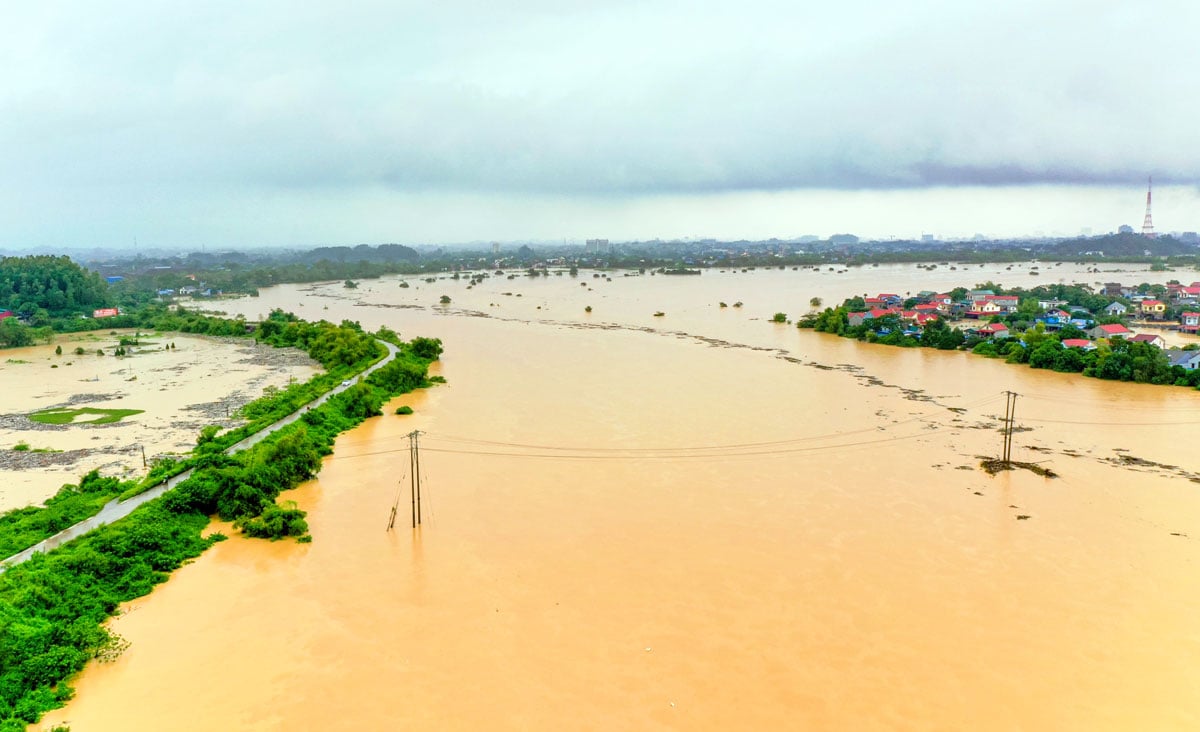
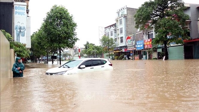
Flood on Cau River at Gia Bay station continues to recede slowly.
According to the forecast of the Thai Nguyen Province Hydrometeorological Station, in the next 12 hours, the flood on Cau River at Gia Bay station will continue to slowly decrease and be about 0.8m above alert level 3; at Cha hydrological station, the flood will continue to slowly rise and peak, possibly reaching a level 1.00-1.20m higher than the historical flood level on August 20, 1971, tomorrow morning, October 9.
In the next 12-24 hours, the flood on Cau River at Gia Bay station will continue to decrease slowly but still remain at a higher level than alert level 2 (alarm level 2 is 26m). At Cha hydrological station, the flood peaked and tends to decrease slowly.
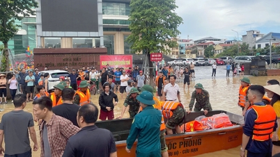
Warning of flood risk, possibility of other accompanying natural disasters: Deep flooding over a large area in many areas of communes and wards such as: Phan Dinh Phung, Gia Sang, Tich Luong, Linh Son, Quan Trieu, Phu Luong, Quang Son, Dong Hy, An Khanh, Yen Trach, La Hien, Nghinh Tuong, Nam Hoa, Trung Hoi, Van Han, Phu Dinh, Trung Hoi, Dong Hy, Dai Phuc, Than Sa, Binh Thanh, Trai Cau, Lam Vy, Dan Tien, Van Xuan, Pho Yen, Diem Thuy, Phu Binh, Kha Son, Phu Binh, Dai Tu, Phu Lac...
Flooding also occurred in the communes: Nam Cuong, Ba Be, Cho Ra, Hiep Luc, Na Ri, Van Lang, Cuong Loi, Con Minh, Xuan Duong, Bac Kan ward, Yen Binh, Cho Moi...
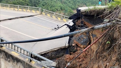
Widespread flooding in communes and wards downstream of Gia Bay hydrological station will last for the next 4-5 days and the depth of flooding will gradually decrease at a rate of about 5-12cm/hour. There is a high risk of flash floods on rivers and streams; landslides on steep mountain slopes, positive slopes, traffic routes, areas with poor soil structure, areas with construction works under construction; and land subsidence.
Flood disaster risk warning level: Level 3.
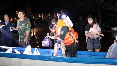
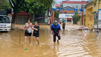
Flood impact warning: Floods cause flooding along rivers, inundation in low-lying areas, roads - spillways... Floods in rivers and streams can cause flash floods, landslides, flooding along rivers, low-lying areas, affecting agricultural production, aquaculture and local residential areas.
Rapidly rising floods cause danger when flowing through culverts, spillways, deeply flooded areas, strong water flows... affecting people's lives and production, threatening people's lives and property and socio-economic activities.
Source: https://baothainguyen.vn/tin-moi/202510/lu-van-con-dien-bien-phuc-tap-can-canh-giac-voi-sat-lo-dat-23e7e92/

![[Photo] Prime Minister Pham Minh Chinh inspects and directs the work of overcoming the consequences of floods after the storm in Thai Nguyen](https://vphoto.vietnam.vn/thumb/1200x675/vietnam/resource/IMAGE/2025/10/08/1759930075451_dsc-9441-jpg.webp)


![[Photo] Prime Minister Pham Minh Chinh attends the World Congress of the International Federation of Freight Forwarders and Transport Associations - FIATA](https://vphoto.vietnam.vn/thumb/1200x675/vietnam/resource/IMAGE/2025/10/08/1759936077106_dsc-0434-jpg.webp)


Comment (0)