
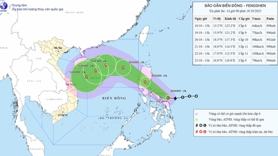
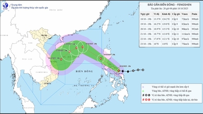
At 7:00 p.m. on October 17, the center of the tropical depression was at about 13.5 degrees North latitude; 129.0 degrees East longitude, in the sea east of the central Philippines. The intensity and direction of movement remained unchanged with the strongest wind near the center of the tropical depression at level 7 (50-61 km/h), gusting to level 9. Moving west at a speed of 20-25 km/h.
At 7:00 p.m. on October 18, the tropical depression in the sea east of the central Philippines, with strong winds of force 8, gusts of force 10, moved west at a speed of about 20-25 km/h and was likely to strengthen into a storm.
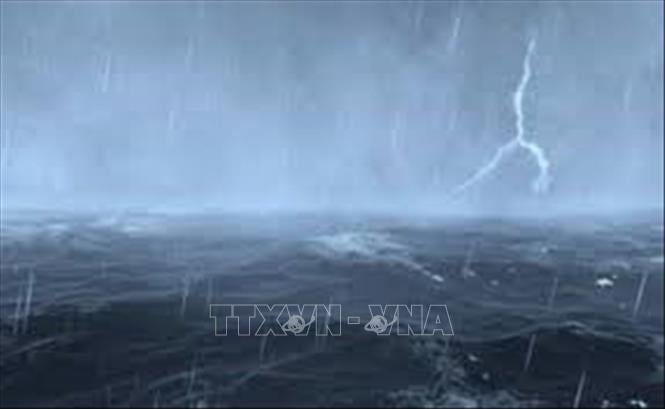
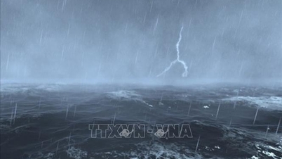
As of 7:00 p.m. on October 19, the storm was in the eastern sea of the North East Sea, with strong winds of level 8, gusts of level 10, moving northwest at a speed of about 20-25 km/h. The affected area was the eastern sea of the North East Sea. Disaster risk level 3.
From the next 48 to 72 hours, the storm will move mainly in the West-Northwest direction, traveling 20-25 km per hour and is likely to strengthen.
Due to the impact of the storm, from October 19, the eastern sea area of the North East Sea will have winds gradually increasing to level 6-7; near the center of the storm, winds will be level 8, gusting to level 10, waves 2.5-4.5m high. The sea will be rough.
Warning: Between October 20 and 22, the North East Sea area (including Hoang Sa special zone) is likely to be affected by strong winds of level 9-11, gusting to level 14.
Vessels operating in the above mentioned dangerous areas are susceptible to the impact of storms, whirlwinds, strong winds and large waves.
Source: https://baotintuc.vn/van-de-quan-tam/du-bao-ap-thap-nhiet-doico-kha-nang-manh-len-thanh-bao-vao-toi-ngay-1810-20251017203925450.htm
![[Photo] Closing ceremony of the 18th Congress of Hanoi Party Committee](https://vphoto.vietnam.vn/thumb/1200x675/vietnam/resource/IMAGE/2025/10/17/1760704850107_ndo_br_1-jpg.webp)
![[Photo] Immerse yourself in the colorful musical world of “Secret Garden Live in Vietnam”](https://vphoto.vietnam.vn/thumb/1200x675/vietnam/resource/IMAGE/2025/10/18/1760805978427_ndo_br_thiet-ke-chua-co-ten-41-png.webp)
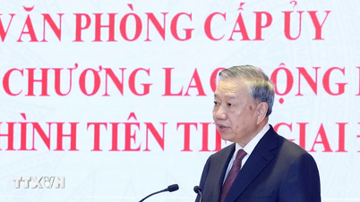
![[Photo] General Secretary To Lam attends the 95th Anniversary of the Party Central Office's Traditional Day](https://vphoto.vietnam.vn/thumb/1200x675/vietnam/resource/IMAGE/2025/10/18/1760784671836_a1-bnd-4476-1940-jpg.webp)
![[Photo] Collecting waste, sowing green seeds](https://vphoto.vietnam.vn/thumb/1200x675/vietnam/resource/IMAGE/2025/10/18/1760786475497_ndo_br_1-jpg.webp)


Comment (0)