
The model is effective in contributing to the transparency of planning information, improving the efficiency of urban management, supporting management agencies in planning work, helping to make quick and accurate decisions in controlling and adjusting ineffective planning projects.
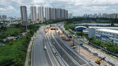
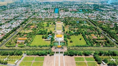
The application of geographic information systems (GIS) to integrate the trend of the 4th industrial revolution with the core being the breakthrough of digital technology is a policy that Binh Dinh is particularly interested in. Based on this, in 2023, the provincial functional sector will pilot the model in Hoai Nhon town (planned to become the core urban area in the North of Binh Dinh province).
After a short time of implementation, the model has brought positive results, helping the locality build a complete GIS database for construction planning through the processes of surveying, collecting, updating and inheriting data. Digitizing, editing and correcting coordinates in accordance with the regulations and standards issued by the state on GIS data; building a software system on WebGIS platforms and mobile Apps such as the application "Management of planning information", "Look up planning information", "Mobile app for looking up planning information"...
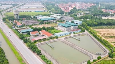
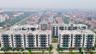
In 2024, Phu Cat district will begin implementing a model of applying Science and Technology to standardize the general construction planning information database system and pilot an online lookup system for detailed planning information of 3 urban areas (Ngo May town, Cat Tien town and Cat Khanh town) with many significant improvements.
The planning information lookup system of Phu Cat district has so far standardized 46 planning projects (including 1 regional planning, 4 general urban planning, 14 general construction planning of 14 communes and 27 detailed planning for the 3 above-mentioned urban areas). The GIS database includes a group of background data and 9 groups of construction planning data with more than 95,000 digitized objects such as: Data on land use planning, traffic, power supply system, lighting, water supply and drainage, trees, communications, environmental impact assessment.
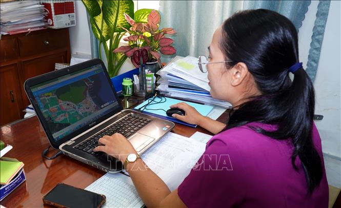
Ms. Nguyen Thi Kim Lien, Deputy Head of the Economic and Infrastructure Department of Phu Cat district, assessed that the system brings many practical benefits, especially effectively supporting the work of leadership, management and information search. It not only helps to quickly provide planning information, the system's navigation function, but also helps investors find locations easily. Thereby, helping to improve the ability to attract investment. This system is a technological solution designed to standardize and publicly disclose urban planning data. Built on the WebGIS technology platform (Web-based Geographic Information System) combined with interactive map technology, the system allows users to easily look up detailed planning information such as land use purposes, construction density, maximum number of floors, land use coefficient and information on technical infrastructure.
The online planning lookup system uses cloud storage, replacing traditional paper management to help avoid data loss and support information sharing between departments and branches. With the shared function, users can access public information without logging in. This system is publicly available at http://quyhoachphucat.ditagis.com, allowing users to look up planning information via internet-connected devices instead of going directly to state agencies, helping to save time and reduce the workload for management staff.
“Because of this convenience, the district is making efforts to standardize detailed planning for the remaining 14 communes, especially the area south of De Gi lagoon and Cat Hiep industrial cluster to better serve the needs of people and businesses,” said Ms. Nguyen Thi Kim Lien.

Dr. Nguyen Huu Ha, Deputy Director of the Department of Science and Technology of Binh Dinh province, informed that urban management in our country as well as other countries in the world is facing great challenges such as rapid increase in urban population, urbanization process, environmental pollution, management of urban infrastructure systems, especially underground infrastructure, has not met the speed of urban development. Therefore, the application of information technology in urban management is necessary; in which the outstanding is the geographic information system (GIS - Geographic Information Systems) - a useful technology in management, processing and integrating urban data with geographical coordinates (maps) with different types of data to turn into useful information to assist managers in choosing locations, managing infrastructure, providing urban services in a reasonable manner...
Dr. Nguyen Huu Ha stated that the model has attracted the attention of many localities and the Department is building a roadmap to gradually replicate it throughout the province. In the long term, in order for the system to maximize its effectiveness, the Department plans to issue regulations on updating and exploiting GIS data to serve the management of urban construction planning and technical infrastructure in the province in order to establish, maintain and operate a framework database for the urban system on the GIS platform implemented in the initialization phase as well as to connect planning data with data on population, land, traffic, environment and construction investment.
The Department coordinates with relevant departments and branches to continue to deploy GIS applications to serve urban management in the direction of 3D GIS, BIM; using high-precision satellite data in real time to implement a pilot model of smart urban management according to the 3D - 4D model to monitor urban changes in near real time (Near Realtime)...
Source: https://doanhnghiepvn.vn/cong-nghe/hieu-qua-ung-dung-cong-nghe-so-vao-tra-cuu-truc-tuyen-thong-tin-quy-hoach/20250514073123796


Comment (0)