
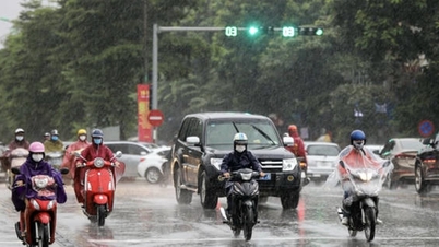
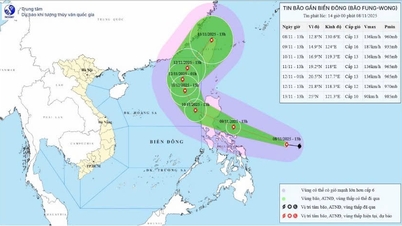
Storm No. 3 has just dissipated, this morning near the East Sea, a tropical depression and a storm appeared at the same time, with the possibility of a double storm appearing in the western Pacific region. The National Center for Hydro-Meteorological Forecasting said that at 10:00 a.m. on July 23, a tropical depression appeared near the East Sea. The center of the tropical depression was located at about 18.1 degrees north latitude and 120.1 degrees east longitude, in the sea northwest of Luzon Island (Philippines). The strongest wind near the center of the tropical depression is level 6 (39 - 49 km/h), gusting to level 8, moving west-southwest at a speed of about 15 km/h.

Early this morning, storm number 7 appeared in the western Pacific Ocean. There is a possibility of a double storm appearing in this ocean in the next few days. SOURCE: JMA
At 10:00 p.m. on July 23, the center of the tropical depression was at about 17.8 degrees north latitude and 118.9 degrees east longitude; in the eastern sea of the northern East Sea. The strongest wind near the center of the tropical depression was at level 7, gusting to level 9. The warning level of natural disaster risk in the eastern sea of the northern East Sea reached level 3.
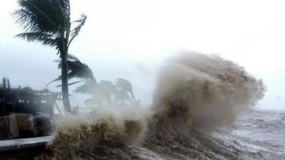
The tropical depression continues to move west-southwest at a speed of 10-15 km/h and is likely to intensify. At 10:00 on July 24, the center of the tropical depression was at about 16.9 degrees north latitude and 118.5 degrees east longitude; in the sea east of the northern East Sea. The strongest wind speed reached level 8, gusting to level 10 and could strengthen into a storm.
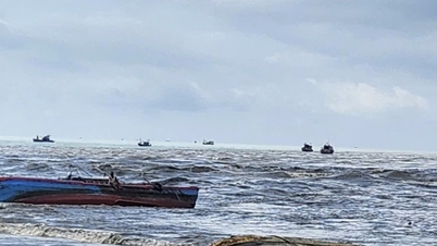
The eastern sea area of the northern East Sea has strong winds of level 6 - 7, near the storm center strong winds of level 8, gusts of level 10; waves 2 - 3.5m high. The sea is very rough. Ships operating in the above dangerous areas are likely to be affected by storms, whirlwinds, strong winds, and big waves.

A new tropical depression has appeared near the East Sea and is likely to strengthen into a storm. SOURCE: NCHMF
In addition, according to the Japan Meteorological Agency (JMA), this morning, in the east of the Philippines, a tropical depression has strengthened into a storm, the 7th storm in the northwest Pacific Ocean with the international name Francisco. This storm is forecast to not enter the East Sea but move towards the sea north of Taiwan.
According to meteorological experts, if the tropical depression near the East Sea strengthens into a storm as predicted, there is a possibility of a double storm in the northwest Pacific Ocean in the coming days. The weather in the coming days will continue to be complicated, so people and local authorities are advised to continue monitoring and updating related information./.
According to Thanh Nien Newspaper
Source: https://thanhnien.vn/kha-nang-xuat-hien-bao-doi-gan-bien-dong-185250723135211152.htm
Source: https://baolongan.vn/kha-nang-xuat-hien-bao-doi-gan-bien-dong-a199316.html


![[Photo] Cutting hills to make way for people to travel on route 14E that suffered landslides](https://vphoto.vietnam.vn/thumb/1200x675/vietnam/resource/IMAGE/2025/11/08/1762599969318_ndo_br_thiet-ke-chua-co-ten-2025-11-08t154639923-png.webp)


![[Photo] "Ship graveyard" on Xuan Dai Bay](https://vphoto.vietnam.vn/thumb/1200x675/vietnam/resource/IMAGE/2025/11/08/1762577162805_ndo_br_tb5-jpg.webp)


![[Video] Hue Monuments reopen to welcome visitors](https://vphoto.vietnam.vn/thumb/402x226/vietnam/resource/IMAGE/2025/11/05/1762301089171_dung01-05-43-09still013-jpg.webp)


Comment (0)