
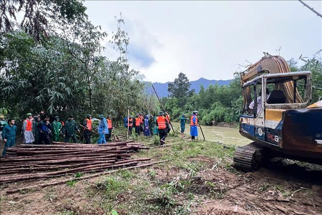
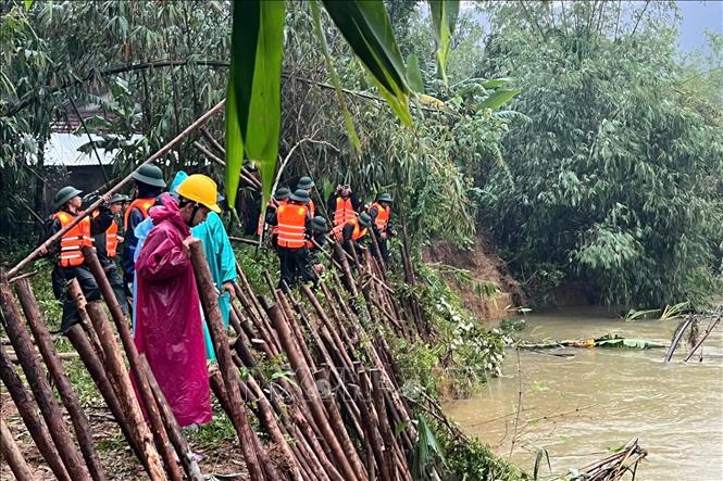
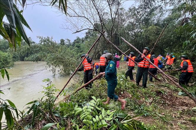
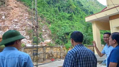
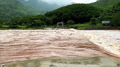
Regardless of the unfavorable rainy weather, the forces of Chan May Port Border Guard Station, Lang Co Border Guard Station and the Command of Region 3 - Phu Loc together with the militia and commune police organized reinforcement, using wooden stakes, tarpaulins, soil and rocks to fill and consolidate the eroded riverbank, promptly ensuring safety for people in the neighboring area.
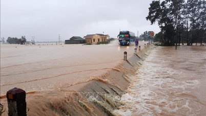
The erosion of the Bu Lu riverbank has been happening for many years and is getting more and more serious. The erosion in many sections, with a total length of about 1km, has caused dozens of households living along the river to live in a state of anxiety and insecurity. The heavy rains in recent days are continuing to cause erosion of the riverbanks here.
Previously, on October 15-16, Chan May - Lang Co commune deployed forces to evacuate 5 households near the banks of Bu Lu River (a branch of the Nuoc Ngot River) to a safe place. Currently, local authorities and units maintain standing forces, closely monitor the development of floods and rains, proactively respond, contributing to ensuring the safety of people's lives and property.
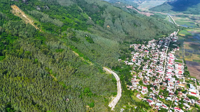
In addition to the risk at the Bu Lu River, the Department of Irrigation and Climate Change (Department of Agriculture and Environment of Hue City) also warned that many areas of Chan May - Lang Co commune will be affected by the tropical depression near the East Sea that is likely to strengthen into a storm in the coming days. Specifically, Phu Gia and Tho Son villages are at risk of landslides in mountainous areas.
National Highway 49B section through the old Loc Binh commune; Bach Thach village; Phuoc Tuong, Phu Gia, Hai Van passes; the road to Bach Ma peak; the slope along the road to Laguna tourist area; the eastern slope of Chan May-Lang Co cape and the road from Tu Hien bridge to Loc Binh beach are at risk of landslides.
Source: https://baotintuc.vn/xa-hoi/khan-truong-khac-phuc-sat-lo-o-xa-chan-may-lang-co-20251018151415956.htm


![[Photo] General Secretary To Lam attends the 95th Anniversary of the Party Central Office's Traditional Day](https://vphoto.vietnam.vn/thumb/1200x675/vietnam/resource/IMAGE/2025/10/18/1760784671836_a1-bnd-4476-1940-jpg.webp)

![[Photo] Closing ceremony of the 18th Congress of Hanoi Party Committee](https://vphoto.vietnam.vn/thumb/1200x675/vietnam/resource/IMAGE/2025/10/17/1760704850107_ndo_br_1-jpg.webp)


![[Photo] Nhan Dan Newspaper launches “Fatherland in the Heart: The Concert Film”](https://vphoto.vietnam.vn/thumb/1200x675/vietnam/resource/IMAGE/2025/10/16/1760622132545_thiet-ke-chua-co-ten-36-png.webp)


Comment (0)