
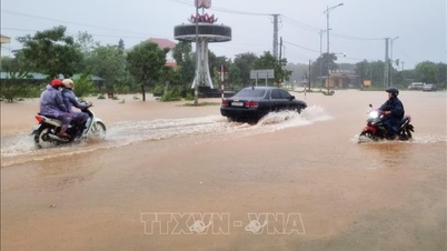
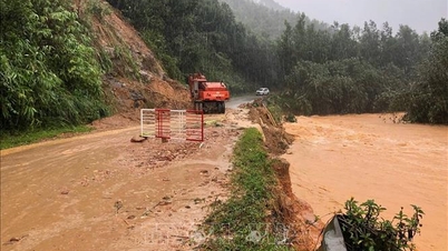
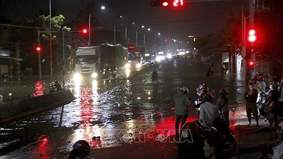
There is a high risk of flooding in low-lying areas along rivers, flash floods and landslides on steep slopes in provinces from Quang Tri to Hue city (real-time warning information on areas at risk of flash floods and landslides is provided online on the website of the Department of Hydrometeorology at: https://luquetsatlo.nchmf.gov.vn and in a separate bulletin warning of flash floods and landslides).
Level 1 flood disaster risk.
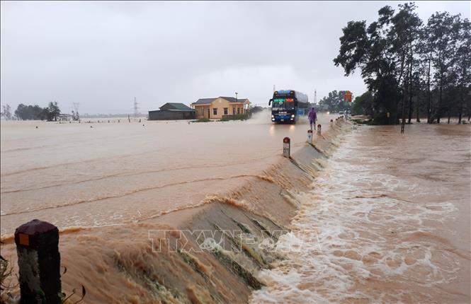
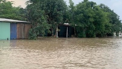
Floods on rivers and streams can cause flooding in low-lying areas along rivers, affecting activities such as waterway transport, aquaculture, agricultural production, people's lives and socio- economic activities.
Currently, the water level on rivers from Quang Tri to Hue city is rising. The water level on Bo river at Phu Oc at 7pm on October 16 was 2.12m, 0.62m above alarm level 1, other rivers are still below alarm level 1.
Along with that, at sea, the National Center for Hydro-Meteorological Forecasting said that on the night of October 16 and October 17, the sea area from South Quang Tri to Ca Mau, from Ca Mau to An Giang, the Gulf of Thailand, the South East Sea area (including Truong Sa special zone) will have scattered showers and thunderstorms, with the possibility of tornadoes, strong gusts of wind of level 6-7 and waves over 2m high.
All vessels operating in the above areas are at risk of being affected by tornadoes and strong gusts of wind.
According to the guidance of the Ministry of Agriculture and Environment, affected coastal provinces and cities must closely monitor warning bulletins, forecasts and developments of strong winds at sea; notify captains and owners of vehicles and vessels operating at sea to proactively prevent and have appropriate production plans, ensuring safety of people and property; maintain communication to promptly handle bad situations that may occur.
Source: https://baotintuc.vn/van-de-quan-tam/lu-tren-cac-song-tuquang-tri-den-thanh-pho-hue-co-noi-tren-bao-dong-2-20251016210653541.htm
![[Photo] Cat Ba - Green island paradise](/_next/image?url=https%3A%2F%2Fvphoto.vietnam.vn%2Fthumb%2F1200x675%2Fvietnam%2Fresource%2FIMAGE%2F2025%2F12%2F04%2F1764821844074_ndo_br_1-dcbthienduongxanh638-jpg.webp&w=3840&q=75)


Comment (0)