
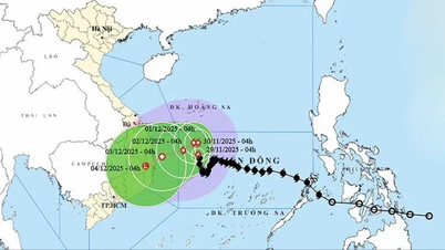
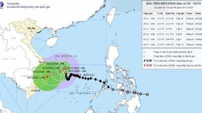
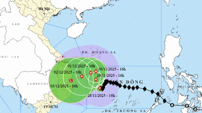
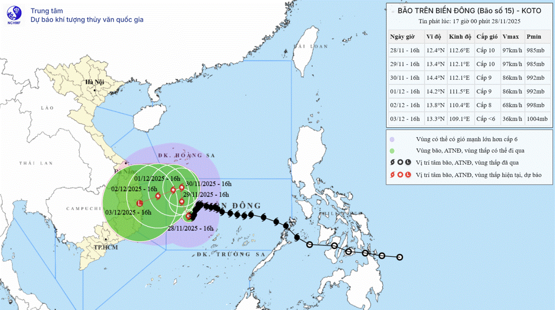
According to the National Center for Hydro-Meteorological Forecasting, storm No. 15 in the western sea of the central East Sea has weakened but is continuously changing direction.
On the afternoon of November 28, the storm center was at about 12.4 degrees North latitude - 112.6 degrees East longitude, about 195km northwest of Song Tu Tay island. The strongest wind near the storm center was level 10 (89-102km/h), gusting to level 13. The storm moved slowly southwest at a speed of 5km/h.

The Meteorological and Hydrological Agency said that from the evening of November 28 to the evening of November 29, storm No. 15 changed direction to move to the North-Northwest (speed of about 5km/hour), the intensity decreased to level 9-10, gusting to level 13 in the western sea of the central East Sea, about 300km northwest of Song Tu Tay island.
From the evening of November 29 to 30, the storm moved at a speed of 3-5km/hour in a northwest direction, decreasing to level 9, gusting to level 12 in the northwest sea of the central East Sea, about 300km east of the eastern coast of Gia Lai province.
From the evening of November 30 to the evening of December 1, the storm changed direction to West Southwest with a speed of 3km/hour, decreasing to level 8-9, gusting to level 12 in the northwest sea of the central East Sea, about 250km east of the eastern coast of Gia Lai province.
The storm then moved slowly west-southwest at a speed of about 5km/h and continued to weaken. The National Center for Hydro-Meteorological Forecasting warned that the offshore waters from Gia Lai to Khanh Hoa would have strong winds of level 6-7, later increasing to level 8, gusting to level 9-10, waves 4-6m high, and rough seas.
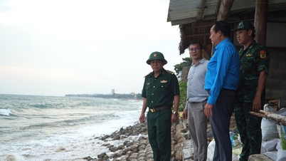
Faced with the complicated movement of storm No. 15, which is at risk of affecting the South Central region, Deputy Minister of Agriculture and Environment Nguyen Hoang Hiep signed an official dispatch to the People's Committees of 6 provinces and cities from Da Nang to Lam Dong, requesting urgent implementation of measures to ensure safety for the dike system in the context that the storm may directly affect the area that has just experienced heavy rains and floods, easily causing landslides on dike routes and increasing the risk of unsafe constructions due to heavy rain from the storm's circulation.
In the dispatch, the Ministry of Agriculture and Environment requested localities to strictly implement the direction in Official Dispatch No. 231/CD-TTg dated November 26, 2025 of the Prime Minister, closely monitor storm developments and dike situation, inspect and immediately deploy dike protection plans at key locations, and at the same time fully prepare forces, materials and means according to the 4 on-site motto. Localities must promptly report any dike incidents so that the Ministry of Agriculture and Environment can promptly coordinate and direct handling.

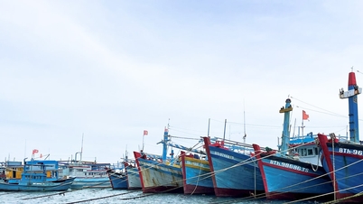
On the afternoon of November 28, the National Civil Defense Steering Committee also issued a telegram to the People's Committees of provinces and cities from Da Nang to An Giang and relevant ministries and branches on proactively responding to the tropical depression that is moving up in the South East Sea.
In the dispatch, the Steering Committee requested the above localities to strictly manage the means of transport going out to sea; organize the counting and notify the owners of the means of transport, captains of ships and boats operating at sea of the location, direction of movement and developments of the tropical depression so that they can proactively avoid, escape or not move into the dangerous area. For now, the dangerous area on November 29 is the area south of the 7th parallel and from the 104th to 108.6th longitude (the dangerous area is adjusted according to the new developments of the tropical depression).
Source: https://www.sggp.org.vn/khan-truong-ung-pho-bao-so-15-va-ap-thap-nhiet-doi-post826020.html


Comment (0)