
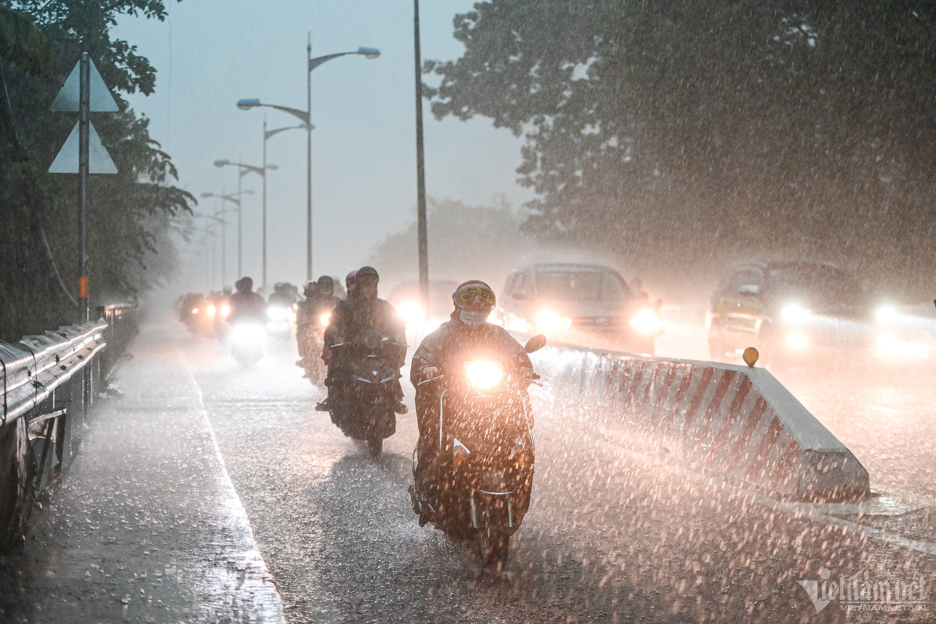
Another very strong cold air mass has strengthened down to our country, causing the temperature in the entire North to continue to drop sharply, the weather has turned very cold, with some places having the lowest temperature below 5 degrees Celsius; in Hanoi, it is 10 degrees Celsius.
On the afternoon of December 12, the National Center for Hydro-Meteorological Forecasting said that the cold air mass that will continue to affect the North Central region, most of the Northwest region and some places in the Central Central region on the afternoon of December 11 continued to affect the North Central region, most of the Northwest region and some places in the Central Central region; in the Gulf of Tonkin, there were strong northeast winds of level 6, sometimes level 7, gusting to level 8.
Tonight and tomorrow (December 13), the cold air will continue to affect other places in the Northwest and North Central regions.
From tomorrow night, the cold air will strengthen and affect the South Central region. The Northeast wind inland will be strong at level 3, and coastal areas at level 4-5.

Due to the influence of consecutive cold air waves, the Northern and North Central regions continue to experience cold weather, with severe cold in the mountainous areas of the North.
Notably, from tomorrow night, the North and Thanh Hoa will experience severe cold, with mountainous areas experiencing severe cold. The lowest temperature during this cold spell in the North will generally be 10-13 degrees Celsius, in mountainous areas 7-10 degrees Celsius, and in high mountainous areas below 5 degrees Celsius; in the North Central region, it will generally be 12-15 degrees Celsius.
As for Hanoi, the weather will continue to be cold, from tomorrow night it will be very cold. The lowest temperature in this cold air mass is commonly 10-13 degrees.
Due to the influence of cold air combined with disturbances in the upper easterly wind zone, from this evening until about December 15, in the Central and South Central regions, there will be moderate rain, heavy rain and thunderstorms, locally very heavy rain; in the North Central region, there will be rain and showers. During thunderstorms, there is a possibility of tornadoes, lightning and strong gusts of wind.
Previously, Mr. Nguyen Van Huong, Head of Weather Forecast Department, National Center for Hydro-Meteorological Forecasting, said that on the afternoon of December 11, the North was affected by the Northeast monsoon. From December 12-14, cold air continuously strengthened, so the weather was very cold, with some mountainous areas experiencing severe cold.
"We estimate that around December 14-15, in the mountainous and midland areas of the North, there is a possibility of severe cold," Mr. Huong noted.
In addition, the meteorological agency also forecasts that in the next 1-month period (December 11 - January 10, 2025), cold air tends to be more active than the average of many years in the same period, with the possibility of many days of severe cold.
At sea, in the Gulf of Tonkin, strong northeast wind level 6, sometimes level 7, gusting to level 8-9; rough seas; waves 2-3.5m high. From tomorrow night, there will be strong northeast wind level 6-7, gusting to level 8-9; rough seas; waves 2-4m high.
The North East Sea area (including Hoang Sa archipelago) has strong northeast winds of level 6-7, gusting to level 8-9; rough seas; waves from 3-6m high. The sea area from Quang Tri to Quang Ngai has strong northeast winds of level 6, gusting to level 7-8; rough seas; waves from 2-4.5m high.

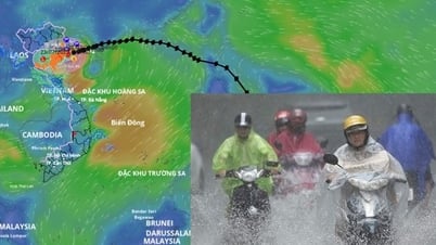
Cold air is active, there will be many days of severe cold in the next month

Cold air continues to flow in, the North is cold continuously
Cold air diffuses, Ho Chi Minh City weather has unseasonal rain and chill
Source: https://vietnamnet.vn/khong-khi-lanh-tiep-tuc-tang-cuong-rat-manh-ha-noi-ret-dinh-diem-10-do-2351714.html


![[Photo] National Assembly Chairman Tran Thanh Man visits Vietnamese Heroic Mother Ta Thi Tran](https://vphoto.vietnam.vn/thumb/1200x675/vietnam/resource/IMAGE/2025/7/20/765c0bd057dd44ad83ab89fe0255b783)


Comment (0)