The land of Gia Lai province today is the long-standing residence of the Jrai and Bahnar ethnic groups, who have the habit of living in villages. Before the French colonialists imposed their domination on the Central Highlands, the Gia Lai ethnic groups were in the final stage of primitive society transitioning to a class society.
Since the early 1940s, French missionaries had penetrated the Bahnar residential areas of Ha Tay commune - Chu Pah district and Ha Dong commune - Dak Doa district today to spread religion. Following the missionaries, the French colonialists increasingly penetrated deeper into the Northern Central Highlands, creating new changes with policies of divide and rule, relying on one group to fight against another, dividing Kinh - Thuong, dividing ethnic groups in the province and in the region from each other.
From the end of the 19th century to the early years of the 20th century, the French colonialists gradually established a governing apparatus on Gia Lai land. After many changes, mergers, and separations to establish administrative units in the Central Highlands, on May 24, 1932, Pleiku province was established (including Pleiku agency and Cheo Reo agency) according to the Decree of the Governor General of Indochina.
Before the August Revolution of 1945, Pleiku province had: Pleiku town (established on December 3, 1929 according to the Decree of the Central Region Resident), An Khe district, Pleikli district, Chu Ty district and Cheo Reo district.
After the success of the August Revolution, the revolutionary government called the province Gia Lai. In June 1946, the French colonialists reoccupied Gia Lai and renamed the province Pleiku. From 1946 to 1954, Pleiku province in particular and the Central Highlands in general went through many governance entities according to the documents of the colonial government and puppet government .
On the revolutionary government side, during the years of resistance against French colonialism, the province's name was still kept as Gia Lai, but at different times, Gia Lai province was under the direct command of different agencies in the region, and the districts in the province also changed their names and administrative boundaries many times.
For the Saigon government, although from 1954 until the day the South was completely liberated, the province's name was still called Pleiku, the province's appearance had changed many times.
From 1954 to 1975, the province's name was still Gia Lai, but the province's administrative boundaries changed a lot during different periods of history.
- On September 20, 1975, according to the Resolution of the Politburo, the two provinces of Gia Lai and Kon Tum were merged into one province called Gia Lai - Kon Tum.
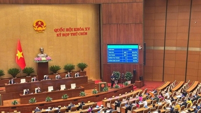
- On August 12, 1991, according to the Resolution of the 9th session of the 8th National Assembly, Gia Lai - Kon Tum was divided into two provinces: Gia Lai and Kon Tum. After the division of the province, Gia Lai continued to divide to establish a number of new districts.
Up to now, Gia Lai Province has 17 administrative units including: Pleiku city; An Khe town, Ayun Pa town, and 14 districts: Chu Pah, Ia Grai, Chu Prong, Duc Co, Chu Se, Mang Yang. Dak Doa, Kbang, Kong Chro, Dak Po, Ia Pa, Phu Thien and Krong Pa, Chu Puh.
According to the history of Gia Lai Provincial Party Committee (1945-2005)
Provincial Information Portal



![[Photo] Prime Minister Pham Minh Chinh chairs the Government's online conference with localities](https://vphoto.vietnam.vn/thumb/1200x675/vietnam/resource/IMAGE/2025/10/5/264793cfb4404c63a701d235ff43e1bd)
![[Photo] Prime Minister Pham Minh Chinh launched a peak emulation campaign to achieve achievements in celebration of the 14th National Party Congress](https://vphoto.vietnam.vn/thumb/1200x675/vietnam/resource/IMAGE/2025/10/5/8869ec5cdbc740f58fbf2ae73f065076)















![[VIDEO] Summary of Petrovietnam's 50th Anniversary Ceremony](https://vphoto.vietnam.vn/thumb/402x226/vietnam/resource/IMAGE/2025/10/4/abe133bdb8114793a16d4fe3e5bd0f12)
![[VIDEO] GENERAL SECRETARY TO LAM AWARDS PETROVIETNAM 8 GOLDEN WORDS: "PIONEER - EXCELLENT - SUSTAINABLE - GLOBAL"](https://vphoto.vietnam.vn/thumb/402x226/vietnam/resource/IMAGE/2025/7/23/c2fdb48863e846cfa9fb8e6ea9cf44e7)














Comment (0)