

Currently, the flood on the upper reaches of the Red River flowing through Lao Cai ward is decreasing. It is forecasted that by 7:00 p.m. on July 2, the water level will likely decrease to 79.20m and then fluctuate little.
Previously, the Lao Cai Province Hydrometeorological Station said that due to the impact of prolonged heavy rain in the locality, combined with heavy rain in the Chinese basin, floods from upstream caused high floods on the Red River, the section flowing through Lao Cai ward.
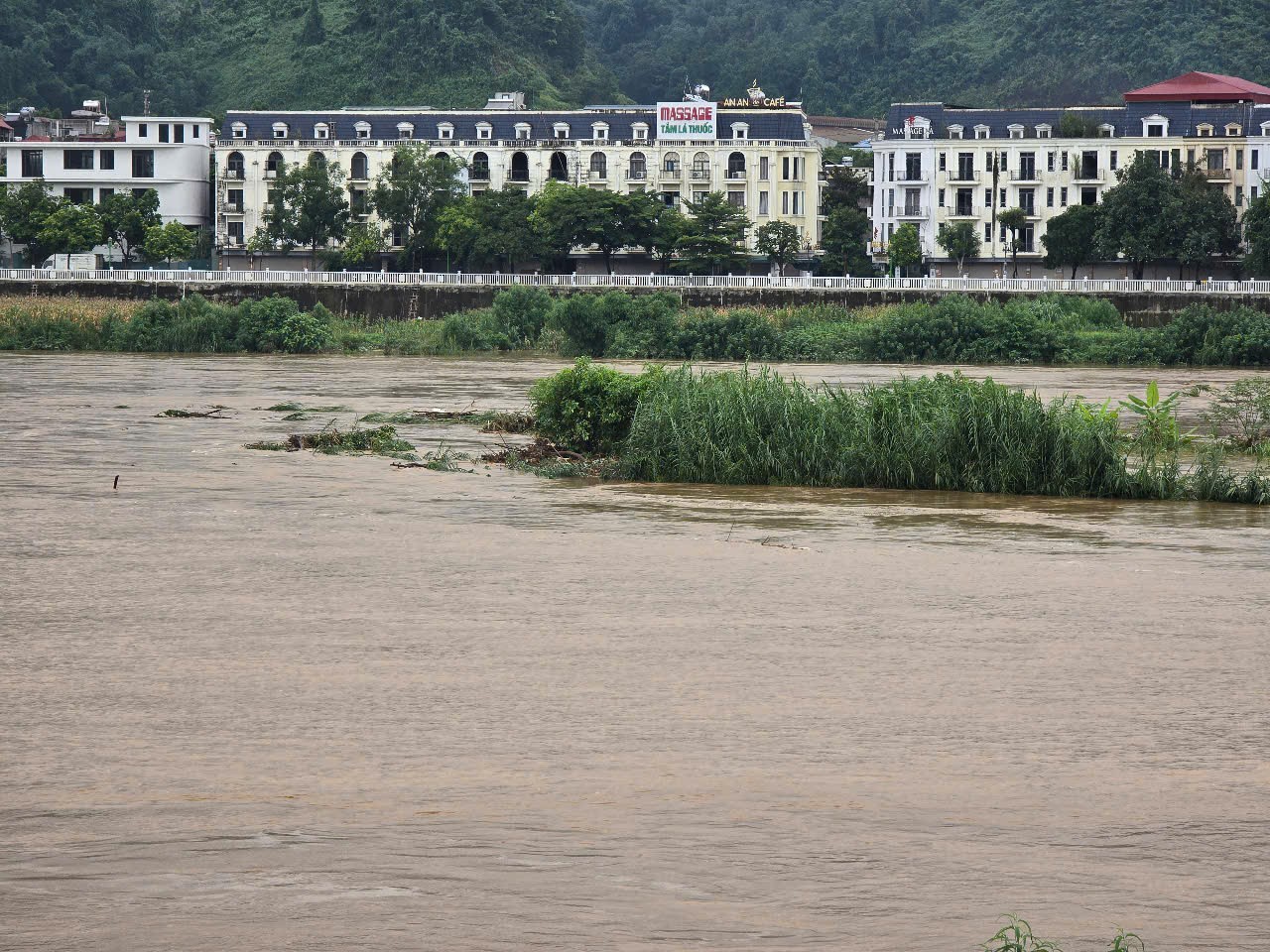
According to monitoring data from Lao Cai Hydrological Station, from the evening of July 1, the flood rose rapidly, and by 3am on July 2, the flood peaked at 80.86m. The flood amplitude was 3.55m; 0.55m above alert level 1.
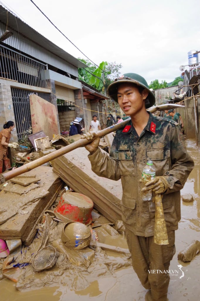
Rising flood waters swept away sand and soil, burying and deeply inundating many areas of crops and vegetables of all kinds grown by people along both sides of the low-lying riverside areas.
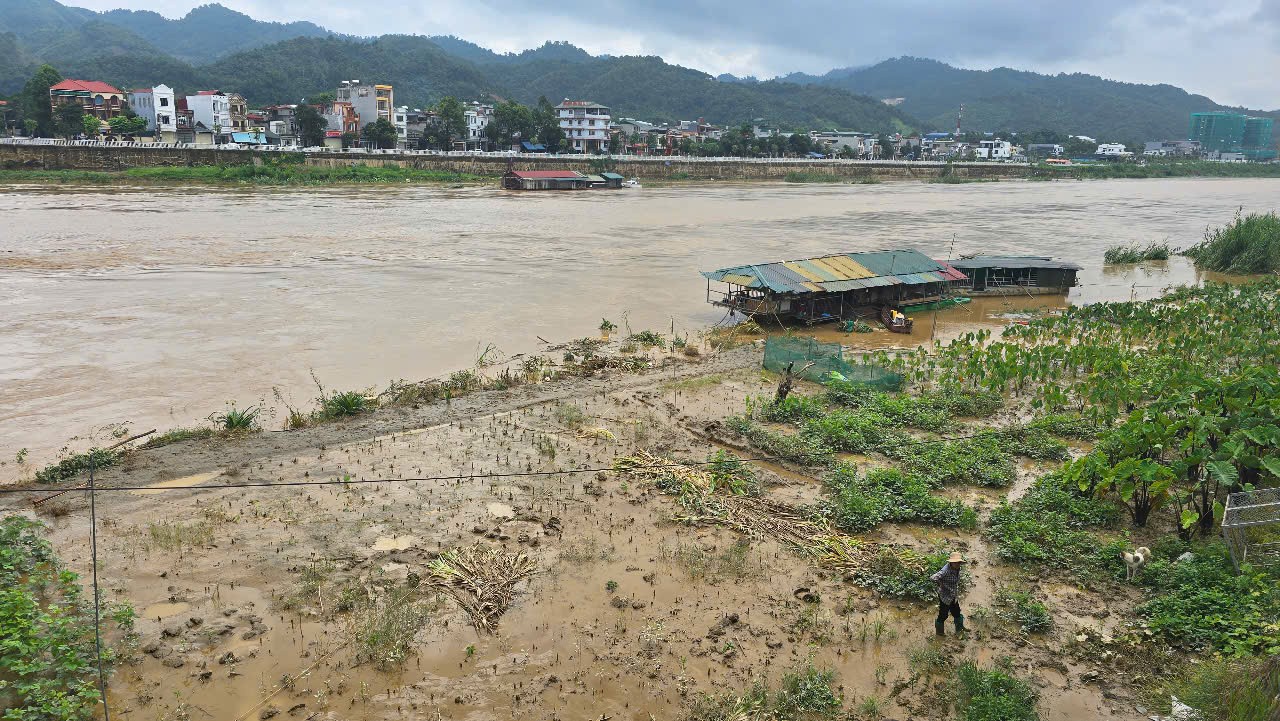
Immediately after receiving news of the flood, authorities at all levels in areas where the Red River flows through urgently directed people living along the river to come up with plans to avoid the flood. Closely monitor the flood situation on the river, be ready to evacuate people and property to safety when the water continues to rise; on-site rescue forces are currently helping people in flooded areas to overcome the consequences.
This is the biggest flood to appear on the Red River in Lao Cai ward since the beginning of the rainy season.

Source: https://baolaocai.vn/lu-dau-nguon-song-hong-doan-chay-qua-phuong-lao-cai-dang-giam-post647827.html


![[Photo] National Assembly Chairman attends the seminar "Building and operating an international financial center and recommendations for Vietnam"](https://vphoto.vietnam.vn/thumb/1200x675/vietnam/resource/IMAGE/2025/7/28/76393436936e457db31ec84433289f72)


Comment (0)