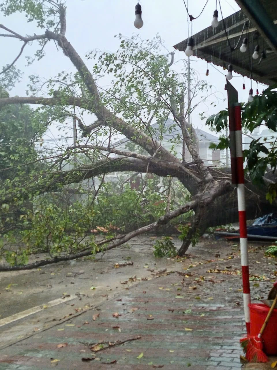
According to records from Da Bac, Cao Phong, Kim Boi, Mai Chau districts and Hoa Binh city, from 2 to 3 p.m. on the same day, there were thunderstorms with tornadoes and strong winds equivalent to storm levels. Many metal roofs were blown away and electric poles were broken.
Notably, in the Doc Cun area (Highway 6), a large banyan tree was blown down by the wind, crushing a small car. Fortunately, there were no casualties.
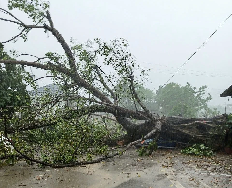
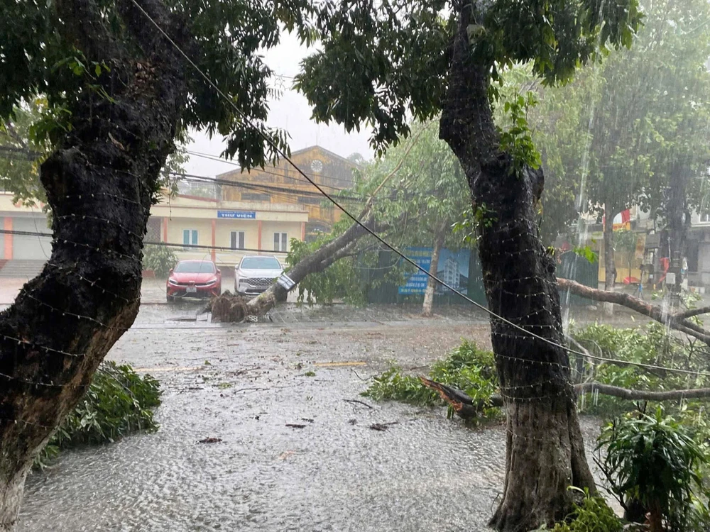
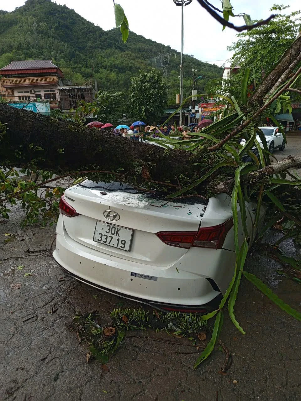
According to the National Center for Hydro-Meteorological Forecasting, this phenomenon is a type of afternoon thunderstorm, which often occurs when the heat reaches its peak and meets mountainous terrain conditions. Cumulonimbus clouds are formed by moist air from the sea combined with heat from the ground and the terrain being lifted, causing strong convection.
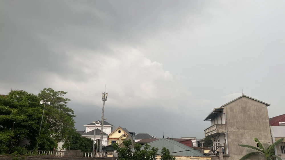
It is forecasted that from the evening to tomorrow night, May 5, the Northern region will continue to have the possibility of localized thunderstorms, accompanied by dangerous weather phenomena such as lightning, strong gusts of wind, tornadoes, and even hail.
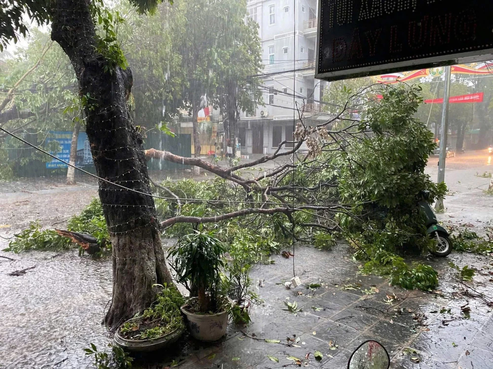
People should closely monitor the weather forecast from 2pm to 6pm every day. When dark clouds are detected coming from the West or Southwest, they should quickly find a safe shelter, away from large trees, electric poles and open areas.
Source: https://www.sggp.org.vn/may-dong-quat-do-cay-da-co-thu-o-hoa-binh-canh-bao-thoi-tiet-ngu-hiem-chieu-toi-5-5-post793747.html


![[Photo] Determining the pairs in the team semi-finals of the National Table Tennis Championship of Nhan Dan Newspaper](https://vphoto.vietnam.vn/thumb/1200x675/vietnam/resource/IMAGE/2025/5/21/eacbf7ae6a59497e9ae5da8e63d227bf)


![[Photo] Scientific workshop "Building a socialist model associated with socialist people in Hai Phong city in the period of 2025-2030 and the following years"](https://vphoto.vietnam.vn/thumb/1200x675/vietnam/resource/IMAGE/2025/5/21/5098e06c813243b1bf5670f9dc20ad0a)
![[Photo] Prime Minister Pham Minh Chinh attends the groundbreaking ceremony of Trump International Hung Yen Project](https://vphoto.vietnam.vn/thumb/1200x675/vietnam/resource/IMAGE/2025/5/21/ca84b87a74da4cddb2992a86966284cf)
![[Photo] Prime Minister Pham Minh Chinh receives Rabbi Yoav Ben Tzur, Israeli Minister of Labor](https://vphoto.vietnam.vn/thumb/1200x675/vietnam/resource/IMAGE/2025/5/21/511bf6664512413ca5a275cbf3fb2f65)








Comment (0)