
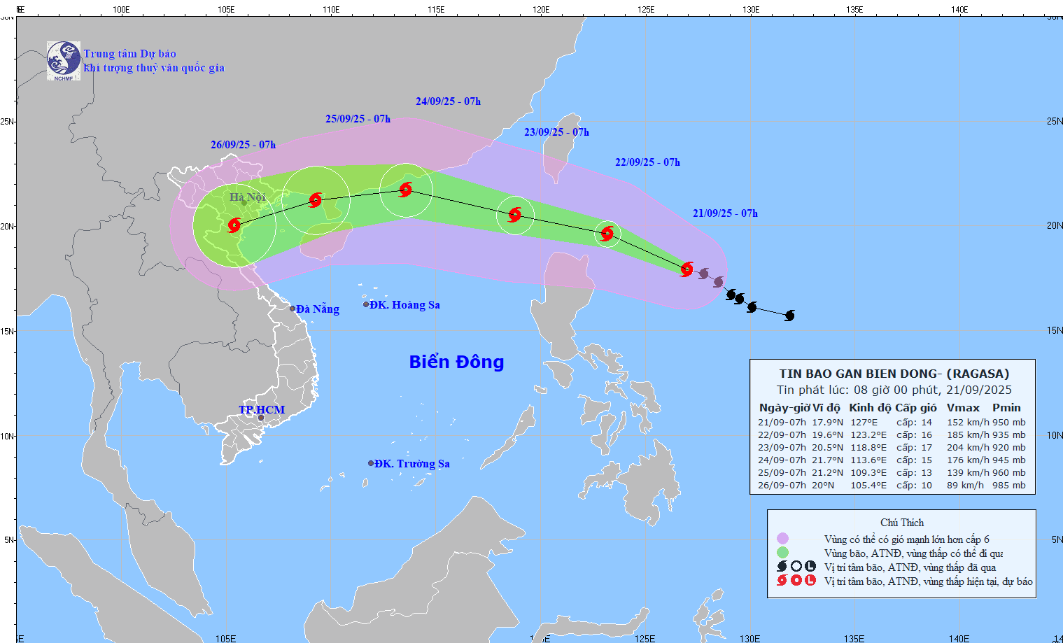
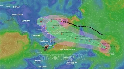
The strongest wind near the storm center is level 14 (150-166 km/h), gusting to level 17. Moving in the West Northwest direction at a speed of about 15 km/h.
At 7:00 a.m. on September 22, the storm was about 180 km northeast of Luzon Island (Philippines) with strong winds of level 16, gusting over level 17; moving west-northwest at a speed of about 15 - 20 km/h and likely to strengthen.
At 7:00 a.m. on September 23, the storm was in the eastern sea, the North Northeast region with strong winds of level 16-17, gusting over level 17; moving in the West Northwest direction at a speed of about 15-20 km/h and entering the East Sea. The affected area is the eastern sea of the North East Sea. Disaster risk level 4.
At 7:00 a.m. on September 24, the storm was in the sea of Guangdong province (China) with strong winds of level 15, gusting over level 17; moving in the West Northwest direction at a speed of about 20-25 km/h. The affected area is the North East Sea. Disaster risk level is level 4.
From the next 72 to 120 hours, the storm will move mainly in the West Southwest direction at about 20 km per hour, gradually weakening in intensity.
Associate Professor, PhD, Director of the National Center for Hydro-Meteorological Forecasting Mai Van Khiem noted: Due to the influence of the storm, from September 22, the eastern sea area of the North East Sea will have strong winds gradually increasing to level 8-9, then increasing to level 10-14, the area near the storm's center will have winds of level 15-17, gusts above level 17, waves over 10m high; the sea will be very rough.
Vessels operating in the above mentioned dangerous areas are susceptible to the impact of storms, whirlwinds, strong winds and large waves.
Source: https://baotintuc.vn/xa-hoi/sieu-bao-ragasa-chuyen-huong-tay-tay-bac-va-co-kha-nang-manh-them-20250921090512094.htm


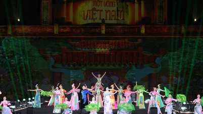
![[Photo] Discover unique experiences at the first World Cultural Festival](https://vphoto.vietnam.vn/thumb/1200x675/vietnam/resource/IMAGE/2025/10/11/1760198064937_le-hoi-van-hoa-4199-3623-jpg.webp)


![[Photo] General Secretary attends the parade to celebrate the 80th anniversary of the founding of the Korean Workers' Party](https://vphoto.vietnam.vn/thumb/1200x675/vietnam/resource/IMAGE/2025/10/11/1760150039564_vna-potal-tong-bi-thu-du-le-duyet-binh-ky-niem-80-nam-thanh-lap-dang-lao-dong-trieu-tien-8331994-jpg.webp)
![[Photo] Opening of the World Cultural Festival in Hanoi](https://vphoto.vietnam.vn/thumb/1200x675/vietnam/resource/IMAGE/2025/10/10/1760113426728_ndo_br_lehoi-khaimac-jpg.webp)


Comment (0)