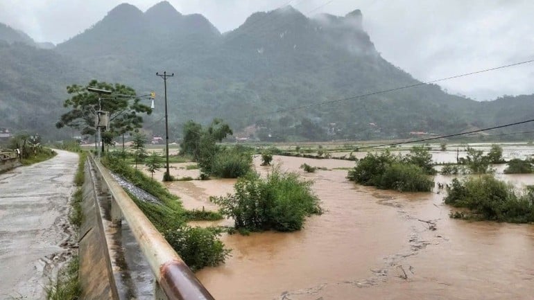
Currently, flood levels on Cau River and Thuong River ( Bac Ninh ) are rising; on Luc Nam River (Bac Ninh) at Luc Nam station reached a peak of 5.41m (6:00 p.m. on October 7), 0.11m above alert level 2 and fluctuating at a high level; water levels on other rivers in the North are rising.
Water levels at 7:00 p.m. on October 7 on rivers are as follows:
On Cau River at Gia Bay station 29.57m, 0.76m above the historical level in 2024 (28.81m); at Dap Cau station 5.71m, 0.41m above alarm level 2;
On Thuong River at Cau Son station 16.64m, above alarm level 3 0.64m; at Phu Lang Thuong station 6.47m, above alarm level 3 0.17m;
On Luc Nam River at Luc Nam station 5.4m, above alarm level 2 0.1m;
On Thai Binh River at Pha Lai station 4.39m above alarm level 1 0.39m.
In the next 12 hours, the flood on Cau River at Dap Cau station, on Thuong River at Phu Lang Thuong station will continue to rise above alert level 3, especially the upstream of Cau River ( Thai Nguyen ) at Gia Bay station is likely to peak at 29.7m in the next few hours, 2.7m above alert level 3 (0.89m above the historical flood in 2024); the flood on Luc Nam River at Luc Nam station will fall below alert level 2.
In the next 12-24 hours, flood on Cau River at Dap Cau station and Thuong River at Phu Lang Thuong station will continue to rise above alert level 3. Flood on Luc Nam River at Luc Nam station will continue to decrease and will be at alert level 1-alarm level 2.
The Meteorological Agency warned that from tonight until October 9, floods on rivers in the Northern region will continue to rise. During this flood, the flood peak on the Thai Binh River (Hai Phong) will reach alert level 2; the flood peak on the Thao River (Lao Cai), Lo River (Tuyen Quang), and Hoang Long River (Ninh Binh) will reach alert level 1-2, with some rivers above alert level 2.
The meteorological agency said that heavy rains and rising river water have caused widespread flooding in the provinces of Thai Nguyen, Bac Ninh, Lang Son, Cao Bang and risks of flooding in low-lying areas along rivers and urban areas in the Northern region; risks of landslides on river banks and river dykes, risks of flash floods on rivers and streams and landslides on steep slopes in the mountainous areas of the Northern region and Thanh Hoa.
Faced with the above situation, Prime Minister Pham Minh Chinh has just signed and issued Official Dispatch No. 189/CD-TTg on focusing on flood prevention, flash floods, landslides in the North.
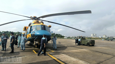
In the telegram, the Prime Minister requested the Chairmen of the People's Committees of Thai Nguyen, Lang Son, Bac Ninh, Cao Bang provinces and other localities in the Thai Binh River basin, especially Cau River and Thuong River, to proactively work with the Ministry of National Defense and the Ministry of Public Security to immediately deploy urgent measures to prevent and combat floods according to the warning level, focusing on reviewing deeply flooded areas, areas at risk of landslides, flash floods, and flash floods to proactively relocate and evacuate residents from dangerous areas, ensuring the safety of people's lives;
At the same time, localities deploy dike protection work, ensure the safety of dikes, dams, and mobilize maximum possible forces, means, and materials to promptly handle incidents from the first hour; use all measures to approach deeply flooded and isolated areas to promptly provide food relief to households...
Flash flood and landslide warning due to heavy rains in Lam Dong
In addition, in the past 2 hours (from 7:00 p.m. to 9:00 p.m. on October 7), Lam Dong province had moderate and heavy rain such as Nam NDir 56.6mm, Nam Nung 47mm, ...
Soil moisture models show that some areas in Lam Dong province are near saturation (over 85%) or have reached saturation.
It is forecasted that in the next 3-6 hours, Lam Dong province will continue to have rain with accumulated rainfall ranging from 20-40mm, in some places over 80mm.
Warning, in the next 6 hours, there is a risk of flash floods on small rivers and streams, landslides on steep slopes, especially in the communes/wards of Da Teh, Da Teh 3, Dak Wil, Nam Nung, Quang Phu, Thuan An.
Source: https://nhandan.vn/song-cau-xuat-hien-lu-dac-biet-lon-thu-tuong-chi-dao-ung-pho-ngay-theo-cap-bao-dong-post913617.html


![[Photo] Closing of the 13th Conference of the 13th Party Central Committee](https://vphoto.vietnam.vn/thumb/1200x675/vietnam/resource/IMAGE/2025/10/08/1759893763535_ndo_br_a3-bnd-2504-jpg.webp)


Comment (0)