Landslides and traffic jams continue to occur on many roads in the western communes of Nghe An after storm No. 5.
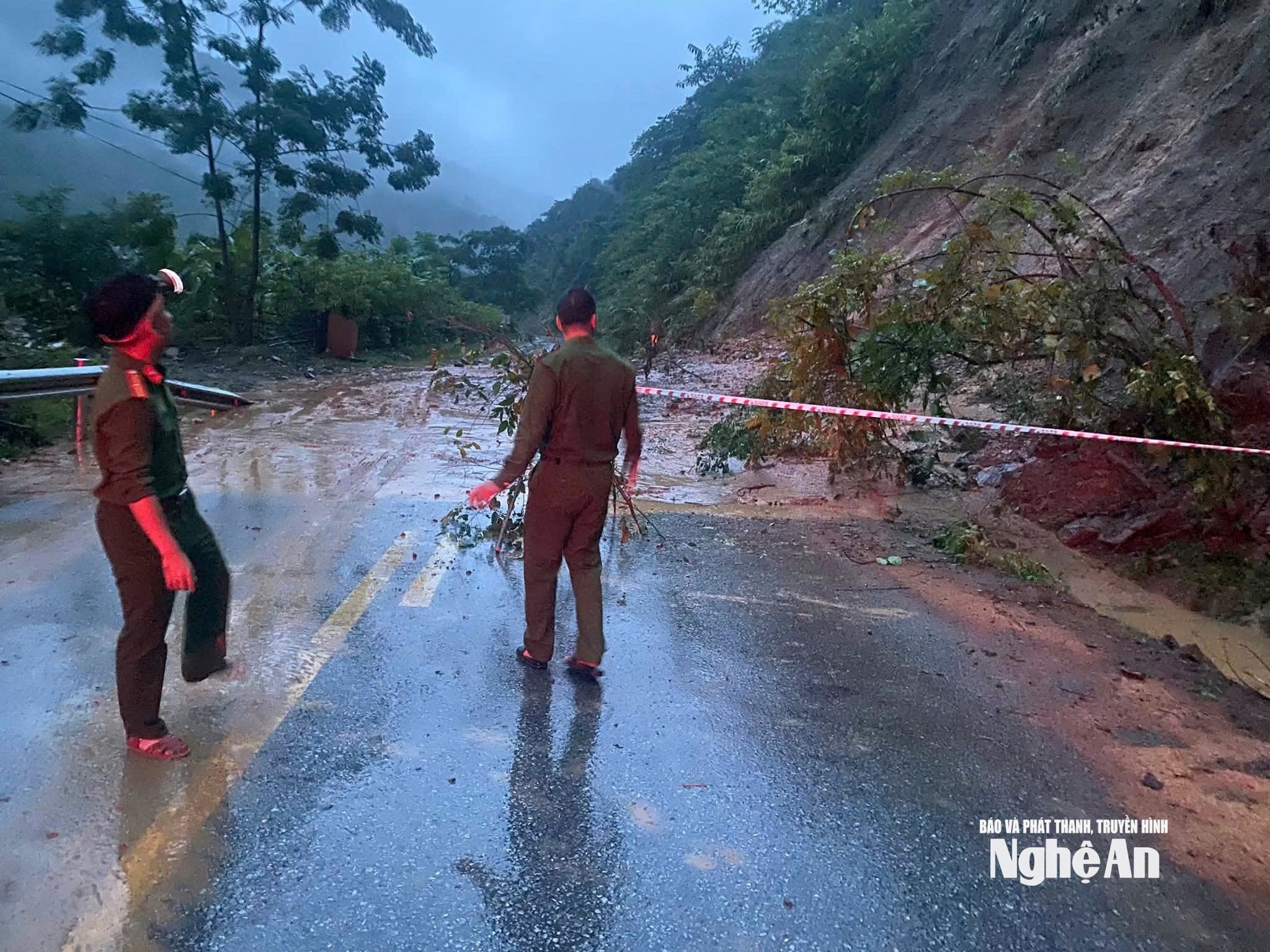
Storm No. 5 caused heavy rain for many days in the communes of Western Nghe An, especially on the night of August 25, causing many sections of national highways and roads connecting villages to suffer severe landslides.
Báo Nghệ An•26/08/2025
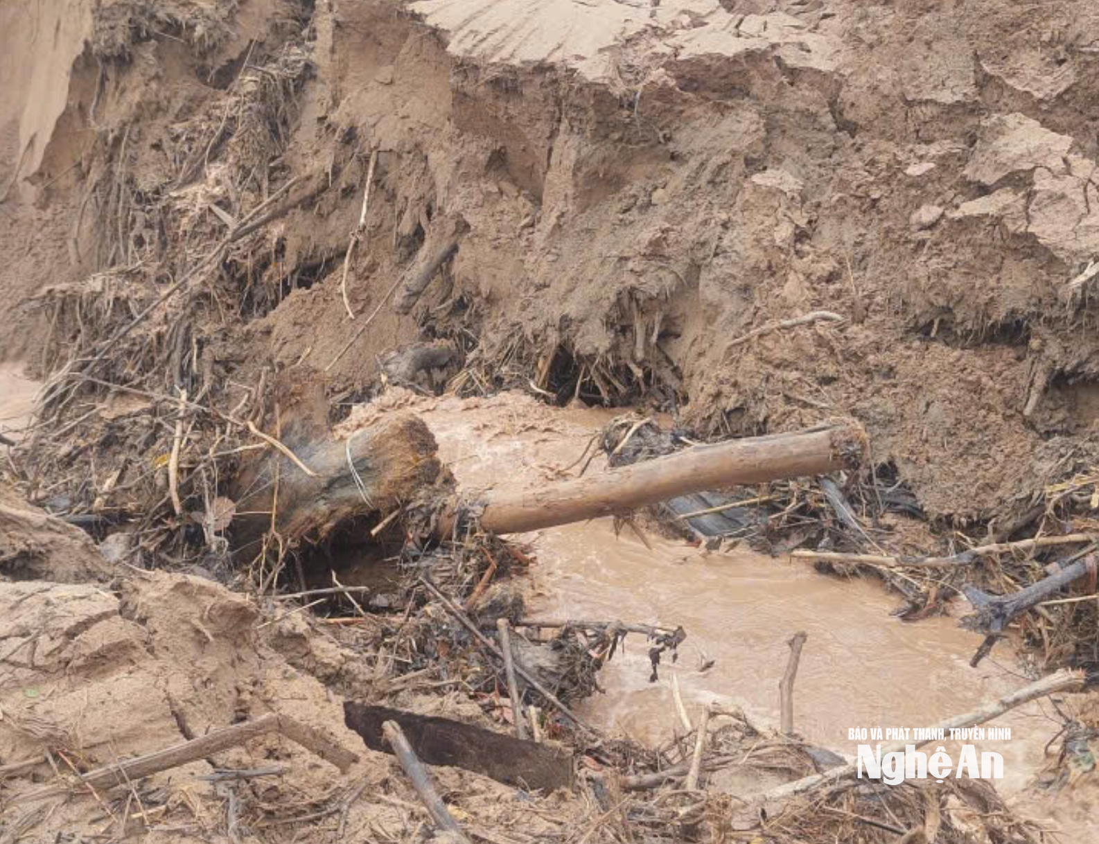
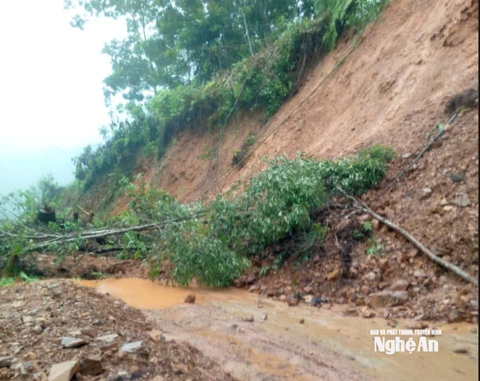
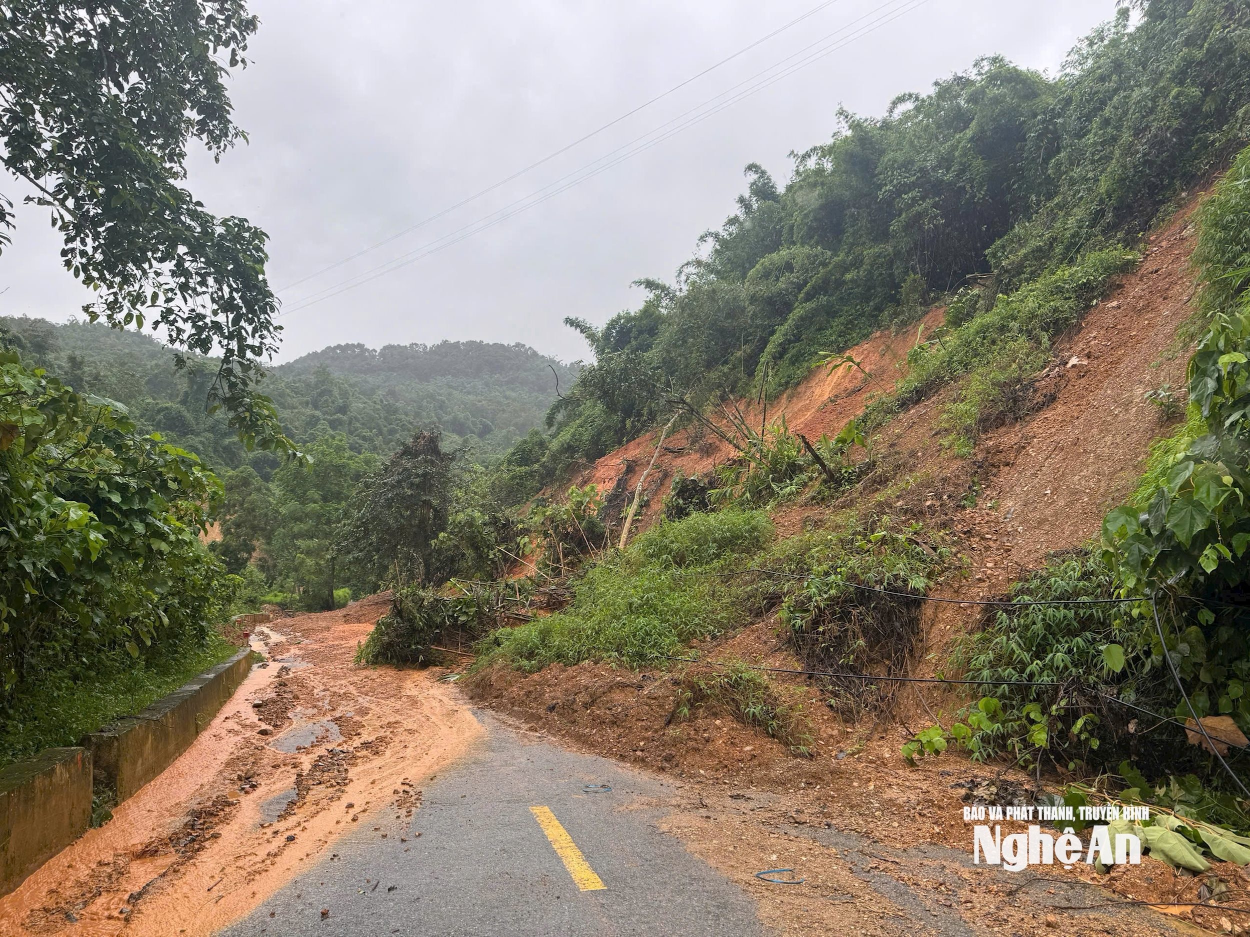
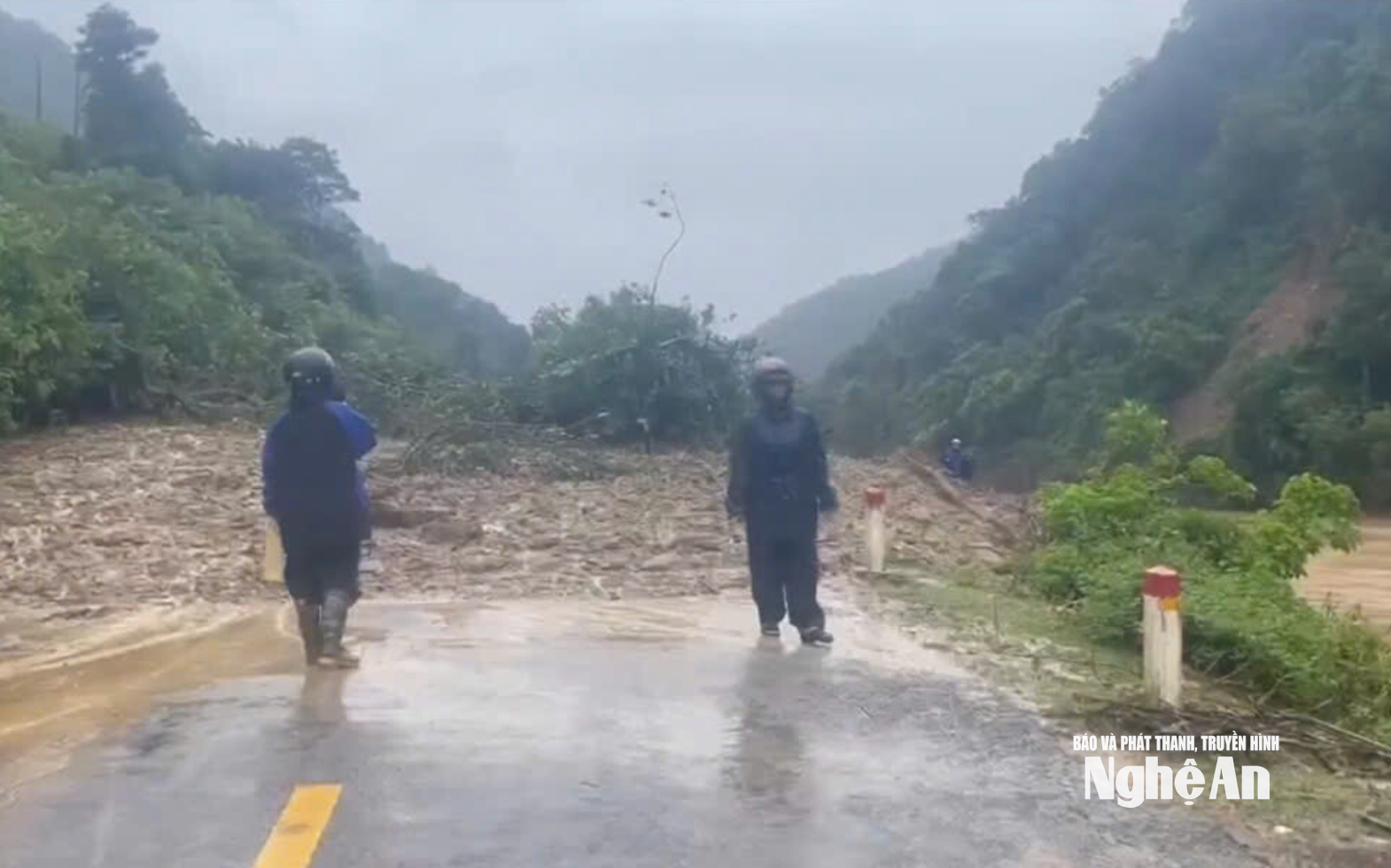
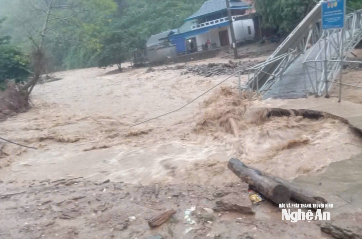
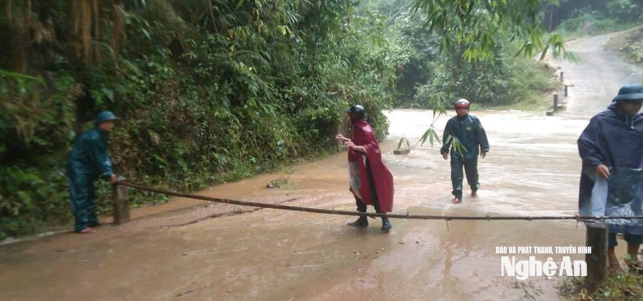
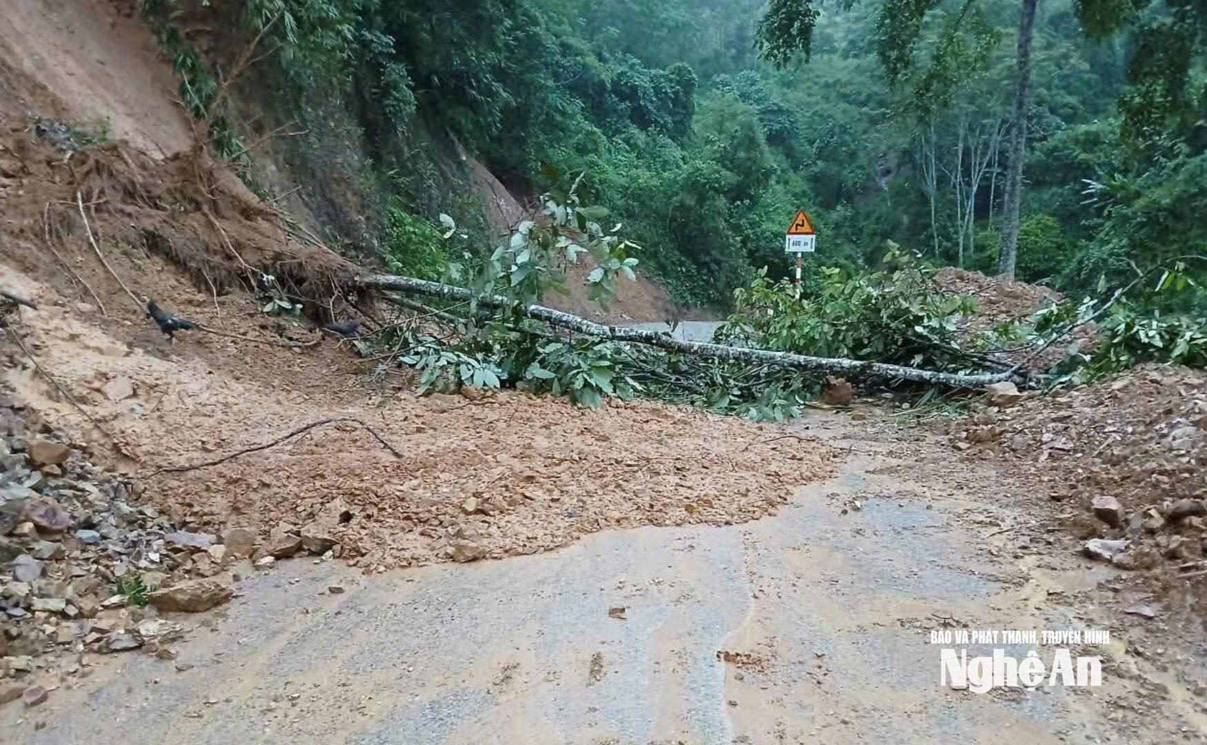
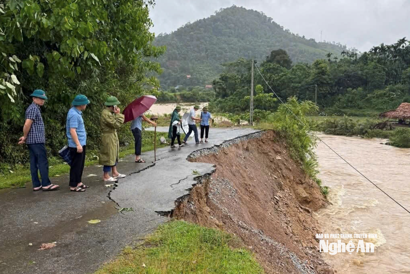
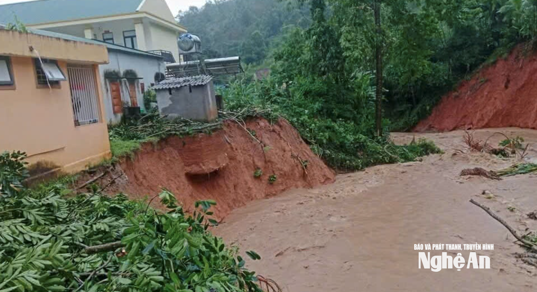
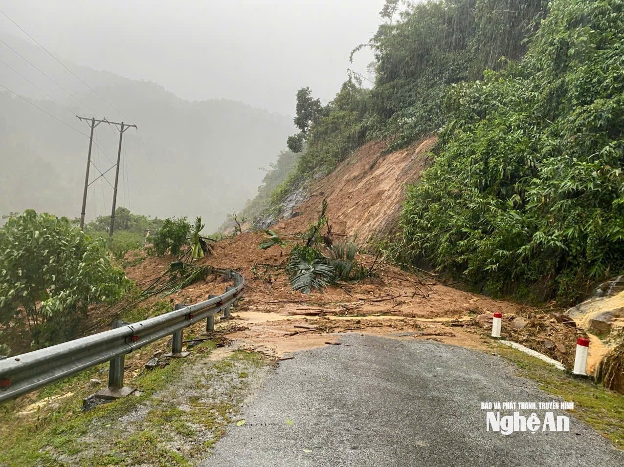
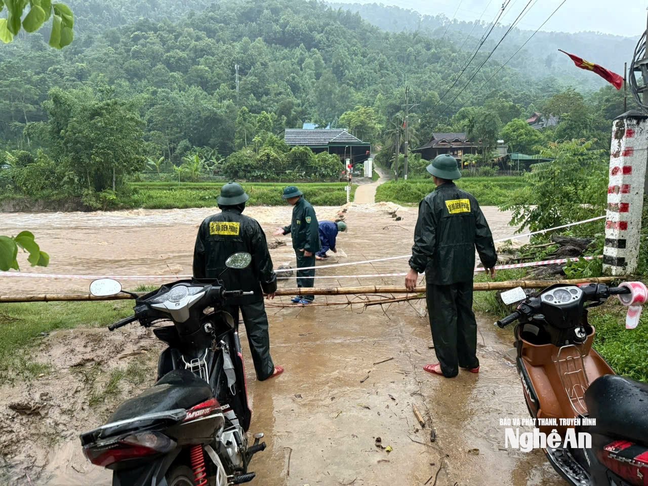
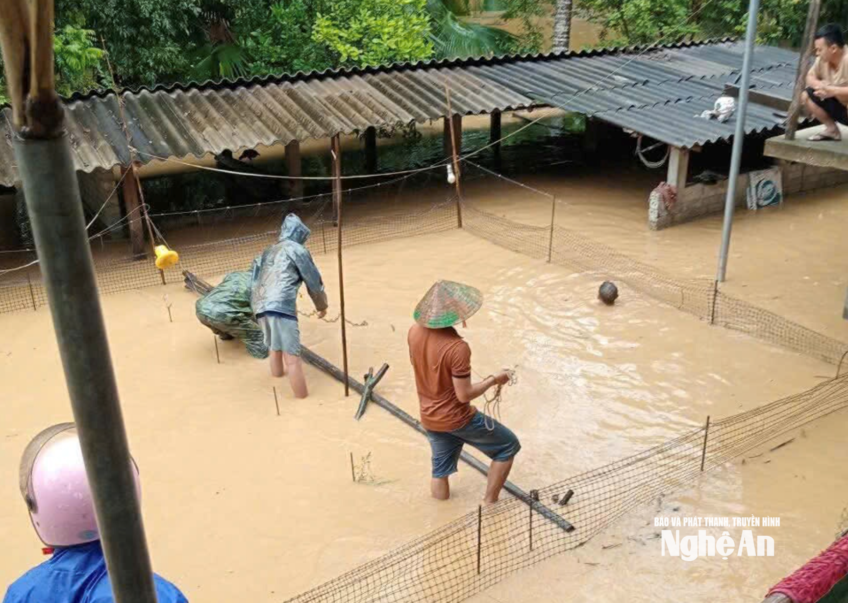
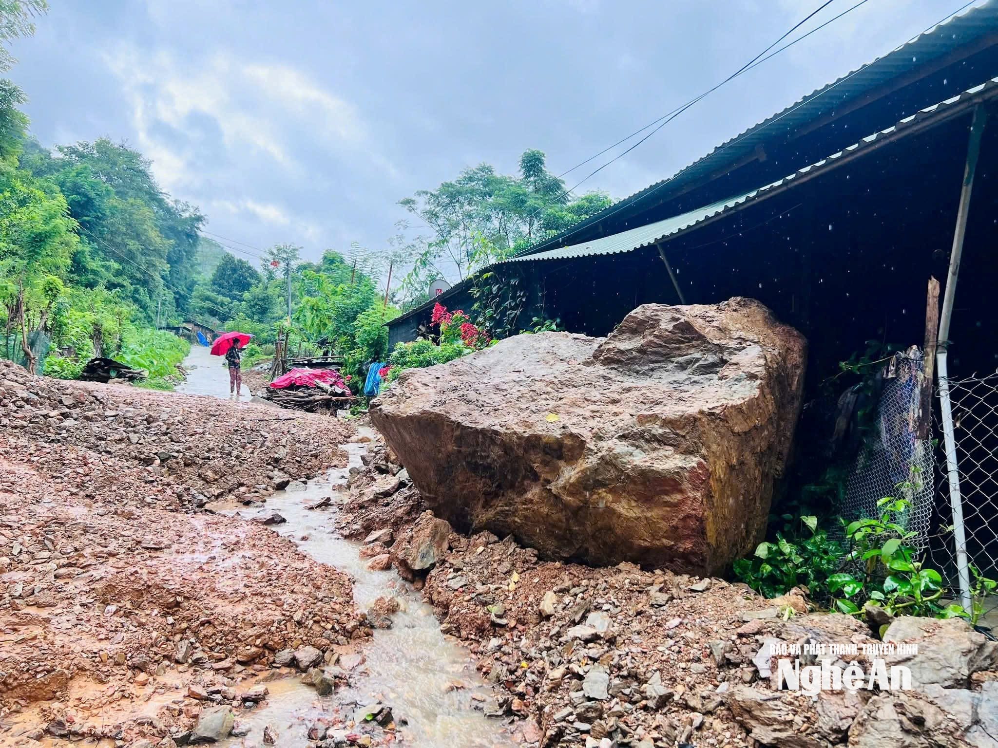
The inter-village road through Xang Tren village in My Ly commune experienced severe erosion at night due to heavy rain. Photo: PV National Highway 16, section through Xop Tu - Hoa Ly village, My Ly commune, had landslides at 2 points, with the volume of landslides about 200m3. The route from Hoa Ly village to Pieng Vai village had landslides at 2 points, about 50m3 of rock and soil, and the route from Hoa Ly village to Pha Chieng village had landslides at 3 points, about 45m3 of rock and soil. Photo: PV National Highway 16, the section bordering Huoi Tu commune and Bac Ly commune, was blocked on the morning of August 26, with cars unable to pass due to many landslides from the mountains. Photo: PV Landslides caused rocks and soil to overflow and cover the road from Sa Vang village (former Ta Ca commune), now Muong Xen commune, to Muong Tip commune. Photo: PV Huoi Giang stream passing through the old Ta Ca commune, now Muong Xen commune, has high water levels and strong currents, eroding traffic works. Photo: PV Muong Xen commune, the area of Huoi Coc overflow into Lu village (old Tay Son commune), on the night of August 25, floodwaters rose high and overflowed the bridge, causing travel to be almost cut off. On the road to Huoi Giang 1,2, landslides caused local congestion. Photo: PV On the morning of August 26, provincial road 543D from Khe Kien, Tuong Duong commune to Na Ngoi commune suffered a serious landslide, causing households along Khe Kien and Xoong Con villages to be flooded, eroded and isolated. Authorities are currently mobilizing personnel to evacuate and reach the people. Photo: PV From about 4 a.m. on August 26, in Hung Chan commune (old Quy Chau district), there was moderate rain, heavy rain in some places, causing flooding, landslides, affecting many roads: Road to Na Lanh village (30m landslide); National Highway 48D (50m landslide, 3-7m wide landslide); KM137 in Sop Lich village area (50m long landslide). The commune arranged regular forces at 7 key spillways; put up warning signs and barriers in areas where water flows rapidly, at risk of deep flooding. Hung Chan commune was merged from Chau Hoan, Chau Phong and Dien Lam communes of old Quy Chau district. Photo by PV In addition, the streamside road from Huu Lap commune (old) to Bao Nam commune (old) was also seriously eroded and temporarily cut off. In the photo: Landslide on National Highway 7A through Huu Kiem commune. (Huu Kiem commune was established on the basis of merging Bao Nam, Huu Lap and Huu Kiem communes of the old Ky Son district). Photo: PV Currently, Thong Thu commune has many roads on National Highway 16 and National Highway 48 that have been seriously eroded, isolating 9/14 villages and hamlets. Including: Muong Cat, Hiep Phong; Ang Dua, Na Luom, Na Hum, Ban Loc, Muong Piet, Muong Phu, Khun Na). Many schools are flooded and eroded. In the photo: Thong Thu Kindergarten is facing the risk of collapsing into the stream. Photo: Van Thanh In addition to damage to roads, rice fields in the villages of Khun Na, Muong Hinh, Dong Moi, Tuc Pang, Muong Cat, Hiep Phong, Muong Phu, Muong Piet, and Na Luom of Thong Thu commune were also flooded, eroded, and buried. Photo: Van Thanh Authorities in Thong Thu assigned people to be on duty and temporarily closed some dangerous and flooded roads. In the photo: the road to Muong Phu village was flooded. Photo by PV Severe flooding in Quy Chau commune on the morning of August 26. The new Quy Chau commune was merged from Tan Lac town and Chau Hanh, Chau Hoi, Chau Nga communes of the old Quy Chau district. Photo: PV Flooding in Yen Na commune (including Yen Tinh and Yen Na communes of the old Tuong Duong district). Photo: PV Landslide, traffic jam at Xop Mat village, Luong Minh commune. Photo: PV

 Báo Nghệ An•26/08/2025


![[Photo] Ready for the 2025 Fall Fair](https://vphoto.vietnam.vn/thumb/1200x675/vietnam/resource/IMAGE/2025/10/14/1760456672454_ndo_br_chi-9796-jpg.webp)


Comment (0)