
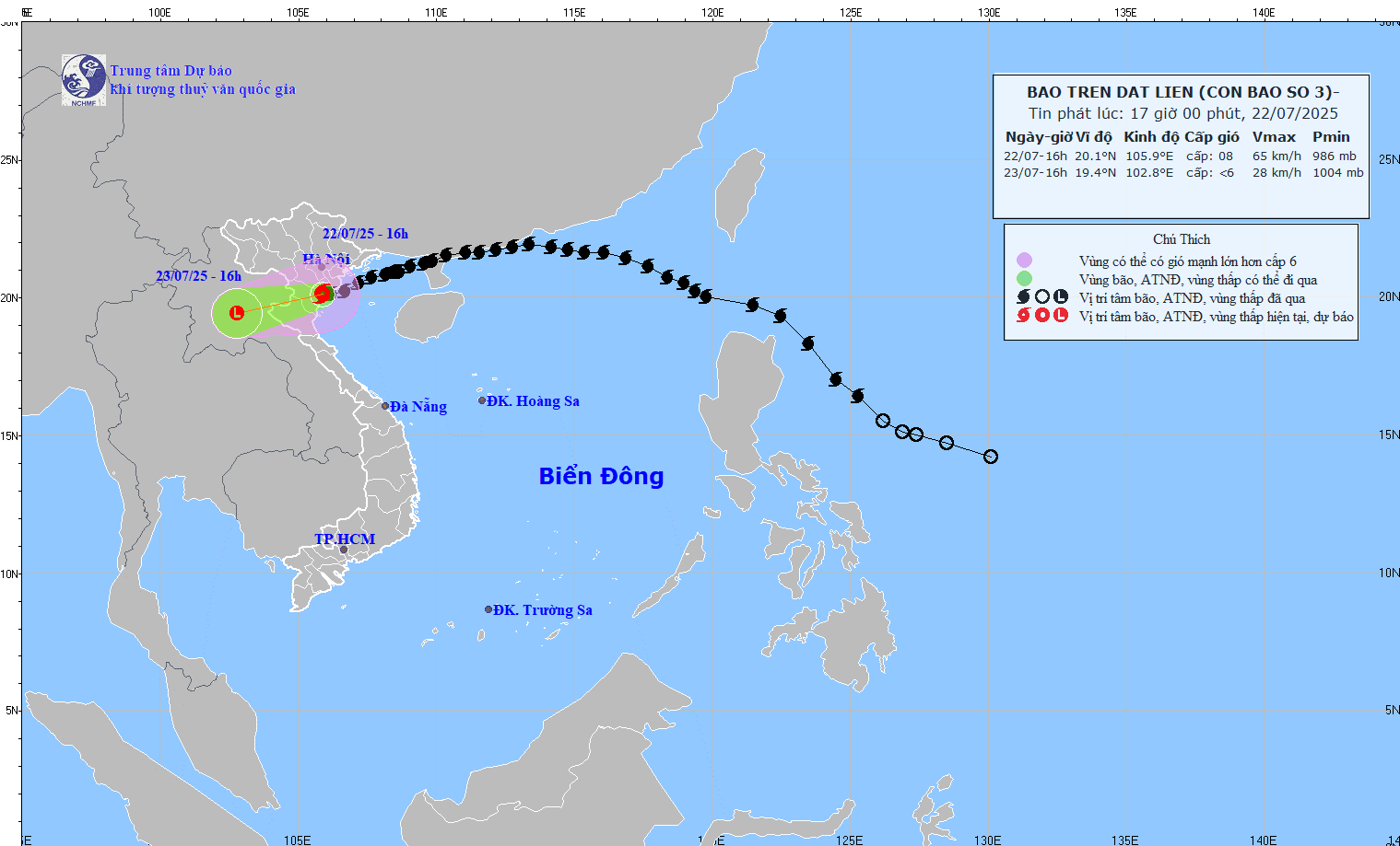
Storm No. 3 is currently at level 8, gusting to level 10 in the Ninh Binh - Thanh Hoa area (Photo: NCHMF)
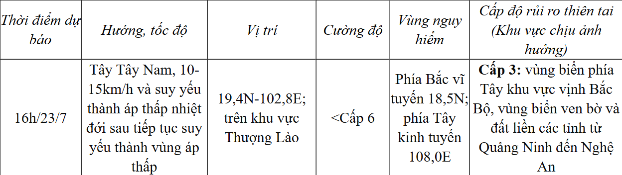
According to forecasts, in the coming time, the storm will weaken into a tropical depression, then continue to weaken into a low pressure area over the Upper Laos region.
Due to the storm's influence, from this evening to the morning of July 23, Thanh Hoa, Nghe An , southern Phu Tho and Son La will have heavy to very heavy rain and thunderstorms with common rainfall of 50-100mm, locally over 200mm.
Other places in the Northern region and Ha Tinh have rain, moderate rain, locally heavy rain and thunderstorms with rainfall of 20-40mm, locally over 100mm.
Storm forecast (in the next 24 hours):
The Hydrometeorological Agency warns of the risk of heavy rain (>150mm/3h). Heavy rain in a short period of time can cause flash floods, landslides in mountainous areas, flooding in low-lying areas, especially Thanh Hoa, Nghe An, Son La...
This evening and tonight (July 22), in the Gulf of Tonkin (including the special zones of Bach Long Vi, Co To, Van Don, Cat Hai, Hon Dau, Hon Ngu): strong winds level 6-7, near the storm center level 8, gusting to level 10. Waves 2.0-4.0m high. Rough seas.
NDS
Source: https://baothanhhoa.vn/trong-3-gio-qua-bao-so-3-gan-nhu-khong-di-chuyen-255752.htm


Comment (0)