
This effort aims to support risk detection, timely notification of deforestation and forest degradation; help early detect illegal exploitation of forest products on forest land, thereby gradually raising people's awareness in forest protection and towards sustainable forest protection and development.
The Forest Protection Department of Region I, Provincial Forest Protection Department is managing an area of more than 45,234 hectares of forest (according to statistics in 2024) of 10 communes after the merger: Son Thuy, Phu Luong, Truong Sinh, Hong Son, Tan Thanh, Son Duong, Dong Tho, Binh Ca, Minh Thanh, Tan Trao. To promote its role as the core force in forest protection and development, the Department has actively and proactively coordinated with localities and sectors to perform well the assigned tasks, focusing on the application of information technology in forest management and protection.
Comrade Tran Ngoc Son, Forest Protection Department of Region I, Tuyen Quang Provincial Forest Protection Department said that recently, the Forest Protection Department has proactively installed and used applications such as: FRMS mobile software installed on phones to update forest developments; Hotspot TQU forest fire warning software. These are effective digital technology application solutions, contributing to improving monitoring capacity, early detection and timely handling of warning situations when forest fires occur. For Hotspot TQU software, when there is a fire, the system will immediately notify via software and link with Google Maps to show directions to the fire location, helping officers determine the exact location, thereby quickly coordinating with localities, organizing forces to inspect, verify and handle the situation. Not only reducing the time to reach the scene, the application also contributes significantly to enhancing proactive capabilities, minimizing damage caused by forest fires.
With the characteristics of a large area and complex terrain, the use and application of information technology not only helps forest rangers improve work efficiency, but also contributes to ensuring safety for the task force, improving efficiency, and helping to respond more promptly to forest fire prevention and fighting in the area.
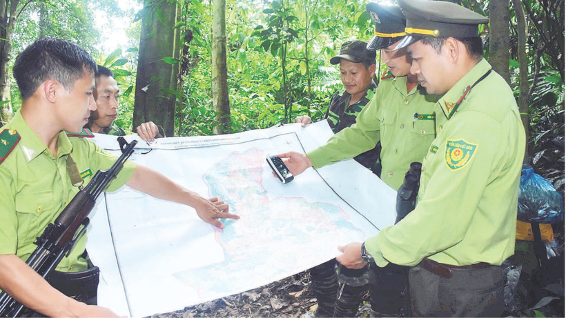
Previously, supporting tools such as: Paper maps, GPS devices, compasses... were "inseparable" items for local forest rangers, but now, the Provincial Forest Protection Department has deployed and integrated supporting tools, installed on tablets or smartphones, with full necessary features through applications and software such as: Locus Map software, Google Earth Pro helps open the map system on the phone when integrating the planning map background of three types of forests and the forest inventory map background; QGIS software serves to monitor forest changes, edit maps; MapInfo Pro helps open the map system on tablets. These software support many features such as: Measurement, support for field inspection, management of forest plot numbers, forest status, forest owner name, crop type, planting year, volume... effectively supporting forest rangers in the process of performing their tasks; help forest rangers detect and warn of unusual changes early, and accurately update fluctuations in forest resources.
Cham Chu special-use forest has a total area of nearly 15,000 hectares, located in 83 villages and hamlets in the communes of Trung Ha, Tan An, Yen Nguyen, Bach Xa, Phu Luu. According to comrade Vuong Van Ninh, Head of the Forest Protection Department of Region III (the unit managing and protecting Cham Chu special-use forest), with a large management area and wide area, previously it was very difficult and time-consuming to grasp information about forest developments. Since using Locus Map software for patrolling and inspection, it has helped forest rangers easily obtain images and grasp the situation of forest areas. The application provides a map of the current status, determines the user's location, the boundaries of sub-areas, takes photos with coordinates, records videos, and uses the phone as a GPS device. In particular, always update specific information on location, forest type, name of each village chief, phone number... Thereby, helping forest rangers monitor and grasp what is happening in the assigned forest area for management, promptly instructing forest owners to implement plans when necessary.
After the merger, Tuyen Quang province currently has more than 1,011,000 hectares of forest and forestry land, accounting for more than 73% of the natural land area; of which the area of special-use forest land is more than 106,043 hectares; protective forest land is more than 352,645 hectares, production forest land is more than 549,545 hectares and the forest area outside the three types of forest is more than 3,062 hectares; the forest cover rate of 61.8% is the third in the country.
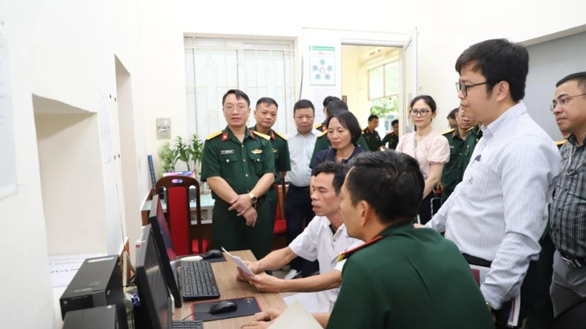
Comrade Dao Duy Tuan, Head of the Tuyen Quang Provincial Forest Protection Department, said: Currently, the Department is effectively operating the forest fire forecasting and warning system based on satellite image data. Thanks to the ability to detect fire spots early through the modern warning system, the functional forces can quickly develop appropriate response plans, proactively organize forces and means, thereby improving the effectiveness of directing and operating forest fire fighting right from the start. The Department has piloted the application of high technology to build a system to detect early deforestation from satellite images. By using satellite data and powerful analysis algorithms, the system will help quickly detect changes in forest area and areas with signs of suspected forest encroachment or deforestation to provide early warnings. From there, the forest rangers of the districts and stations are directed to organize field inspections and promptly handle violations in accordance with the provisions of law.
Faced with the increasing demand for management efficiency, the application of digital technology in the field of forest protection, fire prevention and fighting is an inevitable trend. The system of forest fire forecasting, warning and early detection of deforestation from satellite images has been actively supporting the forest rangers in quickly and accurately detecting changes in forest resources and forestry land. Thereby, improving the effectiveness of management, protection and sustainable forest development, in line with the goal of developing modern, sustainable forestry and adapting to climate change. At the same time, contributing to fundamentally transforming the management method from "passive-treatment" to "proactive-prevention".
Source: https://nhandan.vn/ung-dung-cong-nghe-thong-tin-hieu-qua-trong-quan-ly-bao-ve-rung-post901134.html


![[Photo] Firmly marching under the military flag: Ready for the big festival](https://vphoto.vietnam.vn/thumb/1200x675/vietnam/resource/IMAGE/2025/8/15/86df2fb3199343e0b16b178d53f841ec)
![[Photo] The special solidarity relationship between Vietnam and Cuba](https://vphoto.vietnam.vn/thumb/1200x675/vietnam/resource/IMAGE/2025/8/15/5f06c789ab1647c384ccb78b222ad18e)

![[Photo] Prime Minister Pham Minh Chinh talks on the phone with Cambodian Prime Minister Hun Manet](https://vphoto.vietnam.vn/thumb/1200x675/vietnam/resource/IMAGE/2025/8/15/72d3838db8154bafabdadc0a5165677f)
![[Photo] Prime Minister Pham Minh Chinh attends a special art program called "Hanoi - From the historic autumn of 1945"](https://vphoto.vietnam.vn/thumb/1200x675/vietnam/resource/IMAGE/2025/8/15/c1c42655275c40d1be461fee0fd132f3)

![[Photo] Binh Khanh Bridge Ho Chi Minh City is ready to reach the finish line](https://vphoto.vietnam.vn/thumb/1200x675/vietnam/resource/IMAGE/2025/8/14/b0dcfb8ba9374bd9bc29f26e6814cee2)


![[Photo] President Luong Cuong receives Finnish Ambassador to Vietnam Keijo Norvanto](https://vphoto.vietnam.vn/thumb/402x226/vietnam/resource/IMAGE/2025/8/15/9787f940853c45d39e9d26b6d6827710)


Comment (0)