
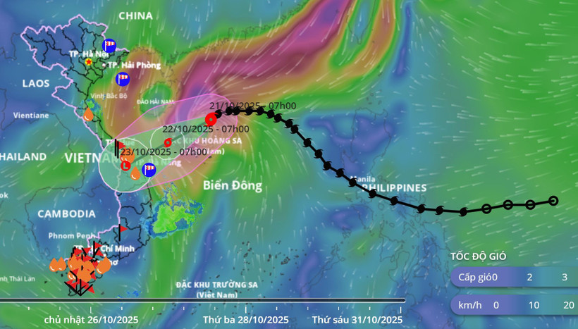
Updated position of storm No. 12 at 9:00 a.m. on October 21. (Source: Vietnam Disaster Monitoring System)
According to the National Center for Hydro-Meteorological Forecasting, at 7:00 a.m. on October 21, the eye of the storm was at about 18.0 degrees north latitude; 112.6 degrees east longitude, about 130km north of Hoang Sa special zone. The strongest wind near the eye of the storm was level 9-10 (75-102km/h), gusting to level 12. Moving westward at a speed of about 20km/h.
At 7:00 a.m. on October 22, the storm moved west-southwest, at about 10-15 km/hour. The center of the storm was at about 16.8 degrees north latitude; 110.2 degrees east longitude, in the sea west of Hoang Sa special zone, about 220 km east-northeast of Da Nang city. The strongest wind near the center of the storm was at level 9, gusting to level 11. Natural disaster risk: Level 3 in the western sea area of the northern East Sea (including Hoang Sa special zone).
At 7:00 a.m. on October 23, the center of the storm was at about 15.6 degrees north latitude; 107.9 degrees east longitude, on the mainland of Da Nang- Quang Ngai city. The storm moved southwest at about 10km/hour and gradually weakened into a tropical depression, then a low pressure area. Natural disaster risks: Level 3 in the western sea area of the northern East Sea (including Hoang Sa special zone), the sea area from southern Quang Tri to Quang Ngai (including Ly Son special zone).
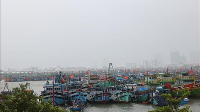
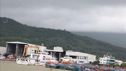
Due to the influence of the storm, at sea, the northern East Sea area (including Hoang Sa special zone) has strong winds of level 7-8; the area near the storm's eye has strong winds of level 9-10, gusting to level 12; waves 3-5m high, the area near the storm's eye has waves of 5-7m high, very rough seas.
The sea area from South Quang Tri to Quang Ngai (including Ly Son special zone) has strong winds of level 6, from the morning of October 22 increasing to level 7, the area near the storm center has level 8, gusts of level 10, waves 3-5m high, rough seas.
All ships and boats operating in the above mentioned dangerous areas are susceptible to the impact of storms, whirlwinds, strong winds and large waves.
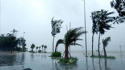
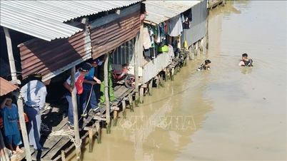
On land, due to the influence of storm circulation and cold air combined with easterly wind disturbances and topographic effects, from the night of October 22 to October 27, the area from Ha Tinh to Quang Ngai is likely to have widespread heavy rain. The total rainfall in Ha Tinh to northern Quang Tri and Quang Ngai is about 200-400mm, locally over 500mm; the area from southern Quang Tri to Da Nang city is commonly 500-700mm, locally over 900mm.
Heavy rains in the Central region are likely to last until the end of October 2025. There is a high risk of flash floods and landslides in mountainous areas, and flooding in low-lying and urban areas.
The meteorological agency noted that localities need to pay attention to the safe operation of hydroelectric and irrigation reservoirs before, during and after the storm, and prepare response plans for flood scenarios on rivers from Quang Tri to Quang Ngai that could reach and exceed alert level 3.
Forecast of disaster risk level due to floods : Level 3.
Nhandan.vn
Source: https://nhandan.vn/bao-so-12-du-kien-do-bo-thanh-pho-da-nang-quang-ngai-sang-2310-post916839.html


![[Photo] Prime Minister Pham Minh Chinh meets with Speaker of the Hungarian National Assembly Kover Laszlo](https://vphoto.vietnam.vn/thumb/1200x675/vietnam/resource/IMAGE/2025/10/20/1760970413415_dsc-8111-jpg.webp)
![[Photo] Da Nang residents "hunt for photos" of big waves at the mouth of the Han River](https://vphoto.vietnam.vn/thumb/1200x675/vietnam/resource/IMAGE/2025/10/21/1761043632309_ndo_br_11-jpg.webp)
![[Photo] Prime Minister Pham Minh Chinh received Mr. Yamamoto Ichita, Governor of Gunma Province (Japan)](https://vphoto.vietnam.vn/thumb/1200x675/vietnam/resource/IMAGE/2025/10/21/1761032833411_dsc-8867-jpg.webp)

![[Photo] Da Nang residents "hunt for photos" of big waves at the mouth of the Han River](https://vphoto.vietnam.vn/thumb/402x226/vietnam/resource/IMAGE/2025/10/21/1761043632309_ndo_br_11-jpg.webp)


Comment (0)