
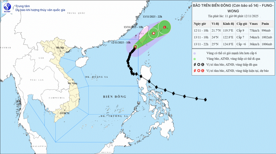
According to the National Center for Hydro-Meteorological Forecasting, at 10:00 a.m. on November 12, the center of the storm was located at about 21.7 degrees North latitude; 119.5 degrees East longitude, in the northeastern sea area of the North East Sea. The strongest wind near the center of the storm was level 8-9 (62-88 km/h), gusting to level 11. Moving in the North-Northeast direction, speed about 10 km/h.
Forecast until 10:00 on November 13, the storm is in the sea east of Taiwan (China) and gradually weakens into a tropical depression, wind force level 7, gust level 9. The storm moves northeast, speed 15 - 20 km/h. The affected area is the sea northeast of the North East Sea. The disaster risk level is level 3.
At 11:00 p.m. on November 13, the storm in the sea northeast of Taiwan (China), with winds below level 6, gradually weakened into a low pressure area, moving in an East Northeast direction at a speed of 20 km/h.
Due to the impact of the storm, the northeastern sea area of the North East Sea has strong winds of level 6-7; the area near the eye of the storm has strong winds of level 8-9, gusts of level 11, waves of 3-5m high, the area near the eye of the storm has waves of 5-7m, very rough seas. All ships operating in the above-mentioned dangerous areas are likely to be affected by storms, whirlwinds, strong winds, and large waves.
Source: https://baotintuc.vn/xa-hoi/bao-so-14-tiep-tuc-doi-huong-di-chuyen-cham-truoc-khi-suy-yeu-20251112114037820.htm


![[Photo] General Secretary To Lam visits Long Thanh International Airport Project](https://vphoto.vietnam.vn/thumb/1200x675/vietnam/resource/IMAGE/2025/11/13/1763008564398_vna-potal-tong-bi-thu-to-lam-tham-du-an-cang-hang-khong-quoc-te-long-thanh-8404600-1261-jpg.webp)

![[Photo] The "scars" of Da Nang's mountains and forests after storms and floods](https://vphoto.vietnam.vn/thumb/1200x675/vietnam/resource/IMAGE/2025/11/13/1762996564834_sl8-jpg.webp)


![[Infographic] Main development goals and targets for the 5-year period 2026-2030](https://vphoto.vietnam.vn/thumb/402x226/vietnam/resource/IMAGE/2025/11/13/1763013984385_cdn-nhandan-vn-images-22f099ca8bc7ae81aa2a8d3416a84bf8267bcc4f3a0ec01ee7b087ca4f1e19412ad321b4a75a62c5b1a9229f3bdfa20548b9382a8c3d1e37736b78a1be2bbad7-_1763006939481-1.jpeg)


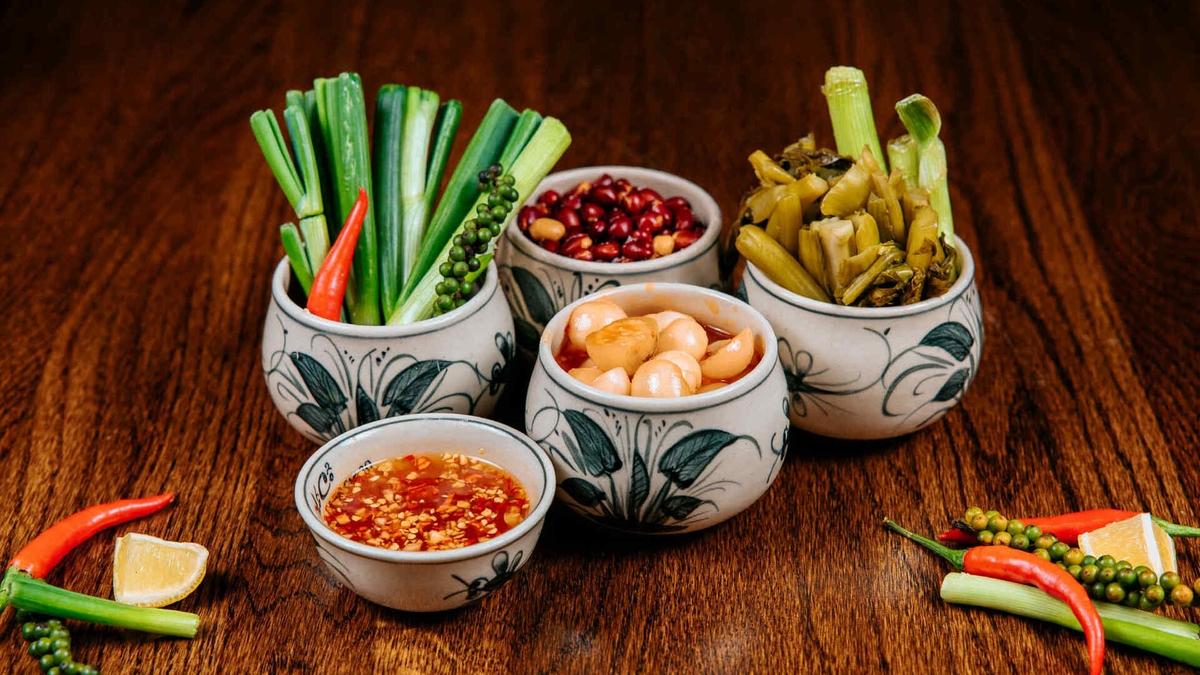
![Dong Nai OCOP transition: [Article 3] Linking tourism with OCOP product consumption](https://vphoto.vietnam.vn/thumb/402x226/vietnam/resource/IMAGE/2025/11/10/1762739199309_1324-2740-7_n-162543_981.jpeg)


Comment (0)