
During the forecast period, cold air continues to operate and increase in frequency and intensity. There is a possibility of widespread heavy rain in the early period in the Northern region and Thanh Hoa and Nghe An provinces. In the provinces from Ha Tinh to Quang Ngai, there is a possibility of some widespread heavy rains during the forecast period.

Other areas have many days of showers and thunderstorms, some of which may have moderate to heavy rain.
There is still a possibility of dangerous weather phenomena such as thunderstorms, tornadoes, lightning, hail and strong gusts of wind across the country.
Total rainfall in common areas is approximately equal to the average of many years, except for the provinces from Ha Tinh to Quang Ngai where total rainfall is 20-40% higher than the average of many years.
"In the context of climate change, weather and climate are becoming increasingly complex with many dangerous and extreme forms such as heavy rain in a short period of time, flash floods, landslides...
Therefore, it is recommended to regularly update and integrate meteorological and hydrological forecast and warning information in short-term bulletins of 1-3 days, to promptly adjust production plans and appropriate response plans.
In particular, the reservoir operation plan must be appropriate, ensuring the safety of the project and downstream areas, along with ensuring safety for production activities and people's lives," the meteorological agency noted.
Many places have heavy rains exceeding historical values.
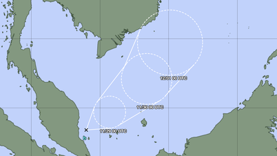
According to the National Center for Hydro-Meteorological Forecasting, from September 11 to October 10, there were 4 storms in the East Sea, including storm No. 8 (Mitag), storm No. 9 (Ragasa), storm No. 10 (Bualoi) and storm No. 11 (Matmo). Of which, storm No. 9, storm No. 10 and storm No. 11 directly affected our country.
In the Northern and North Central provinces, there were many widespread heavy rains, notably the widespread heavy rains caused by storms No. 10 and No. 11 in the North.
During the heavy rains above, in many places, daily rainfall values were recorded exceeding historical values for the same period.
Notably, on October 7, in Thai Nguyen, 491mm of rainfall was observed, not only exceeding the historical value of daily rainfall in October (201mm on October 4, 1978) but also exceeding the highest daily rainfall of the year (374mm on August 5, 1973), as well as the highest total rainfall in October (363mm in October 1964).

Due to many heavy rains and record heavy rains, the total rainfall in the North, Thanh Hoa and Nghe An in the past month was generally 100-200% higher than the average of many years, especially in the mountainous areas of the North, it was 300-450% higher than the average of many years.
Cold air operates early
Notably, the meteorological agency warned that tomorrow night, October 13, in the Northeast and the area from Thanh Hoa to Quang Tri, there will be rain, moderate rain and scattered thunderstorms, locally heavy to very heavy rain.
From October 14, the rain will spread to the northeastern region. From October 15-16, there will be scattered showers and thunderstorms, with some places having heavy rain.
According to forecasts, around October 20-21, a moderate cold front will appear in the Northern region. This cold front will cause thunderstorms and the weather in the North will decrease quite significantly.
Forecasts show that this year, cold air in the Northern region will appear and become stronger earlier than the same period many years ago. From around the second half of October, cold air will become stronger.

Meanwhile, flood water on all rivers such as Cau River, Thuong River, and Trung River are receding.
Water level at 3:00 a.m. on October 12 on Cau River at Dap Cau station was 6.10m, 0.20m below level 3; on Thuong River at Phu Lang Thuong station was 6.91m, 0.61m above level 3.
Today, the flood on the Cau River at Dap Cau station continues to fall and is above level 2; the flood on the Thuong River at Phu Lang Thuong station continues to fall and is above level 3. In the next 12-24 hours, the flood on the Cau River at Dap Cau station will fall below level 2; the flood on the Thuong River at Phu Lang Thuong station will fall below level 3.
Flooding in Thai Nguyen, Bac Ninh, Lang Son provinces and Hanoi city is still continuing in riverside communes and wards, low-lying areas and may last for the next 1-2 days.
Source: https://baolaocai.vn/bien-dong-co-the-xuat-hien-2-3-con-bao-ap-thap-nhiet-doi-trong-thang-toi-post884316.html


Comment (0)